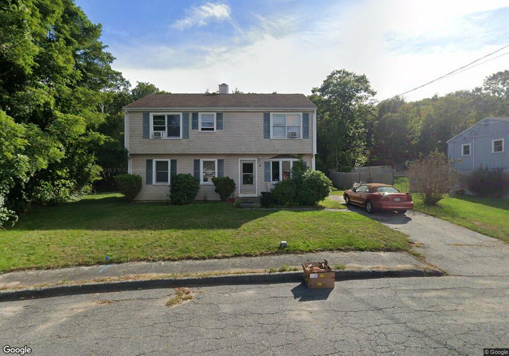
8 Cedarwood Rd Gloucester, MA 01930
West Gloucester NeighborhoodEstimated Value: $706,154 - $920,000
3
Beds
2
Baths
1,887
Sq Ft
$419/Sq Ft
Est. Value
About This Home
This home is located at 8 Cedarwood Rd, Gloucester, MA 01930 and is currently estimated at $790,789, approximately $419 per square foot. 8 Cedarwood Rd is a home located in Essex County with nearby schools including West Parish, Ralph B O'maley Middle School, and Faith Christian School.
Ownership History
Date
Name
Owned For
Owner Type
Purchase Details
Closed on
May 1, 1967
Bought by
Hayes Kenneth M and Hayes Madelin
Current Estimated Value
Create a Home Valuation Report for This Property
The Home Valuation Report is an in-depth analysis detailing your home's value as well as a comparison with similar homes in the area
Home Values in the Area
Average Home Value in this Area
Purchase History
| Date | Buyer | Sale Price | Title Company |
|---|---|---|---|
| Hayes Kenneth M | -- | -- |
Source: Public Records
Mortgage History
| Date | Status | Borrower | Loan Amount |
|---|---|---|---|
| Open | Hayes Kenneth M | $115,000 | |
| Closed | Hayes Kenneth M | $150,000 | |
| Closed | Hayes Kenneth M | $145,000 |
Source: Public Records
Tax History Compared to Growth
Tax History
| Year | Tax Paid | Tax Assessment Tax Assessment Total Assessment is a certain percentage of the fair market value that is determined by local assessors to be the total taxable value of land and additions on the property. | Land | Improvement |
|---|---|---|---|---|
| 2025 | $5,478 | $563,600 | $184,600 | $379,000 |
| 2024 | $5,545 | $569,900 | $175,800 | $394,100 |
| 2023 | $5,306 | $501,000 | $157,000 | $344,000 |
| 2022 | $5,133 | $437,600 | $136,500 | $301,100 |
| 2021 | $4,951 | $398,000 | $124,100 | $273,900 |
| 2020 | $4,890 | $396,600 | $124,100 | $272,500 |
| 2019 | $4,662 | $367,400 | $124,100 | $243,300 |
| 2018 | $4,483 | $346,700 | $124,100 | $222,600 |
| 2017 | $4,342 | $329,200 | $118,200 | $211,000 |
| 2016 | $4,246 | $312,000 | $123,300 | $188,700 |
| 2015 | $4,212 | $308,600 | $123,300 | $185,300 |
Source: Public Records
Map
Nearby Homes
- 30 Atlantic St
- 368 Essex Ave
- 7 Leaman Dr
- 109 Riverview Rd
- 5 Samoset Rd Unit A
- 11 Overlook Ave
- 188 Atlantic St
- 227 Essex Ave
- 49 Thurston Point Rd
- 12 Woodward Ave
- 226 Atlantic St
- 587 Essex Ave
- 145 Essex Ave Unit 610
- 18 Cherry St
- 6 Beauport Ave
- 196 Washington St
- 65 Poplar St
- 15 Harvard St
- 672 Washington St
- 3 Stone Ct