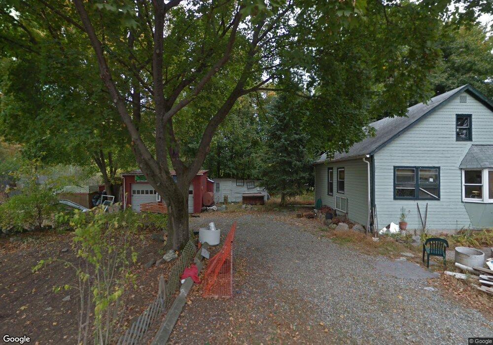
8 Coles Ave Haskell, NJ 07420
Estimated Value: $406,023 - $435,000
2
Beds
1
Bath
1,044
Sq Ft
$398/Sq Ft
Est. Value
About This Home
This home is located at 8 Coles Ave, Haskell, NJ 07420 and is currently estimated at $415,256, approximately $397 per square foot. 8 Coles Ave is a home located in Passaic County with nearby schools including Lakeland Reg High School and St Marys School.
Ownership History
Date
Name
Owned For
Owner Type
Purchase Details
Closed on
Aug 18, 2017
Sold by
Fannie Mae
Bought by
8 Coles Ave Property Llc
Current Estimated Value
Purchase Details
Closed on
May 1, 2017
Sold by
Noonan Roger W and Noonan Jeanne
Bought by
Federal National Mortgage Association
Purchase Details
Closed on
Apr 25, 2003
Sold by
Sitarski John
Bought by
Noonan Roger
Create a Home Valuation Report for This Property
The Home Valuation Report is an in-depth analysis detailing your home's value as well as a comparison with similar homes in the area
Home Values in the Area
Average Home Value in this Area
Purchase History
| Date | Buyer | Sale Price | Title Company |
|---|---|---|---|
| 8 Coles Ave Property Llc | -- | Servicelink | |
| Federal National Mortgage Association | -- | None Available | |
| Noonan Roger | $79,000 | -- |
Source: Public Records
Tax History
| Year | Tax Paid | Tax Assessment Tax Assessment Total Assessment is a certain percentage of the fair market value that is determined by local assessors to be the total taxable value of land and additions on the property. | Land | Improvement |
|---|---|---|---|---|
| 2025 | $7,906 | $183,300 | $94,500 | $88,800 |
| 2024 | $7,748 | $183,300 | $94,500 | $88,800 |
Source: Public Records
Map
Nearby Homes
- 13 Roger Ave
- 1216 Ringwood Ave
- 2 Roger Ave
- 19 Skyland Ave
- 43 Elston Ct Unit 301
- 36 Elston Ct
- 0 Shady Ave
- 23 Dogwood Ln
- 19 Dogwood Ln Unit 19
- 19 Dogwood Ln Unit U9F
- 24 Roseland Ave
- 5 Storms Place
- 38 Wanaque Ave
- 17 Locust St
- 344 Union Ave
- 86 Burnside Place
- 45 Buena Vista Way E
- 7 Birch Rd
- 120 Hershfield St
- 9116 Warrens Way Unit 116
- 8 Cole St
- 1 Cole
- 1151 Ringwood Ave
- 1165 Ringwood Ave
- 1165 Ringwood Ave Unit 1
- 1149 Ringwood Ave
- 1149 Ringwood Ave Unit 1
- 1161 Ringwood Ave
- 1169 Ringwood Ave
- 1173 Ringwood Ave
- 1181 Ringwood Ave
- 1177 Ringwood Ave
- 1141 Ringwood Ave Unit 6
- 1141 Ringwood Ave Unit 5
- 1141 Ringwood Ave Unit 2
- 1156 Ringwood Ave
- 1152 Ringwood Ave
- 1160 Ringwood Ave
- 1162 Ringwood Ave
- 1170 Ringwood Ave
Your Personal Tour Guide
Ask me questions while you tour the home.