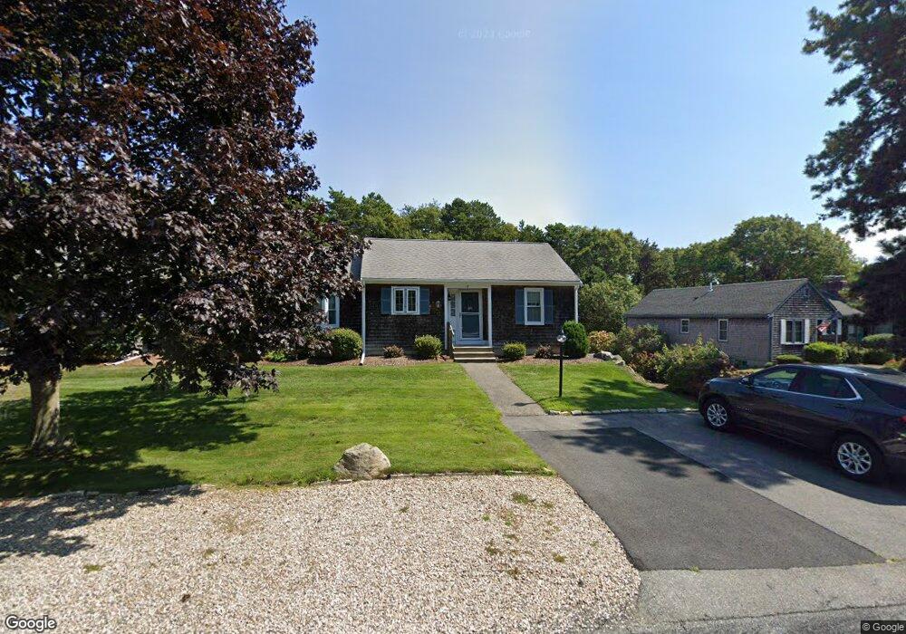
8 Debs Hill Rd Yarmouth Port, MA 02675
Yarmouth Port NeighborhoodEstimated Value: $428,000 - $521,000
2
Beds
2
Baths
1,001
Sq Ft
$475/Sq Ft
Est. Value
About This Home
This home is located at 8 Debs Hill Rd, Yarmouth Port, MA 02675 and is currently estimated at $475,470, approximately $474 per square foot. 8 Debs Hill Rd is a home located in Barnstable County with nearby schools including Dennis-Yarmouth Regional High School and St. Pius X. School.
Ownership History
Date
Name
Owned For
Owner Type
Purchase Details
Closed on
May 26, 2022
Sold by
Alves Karen A
Bought by
Alves Rt 2022
Current Estimated Value
Purchase Details
Closed on
Sep 17, 2021
Sold by
Karen Allen Alves T
Bought by
Alves Karen A
Purchase Details
Closed on
Jul 6, 2007
Sold by
Hitchcock Vreeland Rt
Bought by
Alves Charles L
Purchase Details
Closed on
Jul 28, 2006
Sold by
Vreeland Doreen L and Hitchcock Sherrie L
Bought by
Hitchcock Vreeland Rt
Purchase Details
Closed on
Sep 5, 2000
Sold by
Schaaf Ft
Bought by
Hitchcock Sherrie L
Home Financials for this Owner
Home Financials are based on the most recent Mortgage that was taken out on this home.
Original Mortgage
$150,000
Interest Rate
8.16%
Mortgage Type
Purchase Money Mortgage
Purchase Details
Closed on
Mar 15, 1993
Sold by
Cape Cod Shores L P
Bought by
Schaaf Bradford P
Create a Home Valuation Report for This Property
The Home Valuation Report is an in-depth analysis detailing your home's value as well as a comparison with similar homes in the area
Home Values in the Area
Average Home Value in this Area
Purchase History
| Date | Buyer | Sale Price | Title Company |
|---|---|---|---|
| Alves Rt 2022 | -- | None Available | |
| Alves Karen A | -- | None Available | |
| Alves Charles L | $309,000 | -- | |
| Hitchcock Vreeland Rt | -- | -- | |
| Hitchcock Sherrie L | $189,900 | -- | |
| Schaaf Bradford P | $116,000 | -- |
Source: Public Records
Mortgage History
| Date | Status | Borrower | Loan Amount |
|---|---|---|---|
| Previous Owner | Schaaf Bradford P | $70,000 | |
| Previous Owner | Schaaf Bradford P | $150,000 |
Source: Public Records
Tax History Compared to Growth
Tax History
| Year | Tax Paid | Tax Assessment Tax Assessment Total Assessment is a certain percentage of the fair market value that is determined by local assessors to be the total taxable value of land and additions on the property. | Land | Improvement |
|---|---|---|---|---|
| 2025 | $2,965 | $418,800 | $0 | $418,800 |
| 2024 | $3,246 | $439,900 | $0 | $439,900 |
| 2023 | $3,294 | $406,200 | $0 | $406,200 |
| 2022 | $2,677 | $291,600 | $0 | $291,600 |
| 2021 | $2,857 | $298,900 | $0 | $298,900 |
| 2020 | $2,882 | $288,200 | $0 | $288,200 |
| 2019 | $2,566 | $254,100 | $0 | $254,100 |
| 2018 | $2,526 | $245,500 | $0 | $245,500 |
| 2017 | $2,460 | $245,500 | $0 | $245,500 |
| 2016 | $2,195 | $219,900 | $0 | $219,900 |
| 2015 | $2,186 | $217,700 | $0 | $217,700 |
Source: Public Records
Map
Nearby Homes
- 16 Warren Rd Unit 16
- 16 Warren Rd
- 0 Forsyth Ave
- 176 Beacon St
- 8 Rowley Ln
- 33 Sparrow Way
- 32 Deveau Ln
- 68 Seminole Dr
- 209 Union St
- 4 Old Colony Way
- 72 Quartermaster Row
- 10 Upton Rd
- 76 Captain Chase Rd
- 1 Barnacle Rd
- 97 Captain Bacon Rd
- 49 Captain Besse Rd
- 17 Trowbridge Path
- 129 Driftwood Ln
- 86 Pompano Rd
- 10 Debs Hill Rd
- 2 Debs Hill Rd
- 4 Debs Hill Rd
- 4 Debs Hill Rd Unit 9A
- 9 Deb's Hill Rd
- 10 Deb's Hill Rd
- 7 Debs Hill Rd
- 7 Debs Hill Rd Unit 11A
- 1 Debs Hill Rd
- 14 Debs Hill Rd
- 16 Debs Hill Rd
- 14 Deb's Hill Rd Unit 14
- 7 Debs Hill Unit 7
- 7 Deb Hill Rd
- 9 Debs Hill Rd
- 3 Debs Hill Rd
- 5 Miriah Dr
- 3 Miriah Dr
- 20 Deb's Hill Rd Unit 20
- 20 Debs Hill Rd