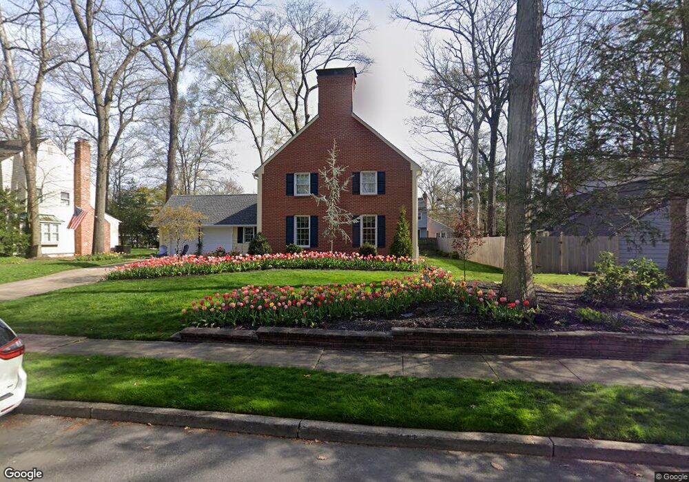
8 Dunbarton Rd Cherry Hill, NJ 08003
Cherry Hill NeighborhoodEstimated Value: $594,000 - $738,000
Studio
--
Bath
2,436
Sq Ft
$269/Sq Ft
Est. Value
About This Home
This home is located at 8 Dunbarton Rd, Cherry Hill, NJ 08003 and is currently estimated at $655,897, approximately $269 per square foot. 8 Dunbarton Rd is a home located in Camden County with nearby schools including Richard Stockton Elementary School, Henry C. Beck Middle School, and Cherry Hill High-East High School.
Ownership History
Date
Name
Owned For
Owner Type
Purchase Details
Closed on
Mar 6, 2009
Sold by
Ciarroccki Michael J and Ciarroccki Marie
Bought by
Ciarroccki Michael J and Ciarroccki Maria E
Current Estimated Value
Home Financials for this Owner
Home Financials are based on the most recent Mortgage that was taken out on this home.
Original Mortgage
$146,000
Outstanding Balance
$92,885
Interest Rate
5.14%
Mortgage Type
Purchase Money Mortgage
Estimated Equity
$563,012
Purchase Details
Closed on
Jun 25, 1999
Sold by
Miksis Thomas G
Bought by
Ciarroccki Michael J and Ciarroccki Marie E
Home Financials for this Owner
Home Financials are based on the most recent Mortgage that was taken out on this home.
Original Mortgage
$180,000
Interest Rate
7.19%
Create a Home Valuation Report for This Property
The Home Valuation Report is an in-depth analysis detailing your home's value as well as a comparison with similar homes in the area
Home Values in the Area
Average Home Value in this Area
Purchase History
| Date | Buyer | Sale Price | Title Company |
|---|---|---|---|
| Ciarroccki Michael J | -- | -- | |
| Ciarroccki Michael J | $225,000 | -- |
Source: Public Records
Mortgage History
| Date | Status | Borrower | Loan Amount |
|---|---|---|---|
| Open | Ciarroccki Michael J | $146,000 | |
| Previous Owner | Ciarroccki Michael J | $180,000 |
Source: Public Records
Tax History
| Year | Tax Paid | Tax Assessment Tax Assessment Total Assessment is a certain percentage of the fair market value that is determined by local assessors to be the total taxable value of land and additions on the property. | Land | Improvement |
|---|---|---|---|---|
| 2025 | $13,172 | $295,400 | $81,500 | $213,900 |
| 2024 | $12,413 | $295,400 | $81,500 | $213,900 |
| 2023 | $12,413 | $295,400 | $81,500 | $213,900 |
| 2022 | $12,070 | $295,400 | $81,500 | $213,900 |
| 2021 | $12,108 | $295,400 | $81,500 | $213,900 |
| 2020 | $11,961 | $295,400 | $81,500 | $213,900 |
| 2019 | $11,955 | $295,400 | $81,500 | $213,900 |
| 2018 | $11,922 | $295,400 | $81,500 | $213,900 |
| 2017 | $11,760 | $295,400 | $81,500 | $213,900 |
| 2016 | $11,603 | $295,400 | $81,500 | $213,900 |
| 2015 | $11,420 | $295,400 | $81,500 | $213,900 |
| 2014 | $11,293 | $295,400 | $81,500 | $213,900 |
Source: Public Records
Map
Nearby Homes
- 1037 Society Hill Blvd
- 1003 Society Hill Blvd
- 701 Society Hill Blvd Unit A
- 11 Strathmore Dr
- 2 Collage Ct
- 7 Cameo Ct
- 1918 Graydon Ave
- 1121 Winding Dr
- 24 Westbury Dr
- 25 Champlain Rd
- 18 Karen Dr
- 206 Mimosa Dr
- 33 N Green Acre Dr
- 8 Elbow Ln
- 6 Wheelwright Ln
- 28 Forest Hill Dr
- 17 Valley Forge Ct
- 324 Tuvira Ln
- 224 Teal Ln
- 38 Doncaster Rd
- 10 Dunbarton Rd
- 6 Dunbarton Rd
- 14 Lavenham Ct
- 16 Lavenham Ct
- 12 Lavenham Ct
- 11 Dunbarton Rd
- 12 Dunbarton Rd
- 9 Dunbarton Rd
- 13 Dunbarton Rd
- 7 Dunbarton Rd
- 4 Dunbarton Rd
- 15 Dunbarton Rd
- 14 Dunbarton Rd
- 108 Lavenham Rd
- 10 Lavenham Ct
- 2 Lavenham Ct
- 5 Dunbarton Rd
- 4 Lavenham Ct
- 106 Lavenham Rd
- 17 Dunbarton Rd
Your Personal Tour Guide
Ask me questions while you tour the home.