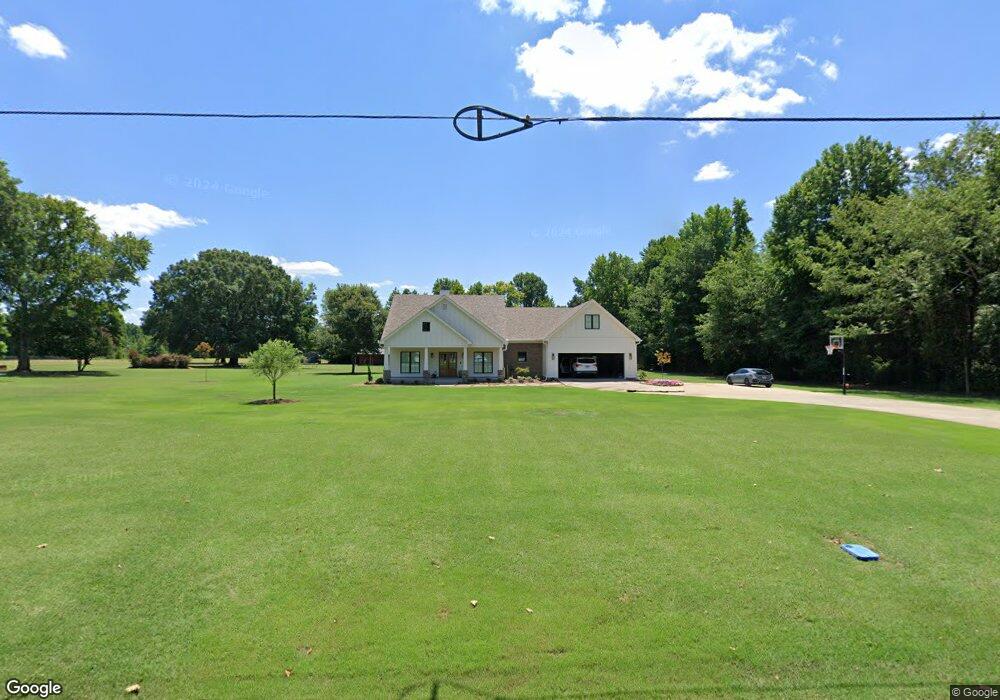
8 E Brannon Dr Conway, AR 72032
Estimated Value: $216,000 - $392,238
Studio
--
Bath
2,175
Sq Ft
$154/Sq Ft
Est. Value
About This Home
This home is located at 8 E Brannon Dr, Conway, AR 72032 and is currently estimated at $335,310, approximately $154 per square foot. 8 E Brannon Dr is a home with nearby schools including Preston & Florence Mattison Elementary School, Bob Courtway Middle School, and Conway Junior High School.
Ownership History
Date
Name
Owned For
Owner Type
Purchase Details
Closed on
Aug 12, 2020
Sold by
Brannon Brad A and Brannon Jill F
Bought by
Brannon Brad A and Brannon Jill F
Current Estimated Value
Purchase Details
Closed on
Sep 30, 2010
Sold by
Brannon Allen and Brannon Rebecca Joyce
Bought by
Brannon Brad A and Brannon Jill F
Create a Home Valuation Report for This Property
The Home Valuation Report is an in-depth analysis detailing your home's value as well as a comparison with similar homes in the area
Home Values in the Area
Average Home Value in this Area
Purchase History
| Date | Buyer | Sale Price | Title Company |
|---|---|---|---|
| Brannon Brad A | -- | None Available | |
| Brannon Brad A | -- | -- |
Source: Public Records
Tax History
| Year | Tax Paid | Tax Assessment Tax Assessment Total Assessment is a certain percentage of the fair market value that is determined by local assessors to be the total taxable value of land and additions on the property. | Land | Improvement |
|---|---|---|---|---|
| 2025 | $2,548 | $77,140 | $5,640 | $71,500 |
| 2024 | $2,432 | $77,140 | $5,640 | $71,500 |
| 2023 | $2,316 | $57,520 | $5,640 | $51,880 |
| 2022 | $1,747 | $53,870 | $5,640 | $48,230 |
| 2021 | $1,624 | $53,870 | $5,640 | $48,230 |
| 2020 | $1,530 | $40,300 | $4,230 | $36,070 |
| 2019 | $1,905 | $40,300 | $4,230 | $36,070 |
| 2018 | $1,905 | $40,300 | $4,230 | $36,070 |
| 2017 | $1,846 | $39,030 | $4,230 | $34,800 |
| 2016 | $1,829 | $38,670 | $4,230 | $34,440 |
| 2015 | $1,624 | $35,150 | $4,230 | $30,920 |
| 2014 | $1,659 | $4,230 | $4,230 | $0 |
Source: Public Records
Map
Nearby Homes
- 19 Alfred Cove
- 60 Wilhelmina Cove
- 63 Wilhelmina Cove Rd
- 260 Sturgis Rd
- 237 Sturgis Rd
- 6 Round Mountain Rd
- lot 7 Shady Point Dr
- 43 Lawrence Landing Rd
- 30 Round Mountain Rd
- 380 Sturgis Rd
- 256 Caney Creek Rd
- 000 Bream Nest Rd
- 25 Fred Ln
- 5 Thomas Ln
- 000 Black Rd
- 104 Lawrence Landing Rd
- 25 Caney Hill Rd
- 00 Kaps Landing Rd
- 114 Lawrence Landing Rd
- 74 Happy Valley Dr
- 14 E Brannon Dr
- 9 E Brannon Dr
- 11 E Brannon Dr
- 15 E Brannon Dr
- 225 Highway 365
- 227 Highway 365
- 213 Highway 365
- 229 Highway 365
- 228 Highway 365
- 233 Hwy 365
- 233 Hwy 365
- 233 Hwy 365
- 233 Highway 365
- 2 W Brannon Dr
- 211 Highway 365
- 9 Brannon Landing Rd
- 234 Highway 365
- 223 Highway 365
- 4 Walker Ln
- 241 Highway 365