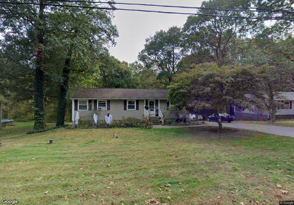
8 E Hayes Rd East Hampton, CT 06424
Estimated Value: $372,000 - $411,000
3
Beds
2
Baths
1,512
Sq Ft
$255/Sq Ft
Est. Value
About This Home
This home is located at 8 E Hayes Rd, East Hampton, CT 06424 and is currently estimated at $385,162, approximately $254 per square foot. 8 E Hayes Rd is a home located in Middlesex County with nearby schools including Memorial School, Center Elementary School, and East Hampton Middle School.
Ownership History
Date
Name
Owned For
Owner Type
Purchase Details
Closed on
Apr 15, 2005
Sold by
Starr Stephanie
Bought by
Caramma Stephen and Caramma Sherry
Current Estimated Value
Home Financials for this Owner
Home Financials are based on the most recent Mortgage that was taken out on this home.
Original Mortgage
$246,900
Outstanding Balance
$127,411
Interest Rate
5.78%
Estimated Equity
$257,751
Purchase Details
Closed on
Oct 10, 1995
Sold by
Valez Elizabeth
Bought by
Starr Stephanie and Starr John
Create a Home Valuation Report for This Property
The Home Valuation Report is an in-depth analysis detailing your home's value as well as a comparison with similar homes in the area
Home Values in the Area
Average Home Value in this Area
Purchase History
| Date | Buyer | Sale Price | Title Company |
|---|---|---|---|
| Caramma Stephen | $259,900 | -- | |
| Caramma Stephen | $259,900 | -- | |
| Starr Stephanie | $114,500 | -- | |
| Starr Stephanie | $114,500 | -- |
Source: Public Records
Mortgage History
| Date | Status | Borrower | Loan Amount |
|---|---|---|---|
| Open | Starr Stephanie | $246,900 | |
| Closed | Starr Stephanie | $246,900 | |
| Previous Owner | Starr Stephanie | $109,900 | |
| Previous Owner | Starr Stephanie | $108,550 |
Source: Public Records
Tax History Compared to Growth
Tax History
| Year | Tax Paid | Tax Assessment Tax Assessment Total Assessment is a certain percentage of the fair market value that is determined by local assessors to be the total taxable value of land and additions on the property. | Land | Improvement |
|---|---|---|---|---|
| 2025 | $5,834 | $146,920 | $38,720 | $108,200 |
| 2024 | $5,589 | $146,920 | $38,720 | $108,200 |
| 2023 | $5,298 | $146,920 | $38,720 | $108,200 |
| 2022 | $5,092 | $146,920 | $38,720 | $108,200 |
| 2021 | $5,073 | $146,920 | $38,720 | $108,200 |
| 2020 | $4,872 | $147,010 | $39,450 | $107,560 |
| 2019 | $4,969 | $149,950 | $40,560 | $109,390 |
| 2018 | $4,696 | $149,950 | $40,560 | $109,390 |
| 2017 | $4,696 | $149,950 | $40,560 | $109,390 |
| 2016 | $4,415 | $149,950 | $40,560 | $109,390 |
| 2015 | $3,966 | $142,750 | $39,040 | $103,710 |
| 2014 | $3,450 | $142,750 | $39,040 | $103,710 |
Source: Public Records
Map
Nearby Homes