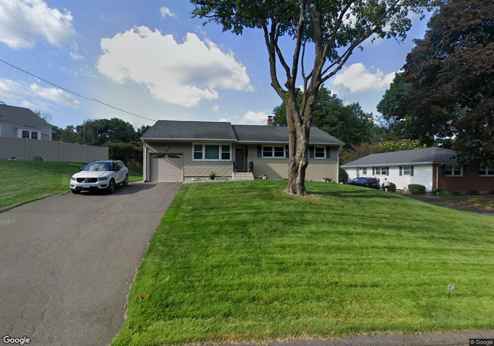
8 E Maxwell Dr West Hartford, CT 06107
Estimated Value: $403,000 - $488,000
3
Beds
2
Baths
1,517
Sq Ft
$294/Sq Ft
Est. Value
About This Home
This home is located at 8 E Maxwell Dr, West Hartford, CT 06107 and is currently estimated at $445,431, approximately $293 per square foot. 8 E Maxwell Dr is a home located in Hartford County with nearby schools including Braeburn School, Sedgwick Middle School, and Conard High School.
Ownership History
Date
Name
Owned For
Owner Type
Purchase Details
Closed on
Apr 19, 1999
Sold by
Weisenberg Peter J and Weisenberg Carrie B
Bought by
Moskowitz Iris and Clow Steven P
Current Estimated Value
Home Financials for this Owner
Home Financials are based on the most recent Mortgage that was taken out on this home.
Original Mortgage
$88,000
Interest Rate
7.04%
Purchase Details
Closed on
Feb 2, 1990
Sold by
Gordon Benjamin
Bought by
Weisenberg Peter
Home Financials for this Owner
Home Financials are based on the most recent Mortgage that was taken out on this home.
Original Mortgage
$100,000
Interest Rate
9.59%
Create a Home Valuation Report for This Property
The Home Valuation Report is an in-depth analysis detailing your home's value as well as a comparison with similar homes in the area
Home Values in the Area
Average Home Value in this Area
Purchase History
| Date | Buyer | Sale Price | Title Company |
|---|---|---|---|
| Moskowitz Iris | $148,000 | -- | |
| Weisenberg Peter | $150,000 | -- |
Source: Public Records
Mortgage History
| Date | Status | Borrower | Loan Amount |
|---|---|---|---|
| Closed | Weisenberg Peter | $88,000 | |
| Previous Owner | Weisenberg Peter | $100,000 |
Source: Public Records
Tax History
| Year | Tax Paid | Tax Assessment Tax Assessment Total Assessment is a certain percentage of the fair market value that is determined by local assessors to be the total taxable value of land and additions on the property. | Land | Improvement |
|---|---|---|---|---|
| 2025 | $8,733 | $195,020 | $79,310 | $115,710 |
| 2024 | $8,259 | $195,020 | $79,310 | $115,710 |
| 2023 | $7,980 | $195,020 | $79,310 | $115,710 |
| 2022 | $7,933 | $195,020 | $79,310 | $115,710 |
| 2021 | $7,658 | $180,530 | $79,310 | $101,220 |
| 2020 | $7,248 | $173,390 | $74,340 | $99,050 |
| 2019 | $7,248 | $173,390 | $74,340 | $99,050 |
| 2018 | $7,109 | $173,390 | $74,340 | $99,050 |
| 2017 | $7,027 | $171,220 | $72,170 | $99,050 |
| 2016 | $7,053 | $178,500 | $73,290 | $105,210 |
| 2015 | $6,838 | $178,500 | $73,290 | $105,210 |
| 2014 | $6,671 | $178,500 | $73,290 | $105,210 |
Source: Public Records
Map
Nearby Homes
- 1 E Normandy Dr
- 19 Glen Hollow
- 11 High Gate Ln
- 60 Fox Chase Ln
- 123 Argyle Ave
- 109 Grennan Rd
- 41 Soby Dr
- 84 Grennan Rd
- 497 Fern St
- 50 Beechtree Ln
- 102 Hunter Dr
- 75 Whitman Ave
- 4 Wyndwood Rd
- 84 High Farms Rd
- 33 Mountain Farms Rd
- 38 N Main St Unit 32
- 16 Morningcrest Dr
- 2 Arapahoe Rd Unit 505
- 2 Arapahoe Rd Unit 604
- 2 Arapahoe Rd Unit 607
- 12 E Maxwell Dr
- 40 Gallaudet Dr
- 46 Gallaudet Dr
- LOT #3 E Maxwell Dr
- 16 E Maxwell Dr
- 9 E Maxwell Dr
- Lot 9 (7 E Maxwell Dr
- 11 E Maxwell Dr
- 5 E Maxwell Dr
- 1 E Maxwell Dr
- 5 E Normandy Dr
- 17 E Maxwell Dr
- 20 E Maxwell Dr
- 43 Gallaudet Dr
- 41 Gallaudet Dr
- 32 Gallaudet Dr
- 54 W Normandy Dr
- 7 E Normandy Dr
- 21 E Maxwell Dr
- 23 Country Ln
Your Personal Tour Guide
Ask me questions while you tour the home.