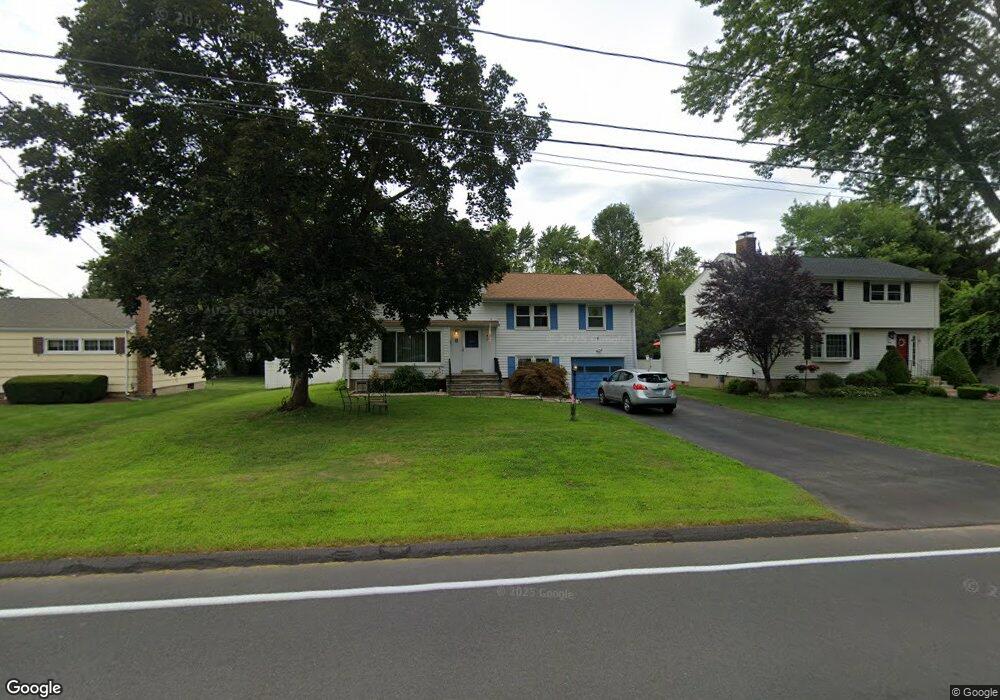
8 Fern St Rocky Hill, CT 06067
Estimated Value: $495,000 - $536,000
5
Beds
4
Baths
2,459
Sq Ft
$211/Sq Ft
Est. Value
About This Home
This home is located at 8 Fern St, Rocky Hill, CT 06067 and is currently estimated at $518,142, approximately $210 per square foot. 8 Fern St is a home located in Hartford County with nearby schools including Albert D. Griswold Middle School, Rocky Hill High School, and Corpus Christi School.
Ownership History
Date
Name
Owned For
Owner Type
Purchase Details
Closed on
Apr 8, 2016
Sold by
Bond Michael J
Bought by
Bond Valerie A
Current Estimated Value
Home Financials for this Owner
Home Financials are based on the most recent Mortgage that was taken out on this home.
Original Mortgage
$189,000
Outstanding Balance
$149,443
Interest Rate
3.62%
Mortgage Type
New Conventional
Estimated Equity
$368,699
Purchase Details
Closed on
Jan 25, 2011
Sold by
Dillon Robert A and Dillon Nancy A
Bought by
Sullo Investments Llc
Purchase Details
Closed on
Aug 31, 1994
Sold by
Senoforte Eileen
Bought by
Dunnigan Neal T and Giglio Virginia
Create a Home Valuation Report for This Property
The Home Valuation Report is an in-depth analysis detailing your home's value as well as a comparison with similar homes in the area
Home Values in the Area
Average Home Value in this Area
Purchase History
| Date | Buyer | Sale Price | Title Company |
|---|---|---|---|
| Bond Valerie A | -- | -- | |
| Bond Valerie A | -- | -- | |
| Sullo Investments Llc | $95,000 | -- | |
| Dunnigan Neal T | $172,000 | -- | |
| Bond Valerie A | -- | -- | |
| Sullo Investments Llc | $95,000 | -- | |
| Dunnigan Neal T | $172,000 | -- |
Source: Public Records
Mortgage History
| Date | Status | Borrower | Loan Amount |
|---|---|---|---|
| Open | Bond Valerie A | $189,000 | |
| Closed | Bond Valerie A | $189,000 | |
| Previous Owner | Dunnigan Neal T | $143,500 |
Source: Public Records
Tax History Compared to Growth
Tax History
| Year | Tax Paid | Tax Assessment Tax Assessment Total Assessment is a certain percentage of the fair market value that is determined by local assessors to be the total taxable value of land and additions on the property. | Land | Improvement |
|---|---|---|---|---|
| 2025 | $8,205 | $271,320 | $87,360 | $183,960 |
| 2024 | $7,914 | $271,320 | $87,360 | $183,960 |
| 2023 | $8,076 | $224,840 | $74,060 | $150,780 |
| 2022 | $7,761 | $224,840 | $74,060 | $150,780 |
| 2021 | $7,667 | $224,840 | $74,060 | $150,780 |
| 2020 | $7,555 | $224,840 | $74,060 | $150,780 |
| 2019 | $7,307 | $224,840 | $74,060 | $150,780 |
| 2018 | $6,212 | $191,730 | $66,710 | $125,020 |
| 2017 | $6,059 | $191,730 | $66,710 | $125,020 |
| 2016 | $5,944 | $191,730 | $66,710 | $125,020 |
| 2015 | $5,694 | $191,730 | $66,710 | $125,020 |
| 2014 | $5,694 | $191,730 | $66,710 | $125,020 |
Source: Public Records
Map
Nearby Homes
- 32 Wright Rd
- 89 Gilbert Ave
- 4 Lexington Ct
- 45 Sandy Dr
- 52 Sandy Dr
- 59 Chapin Ave
- 37 Deming Rd
- 1610 Silas Deane Hwy
- 40 Grimes Rd
- 211 Fairlane Dr
- 28 Colonial Dr Unit D
- 12 Colonial Dr Unit C
- 18 Colonial Dr Unit A
- 887 Cloverdale Cir
- 7 Pearl Ln
- 36 Copper Beech Dr
- 41 Maxwell Dr
- 71 Joiners Rd
- 650 Maple St
- 34 Clayton Dr