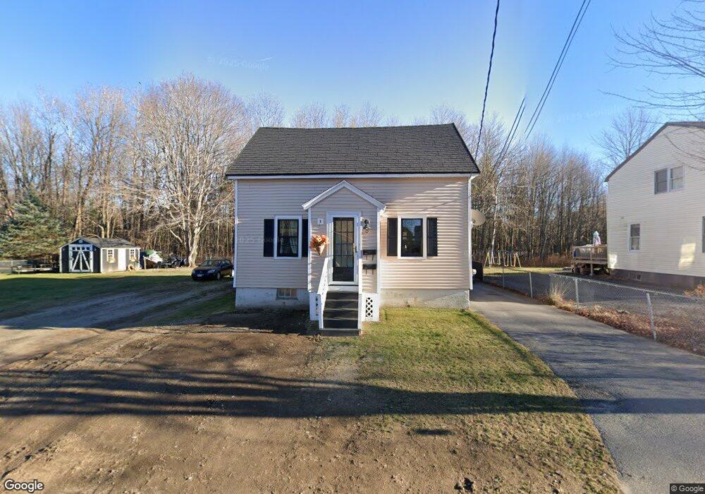
8 Glenwood Ave Saco, ME 04072
Central Saco NeighborhoodEstimated Value: $375,553 - $629,000
3
Beds
2
Baths
1,462
Sq Ft
$344/Sq Ft
Est. Value
About This Home
This home is located at 8 Glenwood Ave, Saco, ME 04072 and is currently estimated at $502,388, approximately $343 per square foot. 8 Glenwood Ave is a home located in York County with nearby schools including C K Burns School, Saco Middle School, and Saint James School.
Ownership History
Date
Name
Owned For
Owner Type
Purchase Details
Closed on
Oct 2, 2007
Sold by
Pomerleau Rhonda J and Pomerleau Leo P
Bought by
Pomerleau Jessica L and Pomerleau Scott P
Current Estimated Value
Home Financials for this Owner
Home Financials are based on the most recent Mortgage that was taken out on this home.
Original Mortgage
$170,000
Outstanding Balance
$108,563
Interest Rate
6.65%
Mortgage Type
Unknown
Estimated Equity
$393,825
Create a Home Valuation Report for This Property
The Home Valuation Report is an in-depth analysis detailing your home's value as well as a comparison with similar homes in the area
Home Values in the Area
Average Home Value in this Area
Purchase History
| Date | Buyer | Sale Price | Title Company |
|---|---|---|---|
| Pomerleau Jessica L | -- | -- | |
| Pomerleau Rhonda J | -- | -- |
Source: Public Records
Mortgage History
| Date | Status | Borrower | Loan Amount |
|---|---|---|---|
| Open | Pomerleau Rhonda J | $170,000 |
Source: Public Records
Tax History Compared to Growth
Tax History
| Year | Tax Paid | Tax Assessment Tax Assessment Total Assessment is a certain percentage of the fair market value that is determined by local assessors to be the total taxable value of land and additions on the property. | Land | Improvement |
|---|---|---|---|---|
| 2024 | $4,413 | $314,100 | $131,200 | $182,900 |
| 2023 | $4,584 | $310,800 | $131,200 | $179,600 |
| 2022 | $3,959 | $216,000 | $100,100 | $115,900 |
| 2021 | $3,755 | $198,900 | $89,400 | $109,500 |
| 2020 | $3,503 | $178,100 | $78,700 | $99,400 |
| 2019 | $3,452 | $178,100 | $78,700 | $99,400 |
| 2018 | $3,312 | $170,900 | $71,500 | $99,400 |
| 2017 | $3,287 | $169,600 | $71,500 | $98,100 |
| 2016 | $3,245 | $167,100 | $66,500 | $100,600 |
| 2015 | $3,185 | $165,700 | $66,500 | $99,200 |
| 2014 | $3,085 | $165,700 | $66,500 | $99,200 |
| 2013 | $3,079 | $165,700 | $66,500 | $99,200 |
Source: Public Records
Map
Nearby Homes
- 16 Heritage Way Unit 17
- 18 Heritage Way Unit 14
- 8 Heritage Way Unit 15
- 8 Heritage Way Unit 21
- 15 Lafayette St
- 36 Lafayette St
- 162 Beach St Unit 10
- 29 Old Orchard Rd Unit 10
- 1 Pine Ridge Rd
- 4 Mainsail Ln Unit 4
- 2 Breakwater Way Unit 2
- 22 James St
- 38 Pine Ridge Rd
- 5 Academy Place Unit 57
- 15 Thunder Rd
- 61 Ocean Park Rd Unit 11
- 15 Lucille St
- 372 Main St Unit 201
- 26 Ocean Greens Dr
- 19 Ocean Greens Dr