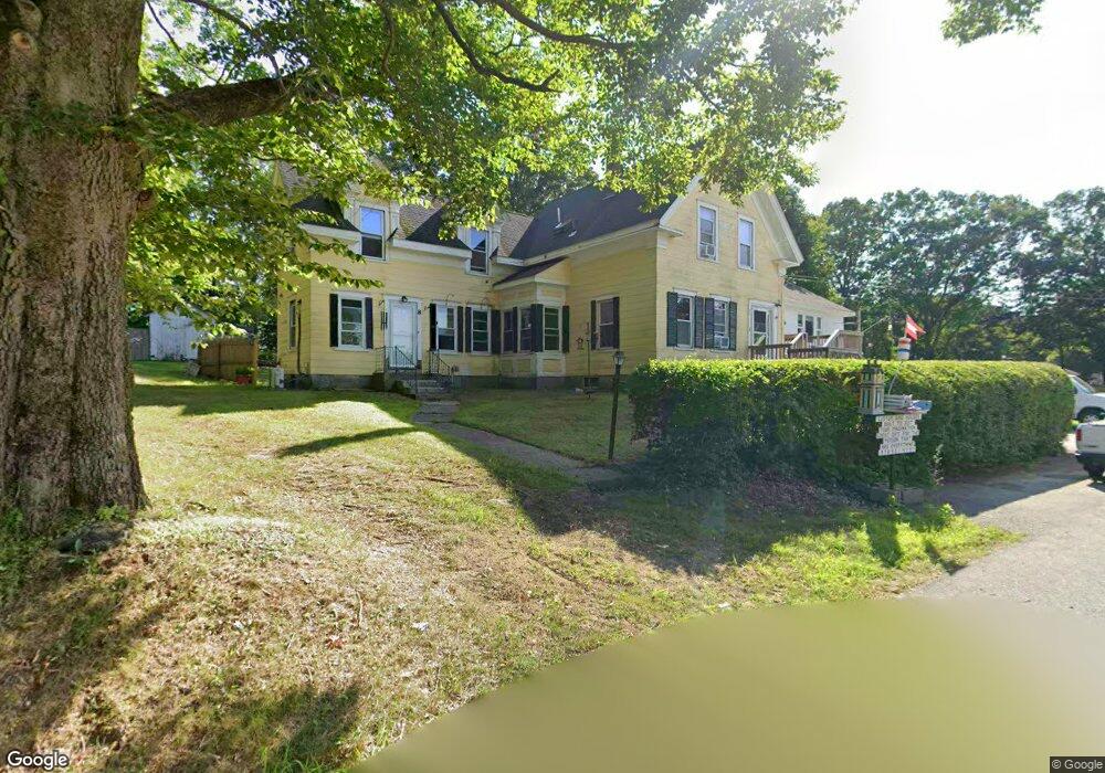
8 Great Rd Littleton, MA 01460
Estimated Value: $748,000 - $1,131,000
5
Beds
6
Baths
2,839
Sq Ft
$322/Sq Ft
Est. Value
About This Home
This home is located at 8 Great Rd, Littleton, MA 01460 and is currently estimated at $913,271, approximately $321 per square foot. 8 Great Rd is a home located in Middlesex County with nearby schools including Shaker Lane Elementary School, Russell Street Elementary School, and Littleton Middle School.
Ownership History
Date
Name
Owned For
Owner Type
Purchase Details
Closed on
May 26, 2009
Sold by
Wiley Estates T and Wiley Timothy M
Bought by
Wiley Timothy M and Wiley Heidi J
Current Estimated Value
Home Financials for this Owner
Home Financials are based on the most recent Mortgage that was taken out on this home.
Original Mortgage
$269,400
Outstanding Balance
$171,674
Interest Rate
4.93%
Mortgage Type
Purchase Money Mortgage
Estimated Equity
$741,597
Create a Home Valuation Report for This Property
The Home Valuation Report is an in-depth analysis detailing your home's value as well as a comparison with similar homes in the area
Home Values in the Area
Average Home Value in this Area
Purchase History
| Date | Buyer | Sale Price | Title Company |
|---|---|---|---|
| Wiley Timothy M | -- | -- |
Source: Public Records
Mortgage History
| Date | Status | Borrower | Loan Amount |
|---|---|---|---|
| Open | Wiley Timothy M | $269,400 |
Source: Public Records
Tax History Compared to Growth
Tax History
| Year | Tax Paid | Tax Assessment Tax Assessment Total Assessment is a certain percentage of the fair market value that is determined by local assessors to be the total taxable value of land and additions on the property. | Land | Improvement |
|---|---|---|---|---|
| 2025 | $93 | $624,500 | $225,000 | $399,500 |
| 2024 | $9,216 | $621,000 | $229,300 | $391,700 |
| 2023 | $8,861 | $545,300 | $211,900 | $333,400 |
| 2022 | $8,720 | $492,400 | $211,900 | $280,500 |
| 2021 | $7,753 | $438,000 | $179,200 | $258,800 |
| 2020 | $7,831 | $440,700 | $179,200 | $261,500 |
| 2019 | $7,672 | $420,600 | $171,900 | $248,700 |
| 2018 | $7,031 | $387,600 | $176,200 | $211,400 |
| 2017 | $6,877 | $378,900 | $167,500 | $211,400 |
| 2016 | $6,689 | $378,100 | $167,500 | $210,600 |
| 2015 | $6,607 | $365,000 | $145,700 | $219,300 |
Source: Public Records
Map
Nearby Homes
- 511 Tumbling Hawk Unit 511
- 522 Tumbling Hawk
- 484 Great Road -6
- 484 Great Road -4
- 484 Great Road -3
- 422 Great Elm Way
- 601 Old Stone Brook
- 445 Old Stone Brook
- 9 Breezy Point Rd
- 484 Great Rd
- 484 Great Rd
- 4 Powers Rd
- 117 Skyline Dr Unit 117
- 420 Great Rd Unit B3
- 403 Great Rd Unit 5
- 407 Great Rd Unit 9
- 388 Great Rd Unit B23
- 3 Monument Place Unit 3
- 3 Monument Place
- 1 Quarry Rd
- 999 Great Rd
- 3 Great Rd
- 3 Nashoba Rd
- 2 Mannion Place
- 14 Mannion Place
- 581 Great Rd
- 3 Boxwood Dr Unit 3
- 3 Boxwood Dr
- 3 Morning Glory Cir Unit EAU 8
- 4 Boxwood Dr
- 4 Boxwood Dr Unit EUA 7
- 5 Boxwood Dr Unit 5
- 5 Boxwood Dr
- 30 Nagog Park
- 30 Nagog Park Unit 215
- Lot 25 Boxwood Dr
- 9 Morning Glory Cir Unit EAU 11
- 9 Morning Glory Cir Unit 9
- 9 Morning Glory Cir
- 11 Morning Glory Cir Unit 9