Estimated Value: $360,000 - $418,189
3
Beds
1
Bath
1,307
Sq Ft
$300/Sq Ft
Est. Value
About This Home
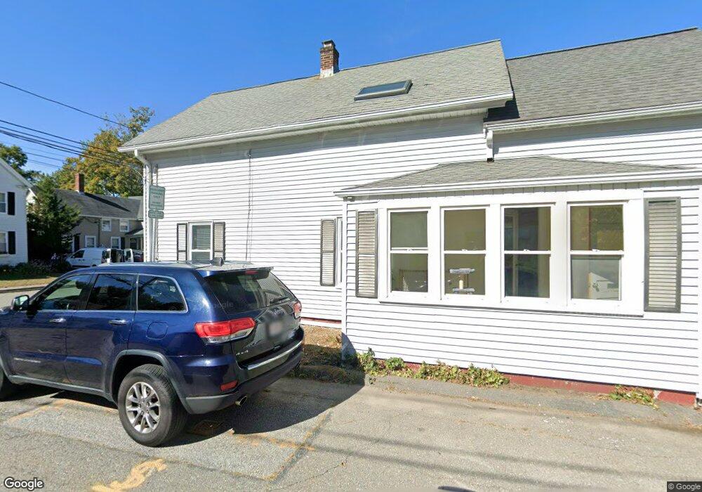
This home is located at 8 Grove St Unit 1, Ayer, MA 01432 and is currently estimated at $392,547, approximately $300 per square foot. 8 Grove St Unit 1 is a home located in Middlesex County with nearby schools including Page Hilltop School, Lura A. White Elementary School, and Ayer Shirley Regional Middle School.
Ownership History
Date
Name
Owned For
Owner Type
Purchase Details
Closed on
May 30, 2003
Sold by
Comr Ira Nagel
Bought by
Dougenik Patricia A and Dougenik Mark E
Current Estimated Value
Home Financials for this Owner
Home Financials are based on the most recent Mortgage that was taken out on this home.
Original Mortgage
$55,000
Outstanding Balance
$23,818
Interest Rate
5.86%
Mortgage Type
Purchase Money Mortgage
Estimated Equity
$368,729
Purchase Details
Closed on
Dec 27, 1999
Sold by
Mcphee Rt and Mcphee
Bought by
2 Shack Rt and Gould
Create a Home Valuation Report for This Property
The Home Valuation Report is an in-depth analysis detailing your home's value as well as a comparison with similar homes in the area
Home Values in the Area
Average Home Value in this Area
Purchase History
| Date | Buyer | Sale Price | Title Company |
|---|---|---|---|
| Dougenik Patricia A | $190,000 | -- | |
| Dougenik Patricia A | $190,000 | -- | |
| 2 Shack Rt | $50,000 | -- |
Source: Public Records
Mortgage History
| Date | Status | Borrower | Loan Amount |
|---|---|---|---|
| Open | Dougenik Patricia A | $55,000 | |
| Closed | 2 Shack Rt | $55,000 | |
| Previous Owner | 2 Shack Rt | $150,000 |
Source: Public Records
Tax History Compared to Growth
Tax History
| Year | Tax Paid | Tax Assessment Tax Assessment Total Assessment is a certain percentage of the fair market value that is determined by local assessors to be the total taxable value of land and additions on the property. | Land | Improvement |
|---|---|---|---|---|
| 2025 | $4,112 | $343,800 | $117,100 | $226,700 |
| 2024 | $3,788 | $309,200 | $117,100 | $192,100 |
| 2023 | $3,553 | $286,100 | $109,300 | $176,800 |
| 2022 | $3,446 | $256,800 | $95,600 | $161,200 |
| 2021 | $3,254 | $230,100 | $87,100 | $143,000 |
| 2020 | $3,067 | $217,500 | $84,000 | $133,500 |
| 2019 | $2,823 | $207,100 | $80,000 | $127,100 |
| 2018 | $2,837 | $196,600 | $77,700 | $118,900 |
| 2017 | $2,596 | $180,400 | $66,000 | $114,400 |
| 2016 | $2,633 | $181,200 | $72,900 | $108,300 |
| 2015 | $2,547 | $174,200 | $77,800 | $96,400 |
| 2014 | $2,412 | $171,300 | $77,800 | $93,500 |
Source: Public Records
Map
Nearby Homes
- 17 Grove St
- 41 E Main St
- 21 High St
- 9 Nashua St
- 8 High St
- 63 E Main St
- 38 Norwood Ave
- 7 Groton Harvard Rd
- 14 Brook St
- 0ABC Park St
- 0 Lot D Park St
- 184 W Main St Unit B2
- 24 Harvard Rd Unit C
- 25 Groton School Rd Unit 23
- 31 Independence Dr
- 51 Sandy Pond Rd
- 23 Calvin St
- 84 Off Groton School Rd
- 75 Sandy Pond Rd Unit 44
- 18 Douglas Dr