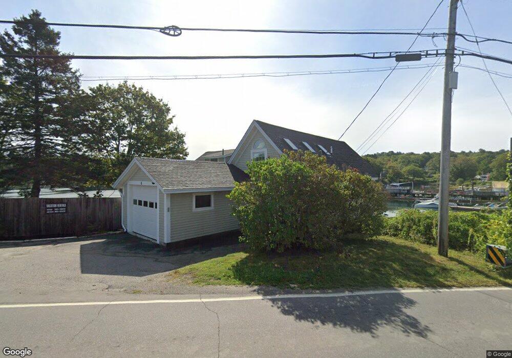
8 Hendricks Hill Rd Southport, ME 04576
Estimated Value: $689,000
3
Beds
3
Baths
2,162
Sq Ft
$319/Sq Ft
Est. Value
About This Home
This home is located at 8 Hendricks Hill Rd, Southport, ME 04576 and is currently priced at $689,000, approximately $318 per square foot. 8 Hendricks Hill Rd is a home located in Lincoln County with nearby schools including Southport Central School.
Ownership History
Date
Name
Owned For
Owner Type
Purchase Details
Closed on
Jan 26, 2016
Sold by
Bank New York Mellon Tr
Bought by
Bank New York Mellon Tr
Current Estimated Value
Purchase Details
Closed on
Nov 9, 2005
Sold by
Tiller Thomas E and Tiller Susan R
Bought by
Emery Richard B and Emery Elizabeth A
Home Financials for this Owner
Home Financials are based on the most recent Mortgage that was taken out on this home.
Original Mortgage
$712,500
Outstanding Balance
$387,763
Interest Rate
5.93%
Mortgage Type
Commercial
Create a Home Valuation Report for This Property
The Home Valuation Report is an in-depth analysis detailing your home's value as well as a comparison with similar homes in the area
Home Values in the Area
Average Home Value in this Area
Purchase History
| Date | Buyer | Sale Price | Title Company |
|---|---|---|---|
| Bank New York Mellon Tr | -- | -- | |
| Emery Richard B | -- | -- |
Source: Public Records
Mortgage History
| Date | Status | Borrower | Loan Amount |
|---|---|---|---|
| Open | Emery Richard B | $712,500 |
Source: Public Records
Tax History Compared to Growth
Tax History
| Year | Tax Paid | Tax Assessment Tax Assessment Total Assessment is a certain percentage of the fair market value that is determined by local assessors to be the total taxable value of land and additions on the property. | Land | Improvement |
|---|---|---|---|---|
| 2024 | $3,713 | $652,630 | $310,000 | $342,630 |
| 2023 | $3,426 | $652,630 | $310,000 | $342,630 |
| 2022 | $3,394 | $652,630 | $310,000 | $342,630 |
| 2021 | $3,720 | $652,630 | $310,000 | $342,630 |
| 2020 | $3,387 | $752,630 | $410,000 | $342,630 |
| 2019 | $3,086 | $752,630 | $410,000 | $342,630 |
| 2018 | $3,086 | $752,630 | $410,000 | $342,630 |
| 2017 | $2,943 | $752,630 | $410,000 | $342,630 |
| 2016 | $2,943 | $752,630 | $410,000 | $342,630 |
| 2007 | -- | $752,630 | $410,000 | $342,630 |
Source: Public Records
Map
Nearby Homes
- 3 Cedar Ln Unit 3
- 1 Cedar Ln Unit 1
- 17 Cedar Ln Unit 17
- 14 Pinkie Ln
- 58 Roads End Rd
- 26 Sea St
- 12 Sea St
- 53 Commercial St
- 27 Townsend Ave
- 34 Townsend Ave
- 37 Townsend Ave
- 66 Townsend Avenue & 43 Oak St
- 43 Oak St
- 66 Townsend Ave
- 461 Hendricks Hill Rd
- 31 Bay St
- 74 & 76 Bay St
- 302 Townsend Ave
- 44-4 Windrush Ln
- 11 Youngs Rd
- 16 Hendricks Hill Rd
- 8 Hendricks Hill
- 10 Hendricks Hill Rd
- 8 Thompsons Hill Rd
- 7 Thompsons Hill Rd
- 4 Thompsons Hill Rd
- 4 Hendricks Hill Rd
- 11 Thompsons Hill Rd
- 6 Thompsons Hill Rd
- 20 Hendricks Hill Rd
- 11 Beacon Hill Rd
- 00 Cape Newagen Rd
- 7 Beacon Hill Rd
- 25 Hendricks Hill Rd
- 9 Beacon Hill Rd
- 25 Beacon Hill Rd
- 17 Beacon Hill Rd
- 0 Beacon Hill Rd
- 0 Beacon Hill
- 35 Beacon Hill Rd