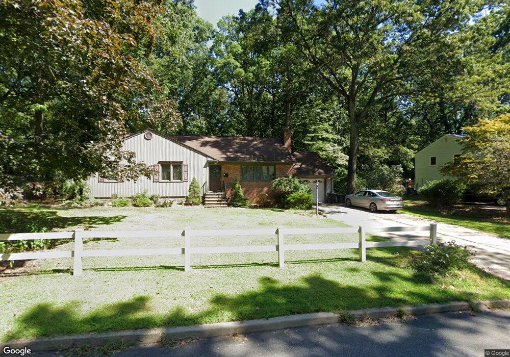
8 Highland Ct Morris Plains, NJ 07950
Estimated Value: $646,956 - $770,000
--
Bed
--
Bath
1,886
Sq Ft
$382/Sq Ft
Est. Value
About This Home
This home is located at 8 Highland Ct, Morris Plains, NJ 07950 and is currently estimated at $720,739, approximately $382 per square foot. 8 Highland Ct is a home located in Morris County with nearby schools including Littleton Elementary School, Brooklawn Middle School, and Parsippany Hills High School.
Ownership History
Date
Name
Owned For
Owner Type
Purchase Details
Closed on
May 5, 2009
Sold by
Barrett Colleen M
Bought by
Tizzoni Stephen M and Demming Bria T
Current Estimated Value
Home Financials for this Owner
Home Financials are based on the most recent Mortgage that was taken out on this home.
Original Mortgage
$417,000
Interest Rate
4.86%
Mortgage Type
New Conventional
Purchase Details
Closed on
Apr 11, 2008
Sold by
Palmer Stephen and Palmer Deborah
Bought by
Barrett Colleen M
Home Financials for this Owner
Home Financials are based on the most recent Mortgage that was taken out on this home.
Original Mortgage
$361,000
Interest Rate
6.22%
Mortgage Type
Purchase Money Mortgage
Purchase Details
Closed on
Jun 15, 2005
Sold by
Caruso Annette M
Bought by
Palmer Stephen and Palmer Deborah
Home Financials for this Owner
Home Financials are based on the most recent Mortgage that was taken out on this home.
Original Mortgage
$359,600
Interest Rate
5.71%
Mortgage Type
New Conventional
Create a Home Valuation Report for This Property
The Home Valuation Report is an in-depth analysis detailing your home's value as well as a comparison with similar homes in the area
Home Values in the Area
Average Home Value in this Area
Purchase History
| Date | Buyer | Sale Price | Title Company |
|---|---|---|---|
| Tizzoni Stephen M | $495,000 | None Available | |
| Barrett Colleen M | $511,000 | First American Title Ins Co | |
| Palmer Stephen | $455,000 | -- |
Source: Public Records
Mortgage History
| Date | Status | Borrower | Loan Amount |
|---|---|---|---|
| Previous Owner | Tizzoni Stephen M | $417,000 | |
| Previous Owner | Barrett Colleen M | $361,000 | |
| Previous Owner | Palmer Stephen | $359,600 |
Source: Public Records
Tax History Compared to Growth
Tax History
| Year | Tax Paid | Tax Assessment Tax Assessment Total Assessment is a certain percentage of the fair market value that is determined by local assessors to be the total taxable value of land and additions on the property. | Land | Improvement |
|---|---|---|---|---|
| 2025 | $12,222 | $351,800 | $188,200 | $163,600 |
| 2024 | $11,989 | $351,800 | $188,200 | $163,600 |
| 2023 | $11,989 | $351,800 | $188,200 | $163,600 |
| 2022 | $11,156 | $351,800 | $188,200 | $163,600 |
| 2021 | $11,156 | $351,800 | $188,200 | $163,600 |
| 2020 | $10,850 | $351,800 | $188,200 | $163,600 |
| 2019 | $10,558 | $351,800 | $188,200 | $163,600 |
| 2018 | $10,110 | $346,700 | $188,200 | $158,500 |
| 2017 | $9,881 | $346,700 | $188,200 | $158,500 |
| 2016 | $9,711 | $346,700 | $188,200 | $158,500 |
| 2015 | $9,465 | $346,700 | $188,200 | $158,500 |
| 2014 | $9,326 | $346,700 | $188,200 | $158,500 |
Source: Public Records
Map
Nearby Homes
- 35 Ferncliff Rd
- 9 Craydon St
- 2 A Foxwood Dr Unit A
- 62 Brookstone Cir
- 21 G Foxwood Dr
- 2350 State Route 10 Unit D11
- 7 J Foxwood Dr Unit J
- 22 A Foxwood Dr Unit A
- 7 D Foxwood Dr Unit D
- 21 Holly Dr
- 2467 Route 10 Unit 4A
- 2467 Route10 Unit 1A
- 2467 New Jersey 10 Unit 6A
- 2467 New Jersey 10 Unit 1
- 2467 New Jersey 10 Unit 7A
- 2467 State Route 10 Unit 12-7A
- 2467 State Route 10 Unit 3B
- 2467 State Route 10 Unit 6-B
- 2467 State Route 10 Unit 5A
- 2467 State Route 10 Unit 24-6B