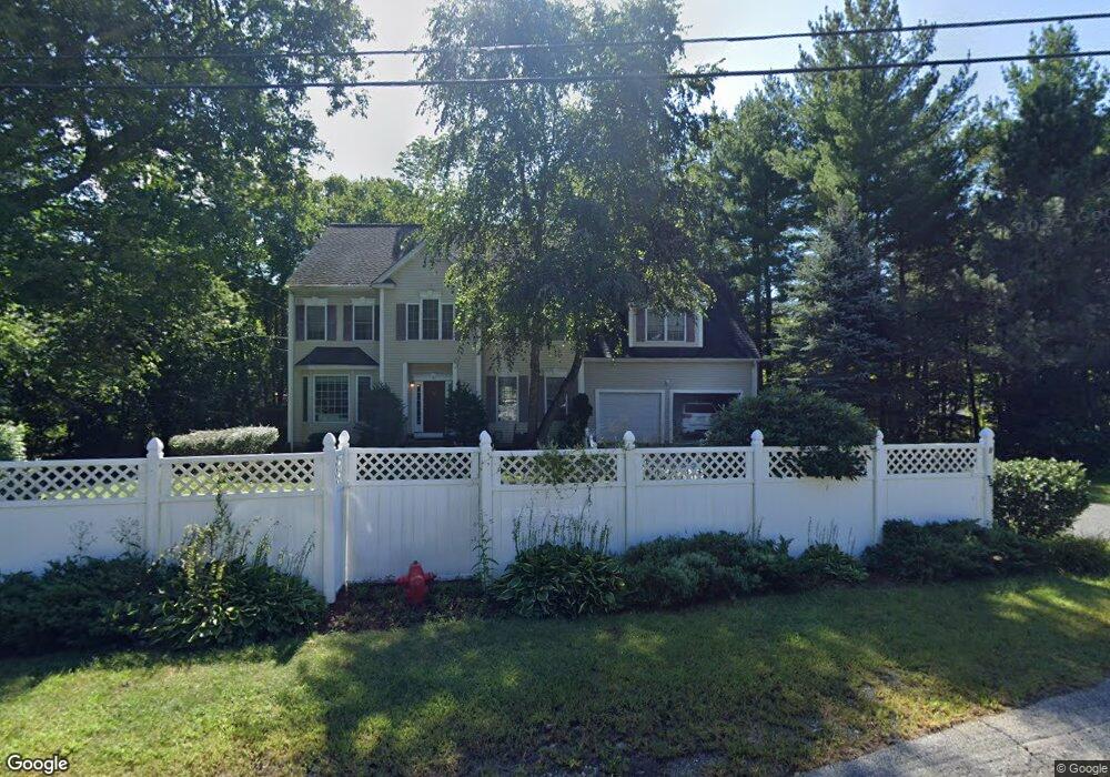
8 Howe St Ashland, MA 01721
Estimated Value: $1,013,283 - $1,201,000
4
Beds
3
Baths
3,728
Sq Ft
$291/Sq Ft
Est. Value
About This Home
This home is located at 8 Howe St, Ashland, MA 01721 and is currently estimated at $1,083,821, approximately $290 per square foot. 8 Howe St is a home located in Middlesex County with nearby schools including William Pittaway Elementary School, David Mindess Elementary School, and Henry E. Warren Elementary School.
Ownership History
Date
Name
Owned For
Owner Type
Purchase Details
Closed on
Mar 31, 2017
Sold by
Berotte-Joseph Carole M
Bought by
Pisani-Botto Robin and Botto Timothy
Current Estimated Value
Home Financials for this Owner
Home Financials are based on the most recent Mortgage that was taken out on this home.
Original Mortgage
$454,400
Outstanding Balance
$367,770
Interest Rate
3.25%
Mortgage Type
New Conventional
Estimated Equity
$716,051
Purchase Details
Closed on
Mar 10, 2005
Sold by
Wellborn Bldrs Llc
Bought by
Berotte-Joseph Carole M
Home Financials for this Owner
Home Financials are based on the most recent Mortgage that was taken out on this home.
Original Mortgage
$450,000
Interest Rate
5.64%
Mortgage Type
Purchase Money Mortgage
Create a Home Valuation Report for This Property
The Home Valuation Report is an in-depth analysis detailing your home's value as well as a comparison with similar homes in the area
Home Values in the Area
Average Home Value in this Area
Purchase History
| Date | Buyer | Sale Price | Title Company |
|---|---|---|---|
| Pisani-Botto Robin | $568,000 | -- | |
| Berotte-Joseph Carole M | $590,000 | -- |
Source: Public Records
Mortgage History
| Date | Status | Borrower | Loan Amount |
|---|---|---|---|
| Open | Pisani-Botto Robin | $454,400 | |
| Previous Owner | Berotte-Joseph Carole M | $450,000 |
Source: Public Records
Tax History Compared to Growth
Tax History
| Year | Tax Paid | Tax Assessment Tax Assessment Total Assessment is a certain percentage of the fair market value that is determined by local assessors to be the total taxable value of land and additions on the property. | Land | Improvement |
|---|---|---|---|---|
| 2025 | $11,396 | $892,400 | $249,600 | $642,800 |
| 2024 | $10,936 | $826,000 | $249,600 | $576,400 |
| 2023 | $10,019 | $727,600 | $237,900 | $489,700 |
| 2022 | $10,106 | $636,400 | $216,200 | $420,200 |
| 2021 | $15,926 | $605,200 | $216,200 | $389,000 |
| 2020 | $15,380 | $583,800 | $216,200 | $367,600 |
| 2019 | $9,156 | $562,400 | $216,200 | $346,200 |
| 2018 | $9,325 | $561,400 | $214,200 | $347,200 |
| 2017 | $10,012 | $599,500 | $230,100 | $369,400 |
| 2016 | $9,772 | $574,800 | $227,100 | $347,700 |
| 2015 | $9,645 | $557,500 | $214,200 | $343,300 |
| 2014 | $9,453 | $543,600 | $190,200 | $353,400 |
Source: Public Records
Map
Nearby Homes
- 0 Cordaville Rd
- 22 Irene Cir
- 0 Oak St
- 43 Edgewood Rd
- 20 Braeburn Ln
- 0 Cross St
- 203 Pleasant St
- 23 Stonebrook Ct Unit 11
- 30 Waterville Ln Unit 30
- 34 Waterville Ln Unit 34
- 36 Waterville Ln Unit 36
- 38 Waterville Ln Unit 38
- 10 Waterville Ln Unit 10
- 4 Waterville Ln Unit 4
- 2 Aikens Rd
- 13 Birkdale Ln Unit 13
- 71 Weston Ln Unit 71
- 20 Southville Rd
- 3 Blueberry Hill Ln
- 8 Parker St
- 8 Howe St
- 208 Cordaville
- 200 Cordaville Rd
- 4 Howe St
- 3 Howe St
- 207 Cordaville Rd
- 198 Cordaville Rd
- 220 Cordaville Rd
- 221 Cordaville Rd
- 195 Cordaville Rd
- 224 Cordaville Rd
- 194 Cordaville Rd
- 223 Cordaville Rd
- 189 Cordaville Rd
- 190 Cordaville Rd
- 228 Cordaville Rd
- 0 Thomas St
- 185 Cordaville Rd
- 234 Cordaville Rd
- 186 Cordaville Rd