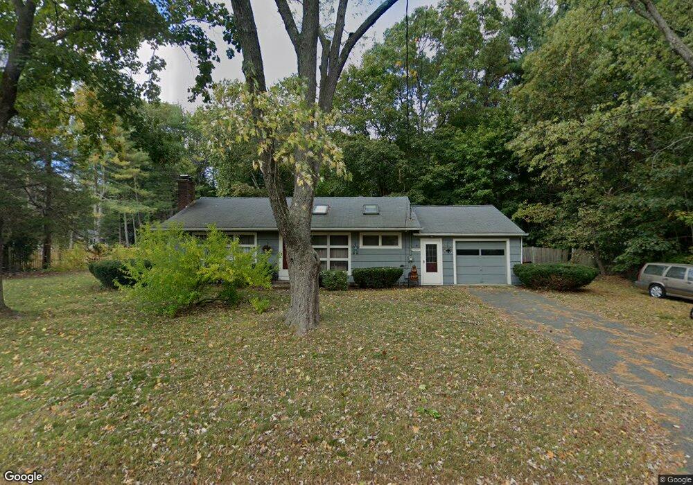
8 Howell Rd Sudbury, MA 01776
Estimated Value: $425,000 - $700,000
2
Beds
1
Bath
960
Sq Ft
$576/Sq Ft
Est. Value
About This Home
This home is located at 8 Howell Rd, Sudbury, MA 01776 and is currently estimated at $553,423, approximately $576 per square foot. 8 Howell Rd is a home located in Middlesex County with nearby schools including Israel Loring Elementary School, Ephraim Curtis Middle School, and Lincoln-Sudbury Regional High School.
Ownership History
Date
Name
Owned For
Owner Type
Purchase Details
Closed on
Mar 27, 2009
Sold by
Dibattista Christina M
Bought by
Elgart Patricia L
Current Estimated Value
Home Financials for this Owner
Home Financials are based on the most recent Mortgage that was taken out on this home.
Original Mortgage
$145,000
Outstanding Balance
$92,643
Interest Rate
5.14%
Mortgage Type
Purchase Money Mortgage
Estimated Equity
$460,780
Purchase Details
Closed on
Jun 22, 2007
Sold by
Intraversato Tr Gail M and Intraversato Joseph R
Bought by
Dibattista Christina M
Home Financials for this Owner
Home Financials are based on the most recent Mortgage that was taken out on this home.
Original Mortgage
$279,900
Interest Rate
6.14%
Mortgage Type
Purchase Money Mortgage
Create a Home Valuation Report for This Property
The Home Valuation Report is an in-depth analysis detailing your home's value as well as a comparison with similar homes in the area
Home Values in the Area
Average Home Value in this Area
Purchase History
| Date | Buyer | Sale Price | Title Company |
|---|---|---|---|
| Elgart Patricia L | $300,000 | -- | |
| Dibattista Christina M | $349,900 | -- |
Source: Public Records
Mortgage History
| Date | Status | Borrower | Loan Amount |
|---|---|---|---|
| Open | Elgart Patricia L | $145,000 | |
| Previous Owner | Dibattista Christina M | $279,900 |
Source: Public Records
Tax History Compared to Growth
Tax History
| Year | Tax Paid | Tax Assessment Tax Assessment Total Assessment is a certain percentage of the fair market value that is determined by local assessors to be the total taxable value of land and additions on the property. | Land | Improvement |
|---|---|---|---|---|
| 2025 | $3,635 | $248,282 | $130,000 | $118,282 |
| 2024 | $3,406 | $233,149 | $130,000 | $103,149 |
| 2023 | $3,168 | $200,887 | $130,000 | $70,887 |
| 2022 | $3,401 | $188,415 | $130,000 | $58,415 |
| 2021 | $3,548 | $188,415 | $130,000 | $58,415 |
| 2020 | $3,236 | $175,390 | $130,000 | $45,390 |
| 2019 | $3,141 | $175,390 | $130,000 | $45,390 |
| 2018 | $2,984 | $166,400 | $130,000 | $36,400 |
| 2017 | $2,964 | $167,079 | $130,000 | $37,079 |
| 2016 | $2,718 | $152,700 | $130,000 | $22,700 |
| 2015 | $2,688 | $152,700 | $130,000 | $22,700 |
| 2014 | $2,753 | $152,700 | $130,000 | $22,700 |
Source: Public Records
Map
Nearby Homes
- 54 Stone Rd
- 0 Robbins Rd
- 12 Hickory Rd
- 0 Boston Post Rd
- 30 Rolling Ln
- 7 Adams Rd
- 24 Woodland Rd
- 143 Peakham Rd
- 89 Bridle Path
- 128 Nobscot Rd
- 7 Saddle Ridge Rd
- 30 Nobscot Rd Unit 14
- 1011 Boston Post Rd
- 32 Eaton Rd W
- 123 Dutton Rd
- 21 Summer St
- 6 Mountain View Dr
- 270 Old Lancaster Rd
- 100 Nobscot Dr
- 19 Nob Hill Dr