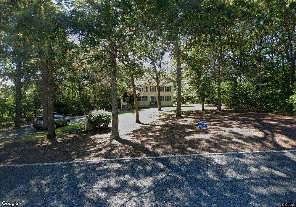
8 Jordan Ln East Freetown, MA 02717
Estimated Value: $689,510 - $838,000
3
Beds
3
Baths
2,272
Sq Ft
$337/Sq Ft
Est. Value
About This Home
This home is located at 8 Jordan Ln, East Freetown, MA 02717 and is currently estimated at $765,378, approximately $336 per square foot. 8 Jordan Ln is a home located in Bristol County with nearby schools including Freetown Elementary School, George R Austin Intermediate School, and Freetown-Lakeville Middle School.
Ownership History
Date
Name
Owned For
Owner Type
Purchase Details
Closed on
Jul 8, 1992
Sold by
Proprietors Acres T
Bought by
Pacheco Steven F and Pacheco Debra A
Current Estimated Value
Home Financials for this Owner
Home Financials are based on the most recent Mortgage that was taken out on this home.
Original Mortgage
$90,000
Interest Rate
8.56%
Mortgage Type
Purchase Money Mortgage
Create a Home Valuation Report for This Property
The Home Valuation Report is an in-depth analysis detailing your home's value as well as a comparison with similar homes in the area
Home Values in the Area
Average Home Value in this Area
Purchase History
| Date | Buyer | Sale Price | Title Company |
|---|---|---|---|
| Pacheco Steven F | $63,000 | -- |
Source: Public Records
Mortgage History
| Date | Status | Borrower | Loan Amount |
|---|---|---|---|
| Open | Pacheco Steven F | $203,389 | |
| Closed | Pacheco Steven F | $50,000 | |
| Closed | Pacheco Steven F | $30,000 | |
| Closed | Pacheco Steven F | $90,000 |
Source: Public Records
Tax History Compared to Growth
Tax History
| Year | Tax Paid | Tax Assessment Tax Assessment Total Assessment is a certain percentage of the fair market value that is determined by local assessors to be the total taxable value of land and additions on the property. | Land | Improvement |
|---|---|---|---|---|
| 2025 | $6,014 | $606,900 | $197,200 | $409,700 |
| 2024 | $5,975 | $572,900 | $186,000 | $386,900 |
| 2023 | $5,820 | $543,400 | $167,600 | $375,800 |
| 2022 | $5,596 | $464,000 | $142,000 | $322,000 |
| 2021 | $5,364 | $422,400 | $129,100 | $293,300 |
| 2020 | $5,328 | $409,200 | $124,100 | $285,100 |
| 2019 | $5,143 | $391,100 | $123,800 | $267,300 |
| 2018 | $4,833 | $363,100 | $123,800 | $239,300 |
| 2017 | $4,689 | $352,000 | $123,800 | $228,200 |
| 2016 | $4,512 | $344,700 | $120,300 | $224,400 |
| 2015 | $4,320 | $334,900 | $114,800 | $220,100 |
| 2014 | $4,258 | $337,700 | $117,800 | $219,900 |
Source: Public Records
Map
Nearby Homes
- 144 Chace Rd
- 0 Costa Dr
- 150 Quanapoag Rd
- Lot 2/3 Quanapoag Rd
- 195 Slab Bridge Rd
- 599 Quanapoag Rd
- 1475 Braley Rd Unit 17
- 13 Luscomb Ln
- 4597 Acushnet Ave
- 16 Swallow St
- 264 Collins Corner Rd
- 1069 Cherokee St
- 353 Upland St
- 24 Bells Brook Rd
- 319 Northwest St
- 64 Blaze Rd
- 210 Heritage Dr
- 34 Poplar Rd
- 9 Paul Ave
- 145 Heritage Dr
- 6 Jordan Ln
- 10 Jordan Ln
- 9 Jordan Ln
- 7 Jordan Ln
- 4 Jordan Ln
- Lot 72 Jordan Ln
- Lot 73 Jordan Ln
- Lot 74 Jordan Ln
- 12 Jordan Ln
- lot 76 Jordan Ln
- Lot 77 Jordan Ln
- 11 Jordan Ln
- 13 Jordan Ln
- 2 Jordan Ln
- 14 Jordan Ln
- 4 King Philip Way
- 5 Boxberry Rd
- 6 King Philip Way
- 1 Buddys Crossing
- Lot 83 King Phillip Way