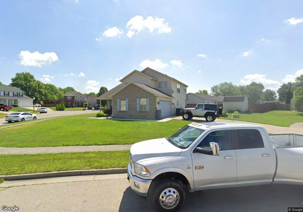
8 Larry Ct Brookville, OH 45309
Estimated Value: $264,000 - $362,000
3
Beds
2
Baths
1,731
Sq Ft
$172/Sq Ft
Est. Value
About This Home
This home is located at 8 Larry Ct, Brookville, OH 45309 and is currently estimated at $297,373, approximately $171 per square foot. 8 Larry Ct is a home located in Montgomery County with nearby schools including Brookville Elementary School, Brookville Intermediate School, and Brookville High School.
Ownership History
Date
Name
Owned For
Owner Type
Purchase Details
Closed on
Aug 30, 2006
Sold by
Building By Design Llc
Bought by
Angel Adrien C and Angel Natalie S
Current Estimated Value
Home Financials for this Owner
Home Financials are based on the most recent Mortgage that was taken out on this home.
Original Mortgage
$175,698
Interest Rate
6.7%
Mortgage Type
VA
Create a Home Valuation Report for This Property
The Home Valuation Report is an in-depth analysis detailing your home's value as well as a comparison with similar homes in the area
Home Values in the Area
Average Home Value in this Area
Purchase History
| Date | Buyer | Sale Price | Title Company |
|---|---|---|---|
| Angel Adrien C | $172,000 | None Available |
Source: Public Records
Mortgage History
| Date | Status | Borrower | Loan Amount |
|---|---|---|---|
| Closed | Angel Adrien C | $175,698 |
Source: Public Records
Tax History
| Year | Tax Paid | Tax Assessment Tax Assessment Total Assessment is a certain percentage of the fair market value that is determined by local assessors to be the total taxable value of land and additions on the property. | Land | Improvement |
|---|---|---|---|---|
| 2025 | $3,586 | $73,730 | $14,220 | $59,510 |
| 2024 | $3,455 | $73,730 | $14,220 | $59,510 |
| 2023 | $3,455 | $73,730 | $14,220 | $59,510 |
| 2022 | $3,496 | $58,060 | $11,200 | $46,860 |
| 2021 | $3,511 | $58,060 | $11,200 | $46,860 |
| 2020 | $3,516 | $58,060 | $11,200 | $46,860 |
| 2019 | $3,479 | $52,610 | $11,200 | $41,410 |
| 2018 | $3,497 | $52,610 | $11,200 | $41,410 |
| 2017 | $3,481 | $52,610 | $11,200 | $41,410 |
| 2016 | $3,249 | $48,170 | $11,200 | $36,970 |
| 2015 | $3,197 | $48,170 | $11,200 | $36,970 |
| 2014 | $3,197 | $48,170 | $11,200 | $36,970 |
| 2012 | -- | $46,000 | $11,200 | $34,800 |
Source: Public Records
Map
Nearby Homes
- 232 Maple St
- 107 Evergreen Way
- 102 Meadowlark Ln
- 102 Meadowlark Ln Unit 905-201
- 104 Meadowlark Ln
- 104 Meadowlark Ln Unit 905-202
- 421 Market St
- 144 Evergreen Way
- 12 Harshman St
- 115 N Wolf Creek St
- 115 Ostend St
- 766 Hunters Run Dr
- 254 Crosswell Ave
- 164 Autumn Maple Ln
- 336 N Wolf Creek St
- 126 Church St
- 124 Ankara Ave
- 143 Antwerp Ave
- 10365 Upper Lewisburg Salem Rd
- 150 Antwerp Ave
- 156 Marilyn Way
- 7 Larry Ct
- 143 Marilyn Way
- 14 Larry Ct
- 137 Marilyn Way
- 162 Marilyn Way
- 161 Marilyn Way
- 18 Larry Ct
- 131 Marilyn Way
- 149 Marilyn Way
- 155 Marilyn Way
- 120 Marilyn Way
- 13 Larry Ct
- 168 Marilyn Way
- 125 Marilyn Way
- 114 Marilyn Way
- 321 E Westbrook Rd
- 327 E Westbrook Rd
- 315 E Westbrook Rd
- 119 Marilyn Way
Your Personal Tour Guide
Ask me questions while you tour the home.