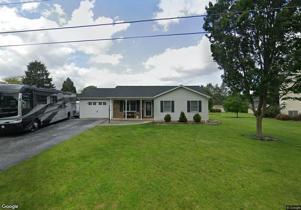
8 Locust St Mont Alto, PA 17237
Estimated Value: $267,000 - $300,000
--
Bed
1
Bath
1,520
Sq Ft
$186/Sq Ft
Est. Value
About This Home
This home is located at 8 Locust St, Mont Alto, PA 17237 and is currently estimated at $282,496, approximately $185 per square foot. 8 Locust St is a home located in Franklin County with nearby schools including Waynesboro Area Senior High School and Providence School - Pigeon Hill Building.
Ownership History
Date
Name
Owned For
Owner Type
Purchase Details
Closed on
Mar 9, 2017
Sold by
Ely Sandy L and Ely Chad R
Bought by
Ely Sandy L and Ely Chad R
Current Estimated Value
Home Financials for this Owner
Home Financials are based on the most recent Mortgage that was taken out on this home.
Original Mortgage
$163,500
Outstanding Balance
$135,658
Interest Rate
4.19%
Mortgage Type
New Conventional
Estimated Equity
$146,838
Purchase Details
Closed on
Feb 22, 2006
Sold by
Hottle Frank S and Hottle Roberta A
Bought by
Ely Sandy L
Home Financials for this Owner
Home Financials are based on the most recent Mortgage that was taken out on this home.
Original Mortgage
$180,000
Interest Rate
6.52%
Mortgage Type
New Conventional
Create a Home Valuation Report for This Property
The Home Valuation Report is an in-depth analysis detailing your home's value as well as a comparison with similar homes in the area
Home Values in the Area
Average Home Value in this Area
Purchase History
| Date | Buyer | Sale Price | Title Company |
|---|---|---|---|
| Ely Sandy L | -- | None Available | |
| Ely Sandy L | $225,000 | None Available |
Source: Public Records
Mortgage History
| Date | Status | Borrower | Loan Amount |
|---|---|---|---|
| Open | Ely Sandy L | $163,500 | |
| Previous Owner | Ely Sandy L | $180,000 |
Source: Public Records
Tax History Compared to Growth
Tax History
| Year | Tax Paid | Tax Assessment Tax Assessment Total Assessment is a certain percentage of the fair market value that is determined by local assessors to be the total taxable value of land and additions on the property. | Land | Improvement |
|---|---|---|---|---|
| 2025 | $3,857 | $25,070 | $2,150 | $22,920 |
| 2024 | $3,744 | $25,070 | $2,150 | $22,920 |
| 2023 | $3,647 | $25,070 | $2,150 | $22,920 |
| 2022 | $3,547 | $25,070 | $2,150 | $22,920 |
| 2021 | $3,446 | $25,070 | $2,150 | $22,920 |
| 2020 | $3,446 | $25,070 | $2,150 | $22,920 |
| 2019 | $3,371 | $25,070 | $2,150 | $22,920 |
| 2018 | $3,240 | $25,070 | $2,150 | $22,920 |
| 2017 | $718 | $25,070 | $2,150 | $22,920 |
| 2016 | $602 | $21,020 | $2,150 | $18,870 |
| 2015 | $561 | $21,020 | $2,150 | $18,870 |
| 2014 | $561 | $21,020 | $2,150 | $18,870 |
Source: Public Records
Map
Nearby Homes
- 286 Verdier St
- 308 Verdier St
- 6 S Main St
- 111 Poplar St
- 6135 Merion Dr
- 7205 Fairway Dr S
- 6158 Merion Dr
- 7468 Anthony Hwy
- 7130 St Annes Dr
- 7136 Sandwich Ln
- 7059 Duck Hook Ln
- 6337 Medina Ridge Dr
- 7060 Duck Hook Ln
- 7121 Sandwich Ln
- 6396 Saucon Valley Dr
- 6852 Lytham Ln
- 7023 Saint Annes Dr
- 6352 Penn National Dr
- 3881 Farmstead Dr
- 5434 Manheim Rd