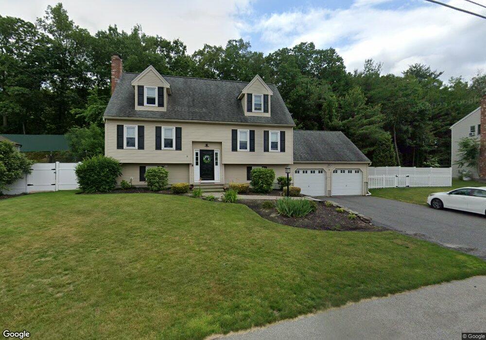
8 Lt Haynes Mem Dr Millbury, MA 01527
Estimated Value: $594,000 - $638,000
3
Beds
4
Baths
1,746
Sq Ft
$350/Sq Ft
Est. Value
About This Home
This home is located at 8 Lt Haynes Mem Dr, Millbury, MA 01527 and is currently estimated at $611,189, approximately $350 per square foot. 8 Lt Haynes Mem Dr is a home located in Worcester County with nearby schools including Elmwood Street Elementary School, Raymond E. Shaw Elementary School, and Millbury Junior/Senior High School.
Ownership History
Date
Name
Owned For
Owner Type
Purchase Details
Closed on
Aug 14, 2006
Sold by
Lagor Gina T and Lagor Richard J
Bought by
Lagor Joseph J and Lagor Nicole
Current Estimated Value
Home Financials for this Owner
Home Financials are based on the most recent Mortgage that was taken out on this home.
Original Mortgage
$305,600
Interest Rate
6.8%
Mortgage Type
Purchase Money Mortgage
Purchase Details
Closed on
Jan 12, 2001
Sold by
Rollie Shepard Rt and Miles John Todd
Bought by
Lagor Richard J and Lagor Gina T
Purchase Details
Closed on
Jan 3, 2001
Sold by
Rollie Shepard Rt and Miles John Todd
Bought by
Lomartire Marc C and Lomartire Nerissa S
Create a Home Valuation Report for This Property
The Home Valuation Report is an in-depth analysis detailing your home's value as well as a comparison with similar homes in the area
Home Values in the Area
Average Home Value in this Area
Purchase History
| Date | Buyer | Sale Price | Title Company |
|---|---|---|---|
| Lagor Joseph J | $382,000 | -- | |
| Lagor Joseph J | $382,000 | -- | |
| Lagor Richard J | $205,000 | -- | |
| Lomartire Marc C | $231,800 | -- |
Source: Public Records
Mortgage History
| Date | Status | Borrower | Loan Amount |
|---|---|---|---|
| Open | Lomartire Marc C | $342,869 | |
| Closed | Lagor Joseph J | $305,600 |
Source: Public Records
Tax History Compared to Growth
Tax History
| Year | Tax Paid | Tax Assessment Tax Assessment Total Assessment is a certain percentage of the fair market value that is determined by local assessors to be the total taxable value of land and additions on the property. | Land | Improvement |
|---|---|---|---|---|
| 2025 | $7,048 | $526,400 | $116,100 | $410,300 |
| 2024 | $6,472 | $489,200 | $107,500 | $381,700 |
| 2023 | $5,562 | $384,900 | $75,500 | $309,400 |
| 2022 | $5,510 | $367,300 | $75,500 | $291,800 |
| 2021 | $5,120 | $331,800 | $75,500 | $256,300 |
| 2020 | $5,267 | $343,600 | $75,500 | $268,100 |
| 2019 | $5,391 | $340,100 | $75,100 | $265,000 |
| 2018 | $4,015 | $322,800 | $75,100 | $247,700 |
| 2017 | $4,513 | $274,700 | $75,100 | $199,600 |
| 2016 | $4,462 | $271,100 | $75,100 | $196,000 |
| 2015 | $4,401 | $267,400 | $76,300 | $191,100 |
| 2014 | $4,154 | $242,900 | $79,800 | $163,100 |
Source: Public Records
Map
Nearby Homes
- 86 Wheelock Ave
- 12 Irene Ct
- 2 Diane St
- 3 May St
- 11 Westview Ave
- 1 Pineland Ave
- 11 Maplewood Rd
- 27 A-B Grafton St
- 90 Macarthur Dr
- 1 Broadmeadow Ave
- 3 Stidsen Way
- 46 John Dr Unit 46
- 330 Millbury Ave
- 21 Lordvale Blvd Unit 406
- 5 Edward Dr
- 12 Alstead Path
- 232 Weatherstone Dr
- 76 Weatherstone Dr
- 76 Samuel Dr
- 5 Lincoln Ln Unit 5
- 8 Lt William S Haynes Memorial Dr
- 10 Lt Haynes Mem Dr
- 10 Lt William S Haynes Memorial Dr
- 10 Lt Wm S Haynes III Dr
- 10 Lt Haynes Dr
- 6 Lt Haynes Mem Dr
- 7 Lt Haynes Mem Dr
- 5 Lt Haynes Mem Dr
- 9 Lt Haynes Mem Dr
- 4 Lt Haynes Dr
- 4 Lt William S Haynes Memorial Dr
- 4 Lt Haynes Mem Dr
- 12 Lt Haynes Mem Dr
- 3 Lt Haynes Mem Dr
- 11 Lt William S Haynes Memorial Dr
- 11 Lt Haynes Mem Dr
- 13 Lt Haynes Dr
- 13 Lt William S Haynes Memor
- 13 Lt Haynes Mem Dr
- 2 Lt William S Haynes Memorial Dr