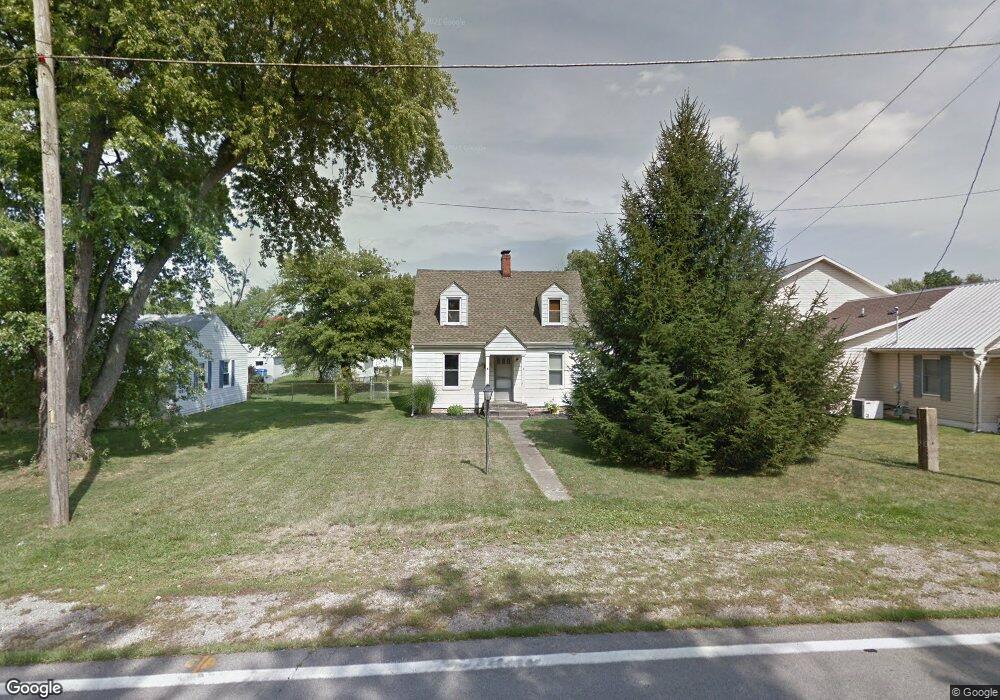
8 Main St Orient, OH 43146
Estimated Value: $112,000 - $229,000
3
Beds
1
Bath
1,208
Sq Ft
$151/Sq Ft
Est. Value
About This Home
This home is located at 8 Main St, Orient, OH 43146 and is currently estimated at $182,908, approximately $151 per square foot. 8 Main St is a home located in Pickaway County.
Ownership History
Date
Name
Owned For
Owner Type
Purchase Details
Closed on
Nov 8, 2012
Sold by
Secretary Of Housing & Urban Development
Bought by
Dedavitt Paula
Current Estimated Value
Home Financials for this Owner
Home Financials are based on the most recent Mortgage that was taken out on this home.
Original Mortgage
$36,000
Outstanding Balance
$4,976
Interest Rate
2.66%
Mortgage Type
Credit Line Revolving
Estimated Equity
$177,932
Purchase Details
Closed on
Jul 30, 2012
Sold by
U S Bank Na
Bought by
Secretary Of Housing & Urban Development
Purchase Details
Closed on
Sep 23, 2010
Sold by
Scott James A
Bought by
Us Bank Na
Purchase Details
Closed on
Aug 25, 2006
Sold by
Martin Douglas P and Martin Jean M
Bought by
Scott James A
Home Financials for this Owner
Home Financials are based on the most recent Mortgage that was taken out on this home.
Original Mortgage
$112,014
Interest Rate
6.59%
Mortgage Type
FHA
Purchase Details
Closed on
Dec 1, 1985
Create a Home Valuation Report for This Property
The Home Valuation Report is an in-depth analysis detailing your home's value as well as a comparison with similar homes in the area
Home Values in the Area
Average Home Value in this Area
Purchase History
| Date | Buyer | Sale Price | Title Company |
|---|---|---|---|
| Dedavitt Paula | $40,000 | Arrow Title Agency | |
| Secretary Of Housing & Urban Development | -- | None Available | |
| Us Bank Na | $56,667 | None Available | |
| Scott James A | $112,900 | Title First | |
| -- | $39,900 | -- |
Source: Public Records
Mortgage History
| Date | Status | Borrower | Loan Amount |
|---|---|---|---|
| Open | Dedavitt Paula | $36,000 | |
| Previous Owner | Scott James A | $112,014 |
Source: Public Records
Tax History
| Year | Tax Paid | Tax Assessment Tax Assessment Total Assessment is a certain percentage of the fair market value that is determined by local assessors to be the total taxable value of land and additions on the property. | Land | Improvement |
|---|---|---|---|---|
| 2025 | $2,091 | $40,520 | $4,870 | $35,650 |
| 2024 | $2,091 | $40,520 | $4,870 | $35,650 |
| 2023 | $1,524 | $40,520 | $4,870 | $35,650 |
| 2022 | $1,316 | $32,150 | $4,140 | $28,010 |
| 2021 | $1,320 | $32,150 | $4,140 | $28,010 |
| 2020 | $1,321 | $32,150 | $4,140 | $28,010 |
| 2019 | $1,103 | $26,090 | $4,140 | $21,950 |
| 2018 | $1,017 | $26,090 | $4,140 | $21,950 |
| 2017 | $1,043 | $26,090 | $4,140 | $21,950 |
| 2016 | $992 | $24,760 | $4,120 | $20,640 |
| 2015 | $993 | $24,760 | $4,120 | $20,640 |
| 2014 | $994 | $24,760 | $4,120 | $20,640 |
| 2013 | $1,648 | $24,760 | $4,120 | $20,640 |
Source: Public Records
Map
Nearby Homes
- 472 Creekside Dr
- 505 Conley Dr
- 513 Heidish Dr
- 263 Cavanaugh Dr
- 305 Cherry Hills Rd
- 282 Olympic Loop
- 24 Erin Hills Rd
- 290 Olympic Loop
- 358 Oakmont Dr
- 62 Chambers Bay Rd
- 277 Olympic Loop
- 298 Shady Hollow Dr
- 359 Oakmont Dr
- 304 Cherry Hills Rd
- 305 Olympic Loop
- 56 Chambers Bay Rd
- 507 Walker Pointe Dr
- 239 Peters Run Ct
- 66 Genoa Cir
- 38 Waterman Ave
Your Personal Tour Guide
Ask me questions while you tour the home.