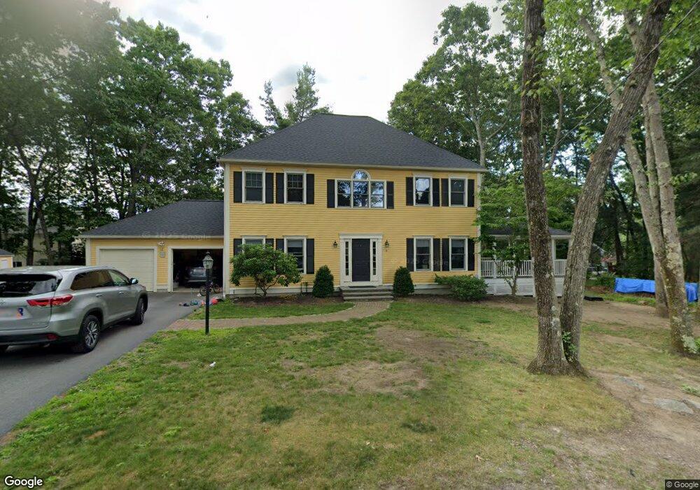
8 Marshall Ave Natick, MA 01760
Estimated Value: $1,199,000 - $1,409,000
4
Beds
4
Baths
3,316
Sq Ft
$397/Sq Ft
Est. Value
About This Home
This home is located at 8 Marshall Ave, Natick, MA 01760 and is currently estimated at $1,317,373, approximately $397 per square foot. 8 Marshall Ave is a home located in Middlesex County with nearby schools including Natick High School, J F Kennedy Middle School, and Johnson Elementary School.
Ownership History
Date
Name
Owned For
Owner Type
Purchase Details
Closed on
Jan 15, 2008
Sold by
Mcgonagle James F and Mcgonagle Paul Marybeth
Bought by
Stich Benjamin A and Gerson Serafine
Current Estimated Value
Home Financials for this Owner
Home Financials are based on the most recent Mortgage that was taken out on this home.
Original Mortgage
$125,000
Interest Rate
6.21%
Mortgage Type
Purchase Money Mortgage
Purchase Details
Closed on
Oct 15, 1997
Sold by
Bartlett Kenneth M
Bought by
Kirby Pamela J
Create a Home Valuation Report for This Property
The Home Valuation Report is an in-depth analysis detailing your home's value as well as a comparison with similar homes in the area
Home Values in the Area
Average Home Value in this Area
Purchase History
| Date | Buyer | Sale Price | Title Company |
|---|---|---|---|
| Stich Benjamin A | $705,000 | -- | |
| Kirby Pamela J | $5,750 | -- |
Source: Public Records
Mortgage History
| Date | Status | Borrower | Loan Amount |
|---|---|---|---|
| Open | Kirby Pamela J | $300,000 | |
| Closed | Kirby Pamela J | $123,000 | |
| Closed | Stich Benjamin A | $125,000 | |
| Previous Owner | Kirby Pamela J | $340,000 |
Source: Public Records
Tax History
| Year | Tax Paid | Tax Assessment Tax Assessment Total Assessment is a certain percentage of the fair market value that is determined by local assessors to be the total taxable value of land and additions on the property. | Land | Improvement |
|---|---|---|---|---|
| 2025 | $13,579 | $1,135,400 | $485,500 | $649,900 |
| 2024 | $13,180 | $1,075,000 | $459,900 | $615,100 |
| 2023 | $12,050 | $953,300 | $428,300 | $525,000 |
| 2022 | $11,863 | $889,300 | $386,700 | $502,600 |
| 2021 | $11,099 | $815,500 | $381,600 | $433,900 |
| 2020 | $10,891 | $800,200 | $366,300 | $433,900 |
| 2019 | $10,171 | $800,200 | $366,300 | $433,900 |
| 2018 | $9,583 | $734,300 | $353,600 | $380,700 |
| 2017 | $9,625 | $713,500 | $339,700 | $373,800 |
| 2016 | $9,636 | $710,100 | $339,700 | $370,400 |
| 2015 | $9,337 | $675,600 | $339,700 | $335,900 |
Source: Public Records
Map
Nearby Homes
- 46 Silver Hill Ln Unit 1
- 36 Silver Hill Ln Unit 21
- 79 Speen St
- 5 Lanes End
- 3 Silver Hill Ln Unit 6
- 26 Wellesley Ave Unit B
- 34 Walden Dr Unit 5
- 8 Walden Dr Unit 13
- 28 Sylvester Rd
- 50 Village Brook Ln Unit 4
- 57 Village Brook Ln Unit 5
- 52 Village Brook Ln Unit 14
- 4 Village Brook Ln
- 1 Fern St
- 27 Stillman St
- 4 Village Rock Ln Unit 9
- 21 Village Rock Ln Unit 4
- 9 Village Hill Ln Unit 15
- 5 Village Rock Ln Unit 24
- 29 Village Rock Ln Unit 6
- 0 Marshall Ave Unit 72864095
- 5 Great Rock Cir
- 6 Marshall Ave
- 11 Marshall Ave
- 7 Marshall Ave
- 3 Great Rock Cir
- 7 Great Rock Cir
- 18 Marshall Ave
- 24 Prescott Ave
- 2 Marshall Ave
- 2 Marshall Ave Unit 1760
- 2 Marshall Ave Unit 1
- 1 Great Rock Cir
- 28 Lookout Ave
- 26 Prescott Ave
- 30 Lookout Ave
- 4 Great Rock Cir
- 6 Great Rock Cir
- 2 Great Rock Cir
- 22 Lookout Ave
Your Personal Tour Guide
Ask me questions while you tour the home.