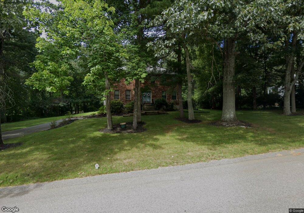
8 Massachusetts Ave Norfolk, MA 02056
Estimated Value: $764,759 - $948,000
4
Beds
3
Baths
2,276
Sq Ft
$381/Sq Ft
Est. Value
About This Home
This home is located at 8 Massachusetts Ave, Norfolk, MA 02056 and is currently estimated at $867,940, approximately $381 per square foot. 8 Massachusetts Ave is a home located in Norfolk County with nearby schools including H. Olive Day School, Freeman-Kennedy School, and Woodside Montessori Academy.
Ownership History
Date
Name
Owned For
Owner Type
Purchase Details
Closed on
May 28, 1993
Sold by
Kenney Edward T and Kenney Joanne M
Bought by
Bertrand Wilbert J and Bertrand Maryellen M
Current Estimated Value
Home Financials for this Owner
Home Financials are based on the most recent Mortgage that was taken out on this home.
Original Mortgage
$130,000
Interest Rate
7.41%
Mortgage Type
Purchase Money Mortgage
Create a Home Valuation Report for This Property
The Home Valuation Report is an in-depth analysis detailing your home's value as well as a comparison with similar homes in the area
Home Values in the Area
Average Home Value in this Area
Purchase History
| Date | Buyer | Sale Price | Title Company |
|---|---|---|---|
| Bertrand Wilbert J | $215,000 | -- |
Source: Public Records
Mortgage History
| Date | Status | Borrower | Loan Amount |
|---|---|---|---|
| Open | Bertrand Wilbert J | $366,300 | |
| Closed | Bertrand Wilbert J | $30,000 | |
| Closed | Bertrand Wilbert J | $130,000 | |
| Previous Owner | Bertrand Wilbert J | $130,000 |
Source: Public Records
Tax History Compared to Growth
Tax History
| Year | Tax Paid | Tax Assessment Tax Assessment Total Assessment is a certain percentage of the fair market value that is determined by local assessors to be the total taxable value of land and additions on the property. | Land | Improvement |
|---|---|---|---|---|
| 2025 | $9,421 | $589,900 | $213,600 | $376,300 |
| 2024 | $8,904 | $571,900 | $213,600 | $358,300 |
| 2023 | $8,605 | $524,400 | $213,600 | $310,800 |
| 2022 | $8,101 | $445,100 | $199,800 | $245,300 |
| 2021 | $7,822 | $434,800 | $194,100 | $240,700 |
| 2020 | $7,792 | $418,000 | $176,400 | $241,600 |
| 2019 | $7,514 | $410,800 | $176,400 | $234,400 |
| 2018 | $7,245 | $389,100 | $176,400 | $212,700 |
| 2017 | $7,142 | $392,000 | $176,400 | $215,600 |
| 2016 | $7,024 | $388,500 | $176,400 | $212,100 |
| 2015 | $6,764 | $383,000 | $168,000 | $215,000 |
| 2014 | $6,636 | $380,700 | $168,000 | $212,700 |
Source: Public Records
Map
Nearby Homes
- 14 Willow Place
- 33 Whichita Rd
- 1 Pueblo Rd
- 26 Noon Hill Ave
- 14 Onondaga Ln
- 14 Cleary Cir
- 14 Cleary Cir Unit 14
- 10 Stop River Rd
- 13 Stop River Rd
- 53 Thomas Mann Cir Unit 31
- 55 Thomas Mann Cir Unit 32
- 51 Thomas Mann Unit 30
- 54 Thomas Mann Unit Lot 42
- 1 Old Mill Rd
- The Georgetown Grand R Plan at Lakeland Hills
- The Georgetown Grand L Plan at Lakeland Hills
- The Georgetown L Plan at Lakeland Hills
- The Georgetown R Plan at Lakeland Hills
- 43 Thomas Mann Cir Unit Lot 26
- 42 Thomas Mann Unit 39
- 7 Massachusetts Ave
- 6 Massachusetts Ave
- 16 Pennacook St
- 5 Massachusetts Ave
- 9 Massachusetts Ave
- 5 54
- 18 Pennacook St
- 15 Pennacook St
- Lot 15 Pennacook St
- 4 Massachusetts Ave
- 3 Massachusetts Ave
- 3 Montauk Ave
- 5 Pocumtuck Ave
- 20 Pennacook St
- 5 Montauk Ave
- 12 Pennacook St
- 3 Pocumtuck Ave
- 23 Pennacook St
- 7 Pocumtuck Ave
- 15 Mohegan St