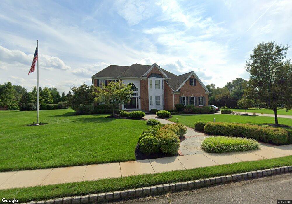
8 Matthew Ct Cream Ridge, NJ 08514
Estimated Value: $1,097,391 - $1,181,000
5
Beds
2
Baths
4,058
Sq Ft
$279/Sq Ft
Est. Value
About This Home
This home is located at 8 Matthew Ct, Cream Ridge, NJ 08514 and is currently estimated at $1,133,348, approximately $279 per square foot. 8 Matthew Ct is a home located in Monmouth County with nearby schools including Newell Elementary School, Stonebridge Middle School, and Allentown High School.
Ownership History
Date
Name
Owned For
Owner Type
Purchase Details
Closed on
Nov 30, 2020
Sold by
Nini Enzo
Bought by
Nini Enzo
Current Estimated Value
Purchase Details
Closed on
Jan 31, 2002
Sold by
D R Horton Inc
Bought by
Derasmo Jameds and Derasmo Maria
Home Financials for this Owner
Home Financials are based on the most recent Mortgage that was taken out on this home.
Original Mortgage
$338,000
Interest Rate
6.85%
Create a Home Valuation Report for This Property
The Home Valuation Report is an in-depth analysis detailing your home's value as well as a comparison with similar homes in the area
Home Values in the Area
Average Home Value in this Area
Purchase History
| Date | Buyer | Sale Price | Title Company |
|---|---|---|---|
| Nini Enzo | -- | Foundation Title | |
| Derasmo Jameds | $497,090 | -- |
Source: Public Records
Mortgage History
| Date | Status | Borrower | Loan Amount |
|---|---|---|---|
| Previous Owner | Derasmo Jameds | $338,000 |
Source: Public Records
Tax History Compared to Growth
Tax History
| Year | Tax Paid | Tax Assessment Tax Assessment Total Assessment is a certain percentage of the fair market value that is determined by local assessors to be the total taxable value of land and additions on the property. | Land | Improvement |
|---|---|---|---|---|
| 2025 | $16,765 | $1,047,700 | $254,000 | $793,700 |
| 2024 | $16,651 | $777,600 | $166,600 | $611,000 |
| 2023 | $16,651 | $749,700 | $166,600 | $583,100 |
| 2022 | $14,843 | $678,900 | $116,600 | $562,300 |
| 2021 | $14,843 | $612,100 | $106,600 | $505,500 |
| 2020 | $14,581 | $604,000 | $106,600 | $497,400 |
| 2019 | $14,626 | $610,200 | $106,600 | $503,600 |
| 2018 | $14,413 | $592,400 | $106,600 | $485,800 |
| 2017 | $14,363 | $598,200 | $136,600 | $461,600 |
| 2016 | $14,163 | $597,100 | $141,600 | $455,500 |
| 2015 | $13,512 | $575,700 | $161,600 | $414,100 |
| 2014 | $13,247 | $568,800 | $126,600 | $442,200 |
Source: Public Records
Map
Nearby Homes
- 198 Burlington Path Rd
- 11 Victoria Ct
- 106 Holmes Mill Rd
- 1111 County Road 539
- 18 Schoolhouse Rd
- 17 Stacy Dr
- 17 Grant Dr
- 6 Cooper Ct
- 113 Holmes Mill Rd
- 120 Jonathan Holmes Rd
- 45 Hill Rd
- 6 Sleepy Hollow Ct
- 9 Arneytown Hornerstown Rd
- 10 Arneytown Hornerstown Rd
- 0 Hill Rd
- 14 Main St
- 9 Main St
- 4 Cranberry Ct
- Normandy Plan at Province Line Estates
- Corsica Plan at Province Line Estates