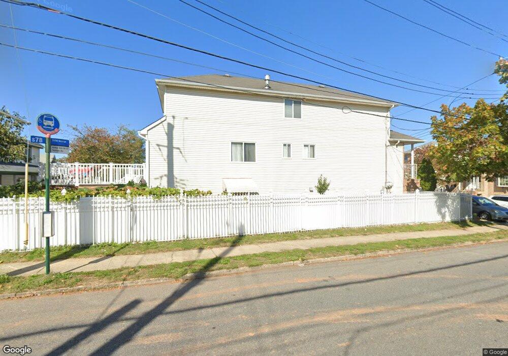
8 Meagan Loop Staten Island, NY 10307
Tottenville NeighborhoodEstimated Value: $810,556 - $1,132,000
3
Beds
3
Baths
2,800
Sq Ft
$339/Sq Ft
Est. Value
About This Home
This home is located at 8 Meagan Loop, Staten Island, NY 10307 and is currently estimated at $948,389, approximately $338 per square foot. 8 Meagan Loop is a home located in Richmond County with nearby schools including P.S. 1 Tottenville, Is 34 Tottenville, and Tottenville High School.
Ownership History
Date
Name
Owned For
Owner Type
Purchase Details
Closed on
Apr 24, 2014
Sold by
Ng Gary and Liu Kun Ying
Bought by
Tan Karen
Current Estimated Value
Purchase Details
Closed on
Jan 11, 2002
Sold by
Harbor Park Estates Ltd
Bought by
Ng Gary and Liu Kun Ying
Home Financials for this Owner
Home Financials are based on the most recent Mortgage that was taken out on this home.
Original Mortgage
$200,000
Interest Rate
7.01%
Mortgage Type
Purchase Money Mortgage
Create a Home Valuation Report for This Property
The Home Valuation Report is an in-depth analysis detailing your home's value as well as a comparison with similar homes in the area
Home Values in the Area
Average Home Value in this Area
Purchase History
| Date | Buyer | Sale Price | Title Company |
|---|---|---|---|
| Tan Karen | $399,000 | None Available | |
| Ng Gary | $408,000 | -- |
Source: Public Records
Mortgage History
| Date | Status | Borrower | Loan Amount |
|---|---|---|---|
| Previous Owner | Ng Gary | $200,000 |
Source: Public Records
Tax History
| Year | Tax Paid | Tax Assessment Tax Assessment Total Assessment is a certain percentage of the fair market value that is determined by local assessors to be the total taxable value of land and additions on the property. | Land | Improvement |
|---|---|---|---|---|
| 2025 | $8,555 | $52,380 | $7,563 | $44,817 |
| 2024 | $8,555 | $54,360 | $7,287 | $47,073 |
| 2023 | $8,525 | $41,976 | $6,936 | $35,040 |
| 2022 | $7,500 | $48,060 | $9,300 | $38,760 |
| 2021 | $7,918 | $50,100 | $9,300 | $40,800 |
| 2020 | $7,513 | $43,920 | $9,300 | $34,620 |
| 2019 | $7,425 | $41,340 | $9,300 | $32,040 |
| 2018 | $7,131 | $34,980 | $8,252 | $26,728 |
| 2017 | $6,727 | $33,000 | $9,300 | $23,700 |
| 2016 | $6,268 | $31,354 | $8,586 | $22,768 |
| 2015 | $5,677 | $29,580 | $7,740 | $21,840 |
| 2014 | $5,677 | $29,580 | $7,740 | $21,840 |
Source: Public Records
Map
Nearby Homes
- 110 Yetman Ave
- 5300 Arthur Kill Rd
- 5396 Arthur Kill Rd
- 5272 Arthur Kill Rd
- 397 Ellis St
- 5265 Arthur Kill Rd
- 147 Wood Ave
- 132 Fisher Ave
- 213 Wood Ave
- 236 Lee Ave
- 5463 Arthur Kill Rd Unit 5465
- 5463-5465 Arthur Kill Rd
- 197 Craig Ave
- 237 Lee Ave
- 200 Barnard Ave
- 217-219 Fisher Ave
- 233 Fisher Ave
- 140 Craig Ave
- 239 Barnard Ave
- 7587 Amboy Rd
- 18 Meagan Loop
- 22 Meagan Loop
- 5351 Arthur Kill Rd
- 26 Meagan Loop
- 5355 Arthur Kill Rd Unit 5357
- 5355 Arthur Kill Rd Unit 5355-57
- 5355-5357 Arthur Kill Rd
- 15 Meagan Loop
- 109 Yetman Ave
- 19 Meagan Loop
- 30 Meagan Loop
- 5352 Arthur Kill Rd
- 23 Meagan Loop
- 5336 Arthur Kill Rd
- 73 Girard St
- 5354 Arthur Kill Rd
- 5330 Arthur Kill Rd
- 27 Meagan Loop
- 34 Meagan Loop
- 5324 Arthur Kill Rd