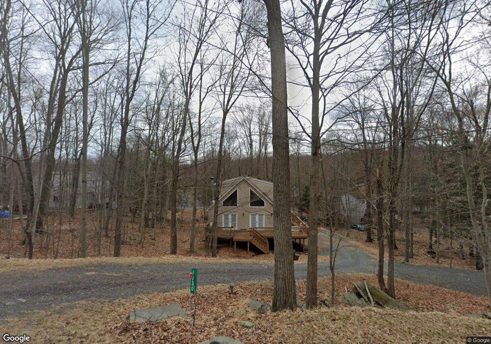
8 Mustang Rd Lake Ariel, PA 18436
Estimated Value: $365,000 - $452,000
3
Beds
3
Baths
1,932
Sq Ft
$217/Sq Ft
Est. Value
About This Home
This home is located at 8 Mustang Rd, Lake Ariel, PA 18436 and is currently estimated at $419,667, approximately $217 per square foot. 8 Mustang Rd is a home located in Wayne County with nearby schools including Western Wayne High School.
Ownership History
Date
Name
Owned For
Owner Type
Purchase Details
Closed on
Nov 24, 2021
Sold by
Clark Steven A
Bought by
Clark Steven A
Current Estimated Value
Purchase Details
Closed on
Nov 18, 2021
Sold by
Clark Steven A
Bought by
Clark Steven A
Purchase Details
Closed on
Dec 15, 2017
Sold by
King Milissa Lee
Bought by
Clark Steven A
Home Financials for this Owner
Home Financials are based on the most recent Mortgage that was taken out on this home.
Original Mortgage
$195,300
Interest Rate
3.9%
Mortgage Type
New Conventional
Purchase Details
Closed on
Feb 8, 2007
Sold by
Terry William V
Bought by
King Robert
Home Financials for this Owner
Home Financials are based on the most recent Mortgage that was taken out on this home.
Original Mortgage
$210,800
Interest Rate
6.23%
Mortgage Type
New Conventional
Purchase Details
Closed on
May 3, 2006
Sold by
Bakos Eileen V
Bought by
Terry William
Create a Home Valuation Report for This Property
The Home Valuation Report is an in-depth analysis detailing your home's value as well as a comparison with similar homes in the area
Home Values in the Area
Average Home Value in this Area
Purchase History
| Date | Buyer | Sale Price | Title Company |
|---|---|---|---|
| Clark Steven A | -- | Clause Tammy Lee | |
| Clark Steven A | -- | Clause Tammy Lee | |
| Clark Steven A | -- | None Listed On Document | |
| Clark Steven A | -- | None Listed On Document | |
| Clark Steven A | $217,000 | None Available | |
| Clark Steven A | $217,000 | None Available | |
| King Robert | $248,000 | None Available | |
| King Robert | $248,000 | None Available | |
| Terry William | $10,500 | None Available | |
| Terry William | $10,500 | None Available |
Source: Public Records
Mortgage History
| Date | Status | Borrower | Loan Amount |
|---|---|---|---|
| Previous Owner | Clark Steven A | $195,300 | |
| Previous Owner | King Robert | $210,800 |
Source: Public Records
Tax History Compared to Growth
Tax History
| Year | Tax Paid | Tax Assessment Tax Assessment Total Assessment is a certain percentage of the fair market value that is determined by local assessors to be the total taxable value of land and additions on the property. | Land | Improvement |
|---|---|---|---|---|
| 2025 | $4,278 | $293,700 | $36,700 | $257,000 |
| 2024 | $4,084 | $293,700 | $36,700 | $257,000 |
| 2023 | $5,723 | $293,700 | $36,700 | $257,000 |
| 2022 | $4,160 | $191,900 | $20,200 | $171,700 |
| 2021 | $3,858 | $181,200 | $16,000 | $165,200 |
| 2020 | $3,848 | $181,200 | $16,000 | $165,200 |
| 2019 | $3,609 | $181,200 | $16,000 | $165,200 |
| 2018 | $3,539 | $181,200 | $16,000 | $165,200 |
| 2017 | $829 | $181,200 | $16,000 | $165,200 |
| 2016 | $3,345 | $181,200 | $16,000 | $165,200 |
| 2014 | -- | $181,200 | $16,000 | $165,200 |
Source: Public Records
Map
Nearby Homes
- 19 Shiloh Dr
- 0 Lacawac Rd
- 0 Cygnus Rd
- Lot 207 Cygnus Rd
- LOT 209 Cygnus Rd
- LOT 228 Cygnus Rd
- 299 Fox Mew
- 834 Goose Pond Rd
- 91 Draco Dr
- Lot 211-212 Aquarius Ln
- 4 Aquarius Ln
- 1013 Arrowhead Ct
- 1642 Hamlin Hwy
- Lot #335 Ruffed Grouse Path
- 61 Cygnus (Draco Dr) Rd
- Lot 510 Panther Cir
- 376-2 Osprey Cir
- Lot 322 Orion Way
- Lot 16 Orion Way
- LOT 418 Orion Way
- 2 Arrowhead Ct
- 40 Mustang Rd
- 2 Aquarius Dr
- 14 Cypress Ct
- 4 Canary Ln
- 7 Ski Bluff Terrace
- 16 Eagle Nest Terrace
- 14 Calypso Dr
- 2 Apache Ct
- 16 Deer Valley Rd
- 64 Wallenpaupack Dr
- 59 Indian Dr
- 8 Canoochee Ct
- 9 Cypress Ct
- 1 Mustang Rd
- 5 Canoe Terrace
- 71 Mustang Rd
- 42 Evergreen Dr
- 38 Sunny Slope Dr
- 33 Mountain Top Dr