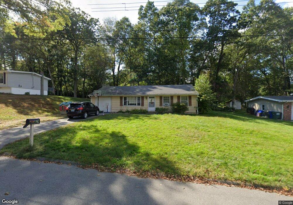
8 Muster Ln Ledyard, CT 06339
Estimated Value: $325,000 - $349,000
3
Beds
1
Bath
1,200
Sq Ft
$279/Sq Ft
Est. Value
About This Home
This home is located at 8 Muster Ln, Ledyard, CT 06339 and is currently estimated at $335,149, approximately $279 per square foot. 8 Muster Ln is a home located in New London County with nearby schools including Ledyard Middle School and Ledyard High School.
Ownership History
Date
Name
Owned For
Owner Type
Purchase Details
Closed on
Aug 29, 2013
Sold by
Coleman Benjamin L and Coleman Teresa O
Bought by
Broadbrook Renewable E
Current Estimated Value
Purchase Details
Closed on
Apr 1, 2009
Sold by
Perry Edwin D
Bought by
Alexander Lila
Home Financials for this Owner
Home Financials are based on the most recent Mortgage that was taken out on this home.
Original Mortgage
$60,000
Interest Rate
4.92%
Mortgage Type
Commercial
Purchase Details
Closed on
Aug 16, 1973
Bought by
Garrett Kermit and Garrett Joyce M
Create a Home Valuation Report for This Property
The Home Valuation Report is an in-depth analysis detailing your home's value as well as a comparison with similar homes in the area
Home Values in the Area
Average Home Value in this Area
Purchase History
| Date | Buyer | Sale Price | Title Company |
|---|---|---|---|
| Broadbrook Renewable E | $53,500 | -- | |
| Alexander Lila | $68,000 | -- | |
| Garrett Kermit | -- | -- |
Source: Public Records
Mortgage History
| Date | Status | Borrower | Loan Amount |
|---|---|---|---|
| Previous Owner | Garrett Kermit | $60,000 |
Source: Public Records
Tax History
| Year | Tax Paid | Tax Assessment Tax Assessment Total Assessment is a certain percentage of the fair market value that is determined by local assessors to be the total taxable value of land and additions on the property. | Land | Improvement |
|---|---|---|---|---|
| 2025 | $4,381 | $117,950 | $42,280 | $75,670 |
| 2024 | $4,153 | $117,950 | $42,280 | $75,670 |
| 2023 | $4,076 | $117,950 | $42,280 | $75,670 |
| 2022 | $3,989 | $117,950 | $42,280 | $75,670 |
| 2021 | $3,963 | $117,950 | $42,280 | $75,670 |
| 2020 | $3,405 | $97,370 | $33,810 | $63,560 |
| 2019 | $3,414 | $97,370 | $33,810 | $63,560 |
| 2018 | $3,339 | $97,370 | $33,810 | $63,560 |
| 2017 | $3,168 | $97,370 | $33,810 | $63,560 |
| 2016 | $3,106 | $97,370 | $33,810 | $63,560 |
| 2015 | $2,960 | $97,370 | $33,810 | $63,560 |
| 2014 | $3,137 | $104,930 | $33,810 | $71,120 |
Source: Public Records
Map
Nearby Homes
- 115 Meeting House Ln
- 14 Pennywise Ln
- 20 Lakeside Dr Unit K
- 22 Boulder Way
- 575 Shewville Rd
- 497 Colonel Ledyard Hwy
- 39 Long Pond Rd S
- 669 Colonel Ledyard Hwy
- 449 Lantern Hill Rd
- 459 Colonel Ledyard Hwy
- 332 Lantern Hill Rd
- 188 Wolf Neck Rd
- Lot 5 Lantern Hill Rd
- 419 Colonel Ledyard Hwy
- 24 Fairway Dr Unit 9
- 3 Hilltop Dr
- 28 Golden Spur
- 22 Golden Spur
- 25 Coachman Pike
- 106 Stephen Dr
Your Personal Tour Guide
Ask me questions while you tour the home.