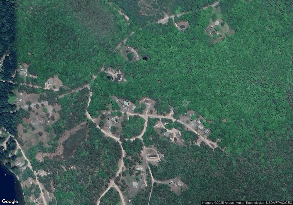
8 N Kendrick Ln Limington, ME 04049
Hollis NeighborhoodEstimated Value: $307,530 - $368,000
2
Beds
2
Baths
--
Sq Ft
2
Acres
About This Home
This home is located at 8 N Kendrick Ln, Limington, ME 04049 and is currently estimated at $334,633. 8 N Kendrick Ln is a home with nearby schools including Bonny Eagle High School.
Ownership History
Date
Name
Owned For
Owner Type
Purchase Details
Closed on
Dec 4, 2020
Sold by
Kendrick Travis D
Bought by
Kendrick Kyle T
Current Estimated Value
Home Financials for this Owner
Home Financials are based on the most recent Mortgage that was taken out on this home.
Original Mortgage
$176,225
Outstanding Balance
$156,457
Interest Rate
2.8%
Mortgage Type
New Conventional
Estimated Equity
$178,176
Purchase Details
Closed on
Jul 5, 2016
Sold by
Kendrick George D and Kendrick Naomi J
Bought by
Kendrick Travis D
Home Financials for this Owner
Home Financials are based on the most recent Mortgage that was taken out on this home.
Original Mortgage
$136,000
Interest Rate
3.58%
Mortgage Type
Commercial
Create a Home Valuation Report for This Property
The Home Valuation Report is an in-depth analysis detailing your home's value as well as a comparison with similar homes in the area
Home Values in the Area
Average Home Value in this Area
Purchase History
| Date | Buyer | Sale Price | Title Company |
|---|---|---|---|
| Kendrick Kyle T | -- | None Available | |
| Kendrick Kyle T | -- | None Available | |
| Kendrick Kyle T | -- | None Available | |
| Kendrick Travis D | -- | -- | |
| Kendrick Travis D | -- | -- |
Source: Public Records
Mortgage History
| Date | Status | Borrower | Loan Amount |
|---|---|---|---|
| Open | Kendrick Kyle T | $176,225 | |
| Closed | Kendrick Kyle T | $176,225 | |
| Previous Owner | Kendrick Travis D | $136,000 |
Source: Public Records
Tax History Compared to Growth
Tax History
| Year | Tax Paid | Tax Assessment Tax Assessment Total Assessment is a certain percentage of the fair market value that is determined by local assessors to be the total taxable value of land and additions on the property. | Land | Improvement |
|---|---|---|---|---|
| 2025 | $3,024 | $270,000 | $84,000 | $186,000 |
| 2024 | $3,032 | $270,000 | $84,000 | $186,000 |
| 2023 | $2,762 | $270,000 | $84,000 | $186,000 |
| 2022 | $2,198 | $149,000 | $56,000 | $93,000 |
| 2021 | $1,967 | $149,000 | $56,000 | $93,000 |
| 2020 | $1,833 | $149,000 | $56,000 | $93,000 |
| 2019 | $1,833 | $149,000 | $56,000 | $93,000 |
| 2017 | $1,746 | $147,940 | $56,000 | $91,940 |
| 2016 | $1,664 | $147,940 | $56,000 | $91,940 |
| 2015 | $1,613 | $147,940 | $56,000 | $91,940 |
| 2014 | $1,613 | $147,940 | $56,000 | $91,940 |
| 2013 | $1,553 | $147,940 | $56,000 | $91,940 |
Source: Public Records
Map
Nearby Homes
- Lot 8 Pelletier Dr
- Lot 10 Pelletier Dr
- 7 Pelletier Dr
- 3 Lincoln Trail
- 541 Cape Rd
- 10 Chase Mill Rd
- 530 Cape Rd
- 110 Saco Rd
- 103 Hardscrabble Rd
- 1044 Ossipee Trail W
- 23 Bonny Eagle Rd
- 252 Plains Rd
- 2 Bonny Eagle Rd
- 4 Pelletier Dr
- 23 Old Limerick Rd
- 78 Ossipee Trail
- 1102 Cape Rd
- 47 Landry Dr
- 57 Landry Dr
- 21 Holiday Ln
- 14 N Kendrick Ln
- 444 Sand Pond Rd
- 9 N Kendrick Ln
- 6 N Kendrick Ln
- 10 Old Stage Rd
- 436 Sand Pond Rd
- 24 N Kendrick Ln
- 00 Sand Pond Rd
- 0 Old Stage Rd
- 428 Sand Pond Rd
- 18 S Kendrick Ln
- 420 Sand Pond Rd
- 460 Sand Pond Rd
- 4 Crosscut Ln
- 38 Carll Ln
- 10 Brick Tavern Rd
- 40 Carll Ln
- 459 Sand Pond Rd
- 42 Carll Ln
- 459 E Sand Pond Rd
