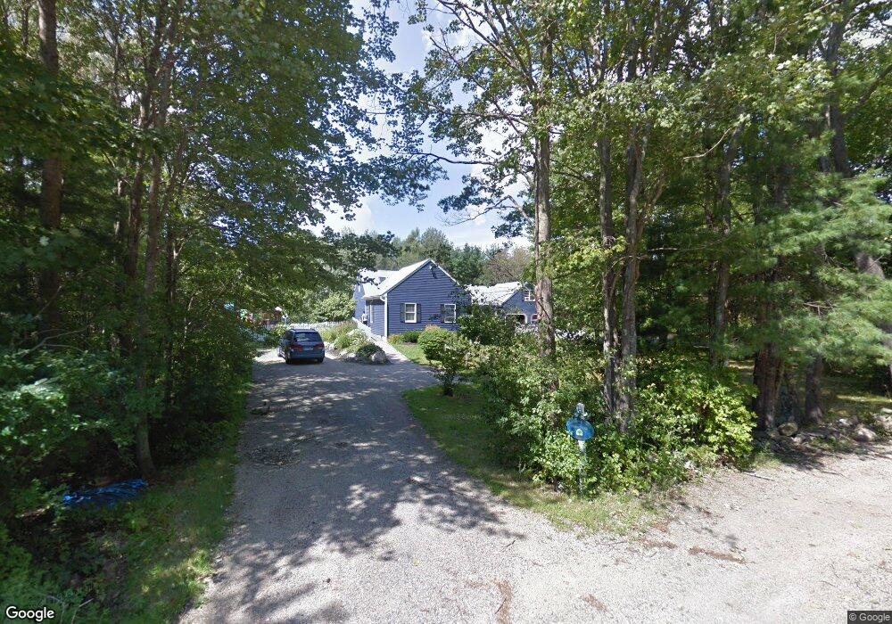
8 New Boston Rd York, ME 03909
York NeighborhoodEstimated Value: $851,772 - $1,045,000
3
Beds
4
Baths
2,670
Sq Ft
$342/Sq Ft
Est. Value
About This Home
This home is located at 8 New Boston Rd, York, ME 03909 and is currently estimated at $911,943, approximately $341 per square foot. 8 New Boston Rd is a home located in York County with nearby schools including Village Elementary School, Coastal Ridge Elementary School, and York Middle School.
Ownership History
Date
Name
Owned For
Owner Type
Purchase Details
Closed on
Aug 27, 2021
Sold by
Aaak Nt and Schoff
Bought by
Larry & Janet Schoff Ft and Fleming
Current Estimated Value
Purchase Details
Closed on
Jan 22, 2008
Sold by
Schoff Larry C and Schoff Janet M
Bought by
Schoff Larry C and Schoff Janet M
Create a Home Valuation Report for This Property
The Home Valuation Report is an in-depth analysis detailing your home's value as well as a comparison with similar homes in the area
Home Values in the Area
Average Home Value in this Area
Purchase History
| Date | Buyer | Sale Price | Title Company |
|---|---|---|---|
| Larry & Janet Schoff Ft | -- | None Available | |
| Larry & Janet Schoff Ft | -- | None Available | |
| Larry & Janet Schoff Ft | -- | None Available | |
| Schoff Larry C | $50,000 | -- | |
| Schoff Larry C | $50,000 | -- |
Source: Public Records
Mortgage History
| Date | Status | Borrower | Loan Amount |
|---|---|---|---|
| Previous Owner | Schoff Larry C | $120,000 |
Source: Public Records
Tax History Compared to Growth
Tax History
| Year | Tax Paid | Tax Assessment Tax Assessment Total Assessment is a certain percentage of the fair market value that is determined by local assessors to be the total taxable value of land and additions on the property. | Land | Improvement |
|---|---|---|---|---|
| 2024 | $5,369 | $639,200 | $179,800 | $459,400 |
| 2023 | $5,007 | $592,600 | $133,200 | $459,400 |
| 2022 | $5,420 | $633,900 | $199,800 | $434,100 |
| 2021 | $4,831 | $485,500 | $119,900 | $365,600 |
| 2020 | $4,649 | $418,800 | $119,900 | $298,900 |
| 2019 | $4,266 | $382,600 | $109,900 | $272,700 |
| 2018 | $4,141 | $371,400 | $109,900 | $261,500 |
| 2017 | $3,863 | $352,800 | $109,900 | $242,900 |
| 2016 | $3,636 | $326,100 | $83,200 | $242,900 |
| 2015 | $3,587 | $326,100 | $83,200 | $242,900 |
| 2014 | $3,489 | $326,100 | $83,200 | $242,900 |
| 2013 | $3,401 | $326,100 | $83,200 | $242,900 |
Source: Public Records
Map
Nearby Homes
- 2 Lils Alley
- 12 Malcolm Rd
- 5 Gowen Ln
- 4 Fall Mill Rd
- 11 Orchard Farm Rd
- 16 Orchard Farm Rd
- 11 Chestnut Ln
- 52 Hooper Shores Rd
- 9 Jeffrey Dr
- 8 Ash Ln
- 49 Betty Welch Rd
- 75 Caincrest Rd
- 3 Long Cove Rd
- 8 Colony Way
- 10 Colony Way
- 14 Colony Way
- 20 Colony Way
- 18 Woodside Meadow Rd Unit 4
- 3 Shaws Farm Ln Unit 1
- 31 Birch Hill Rd
- 10 New Boston Rd
- 4 New Boston Rd
- 9 New Boston Rd
- 4 Thomas Rd
- 2 Thomas Rd
- 11 New Boston Rd
- 6 Thomas Rd
- 177 Cider Hill Rd
- 13 New Boston Rd
- 1 Thomas Rd
- 17 New Boston Rd
- 8 Thomas Rd
- 3 Thomas Rd
- 185 Cider Hill Rd
- 19 New Boston Rd
- 167 Cider Hill Rd
- 7 Thomas Rd
- 170 Cider Hill Rd
- 187 Cider Hill Rd
- 20 New Boston Rd