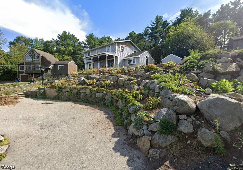
8 New Way Ln Gloucester, MA 01930
West Gloucester NeighborhoodEstimated Value: $775,000 - $895,000
4
Beds
2
Baths
2,000
Sq Ft
$411/Sq Ft
Est. Value
About This Home
This home is located at 8 New Way Ln, Gloucester, MA 01930 and is currently estimated at $821,446, approximately $410 per square foot. 8 New Way Ln is a home located in Essex County with nearby schools including West Parish, Ralph B O'maley Middle School, and Gloucester High School.
Ownership History
Date
Name
Owned For
Owner Type
Purchase Details
Closed on
Jun 9, 2025
Sold by
Curtis Pamela
Bought by
Pamela Curtis Ret and Curtis
Current Estimated Value
Purchase Details
Closed on
Apr 18, 2019
Sold by
Curtis Loran R and Curtis Pamela
Bought by
Curtis Pamela
Home Financials for this Owner
Home Financials are based on the most recent Mortgage that was taken out on this home.
Original Mortgage
$160,000
Interest Rate
4.3%
Mortgage Type
New Conventional
Purchase Details
Closed on
May 6, 2003
Sold by
Curtis Loran R and Curtis Pamela
Bought by
Curtis Loran R
Purchase Details
Closed on
Jan 31, 1997
Sold by
Quinn Stephen M and Quinn Nancy E
Bought by
Curtis Loran R and Goodhue Pamela
Create a Home Valuation Report for This Property
The Home Valuation Report is an in-depth analysis detailing your home's value as well as a comparison with similar homes in the area
Home Values in the Area
Average Home Value in this Area
Purchase History
| Date | Buyer | Sale Price | Title Company |
|---|---|---|---|
| Pamela Curtis Ret | -- | None Available | |
| Pamela Curtis Ret | -- | None Available | |
| Curtis Pamela | $100,000 | -- | |
| Curtis Pamela | $100,000 | -- | |
| Curtis Loran R | -- | -- | |
| Curtis Loran R | -- | -- | |
| Curtis Loran R | $170,000 | -- | |
| Curtis Loran R | $170,000 | -- |
Source: Public Records
Mortgage History
| Date | Status | Borrower | Loan Amount |
|---|---|---|---|
| Previous Owner | Curtis Pamela | $160,000 | |
| Previous Owner | Curtis Loran R | $66,000 | |
| Previous Owner | Curtis Loran R | $100,000 |
Source: Public Records
Tax History Compared to Growth
Tax History
| Year | Tax Paid | Tax Assessment Tax Assessment Total Assessment is a certain percentage of the fair market value that is determined by local assessors to be the total taxable value of land and additions on the property. | Land | Improvement |
|---|---|---|---|---|
| 2025 | $6,901 | $710,000 | $198,000 | $512,000 |
| 2024 | $6,816 | $700,500 | $188,500 | $512,000 |
| 2023 | $6,501 | $613,900 | $168,300 | $445,600 |
| 2022 | $6,352 | $541,500 | $146,400 | $395,100 |
| 2021 | $6,129 | $492,700 | $133,100 | $359,600 |
| 2020 | $6,117 | $496,100 | $133,100 | $363,000 |
| 2019 | $5,868 | $462,400 | $133,100 | $329,300 |
| 2018 | $5,676 | $439,000 | $133,100 | $305,900 |
| 2017 | $5,544 | $420,300 | $126,700 | $293,600 |
| 2016 | $5,424 | $398,500 | $132,200 | $266,300 |
| 2015 | $5,158 | $377,900 | $132,200 | $245,700 |
Source: Public Records
Map
Nearby Homes
- 368 Essex Ave
- 12 Woodward Ave
- 227 Essex Ave
- 5 Samoset Rd Unit A
- 11 Overlook Ave
- 587 Essex Ave
- 7 Leaman Dr
- 109 Riverview Rd
- 359 Western Ave
- 15 Harvard St
- 196 Washington St
- 139 Eastern Ave
- 8 Summer St Unit 103
- 65 Poplar St
- 188 Atlantic St
- 5 Washington Square
- 19 Mystic Ave
- 78 Grove St
- 16 Cleveland Place Unit 11
- 33 Middle St