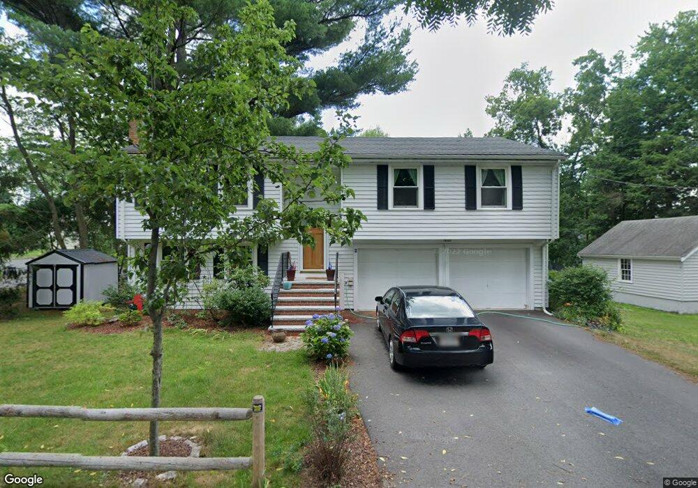
8 Noyes St Needham, MA 02492
Estimated Value: $910,000 - $1,344,000
3
Beds
2
Baths
1,274
Sq Ft
$943/Sq Ft
Est. Value
About This Home
This home is located at 8 Noyes St, Needham, MA 02492 and is currently estimated at $1,201,669, approximately $943 per square foot. 8 Noyes St is a home located in Norfolk County with nearby schools including Sunita L. Williams Elementary School, High Rock Middle School, and Pollard Middle School.
Ownership History
Date
Name
Owned For
Owner Type
Purchase Details
Closed on
Aug 10, 2001
Sold by
Noyes St Rt
Bought by
Schaphorst Kenneth W
Current Estimated Value
Home Financials for this Owner
Home Financials are based on the most recent Mortgage that was taken out on this home.
Original Mortgage
$275,000
Outstanding Balance
$106,885
Interest Rate
7.1%
Mortgage Type
Purchase Money Mortgage
Estimated Equity
$1,094,784
Create a Home Valuation Report for This Property
The Home Valuation Report is an in-depth analysis detailing your home's value as well as a comparison with similar homes in the area
Home Values in the Area
Average Home Value in this Area
Purchase History
| Date | Buyer | Sale Price | Title Company |
|---|---|---|---|
| Schaphorst Kenneth W | $387,000 | -- | |
| Schaphorst Kenneth W | $387,000 | -- |
Source: Public Records
Mortgage History
| Date | Status | Borrower | Loan Amount |
|---|---|---|---|
| Open | Schaphorst Kenneth W | $275,000 | |
| Closed | Schaphorst Kenneth W | $275,000 | |
| Previous Owner | Schaphorst Kenneth W | $30,000 | |
| Previous Owner | Schaphorst Kenneth W | $60,000 |
Source: Public Records
Tax History Compared to Growth
Tax History
| Year | Tax Paid | Tax Assessment Tax Assessment Total Assessment is a certain percentage of the fair market value that is determined by local assessors to be the total taxable value of land and additions on the property. | Land | Improvement |
|---|---|---|---|---|
| 2025 | $11,701 | $1,103,900 | $797,100 | $306,800 |
| 2024 | $10,175 | $812,700 | $504,500 | $308,200 |
| 2023 | $10,341 | $793,000 | $504,500 | $288,500 |
| 2022 | $9,931 | $742,800 | $462,900 | $279,900 |
| 2021 | $9,679 | $742,800 | $462,900 | $279,900 |
| 2020 | $9,490 | $759,800 | $462,800 | $297,000 |
| 2019 | $8,729 | $704,500 | $420,700 | $283,800 |
| 2018 | $8,139 | $685,100 | $420,700 | $264,400 |
| 2017 | $7,750 | $651,800 | $420,700 | $231,100 |
| 2016 | $7,465 | $646,900 | $420,700 | $226,200 |
| 2015 | $7,304 | $646,900 | $420,700 | $226,200 |
| 2014 | $6,795 | $583,800 | $365,800 | $218,000 |
Source: Public Records
Map
Nearby Homes
- 15 Jenna Cir
- 29 Tolman St
- 11 Shirley Rd
- 34 Pershing Rd
- 193 Garden St
- 100 Rosemary Way Unit 129
- 100 Rosemary Way Unit 324
- 73 Maple St Unit 1
- 445 Hillside Ave
- 24 Deerfield Rd
- 3 Crescent Rd
- 287 High Rock St
- 233 Warren St
- 379 Hunnewell St Unit 379
- 400 Hunnewell St Unit 103
- 556 Webster St
- 132 Hillside Ave
- 266 Hunnewell St
- 37 Carleton Dr
- 47 Emerson Rd
- 19 Noyes St
- 4 Farnham Cir
- 20 Noyes St
- 10 Noyes St
- 20 Farnham Cir
- 16 Farnham Cir
- 39 Mallard Rd
- 12 Farnham Cir
- 33 Mallard Rd
- 1069 Central Ave
- 26 Noyes St
- 25 Mallard Rd
- 1038 Central Ave
- 1086 Central Ave
- 160 Meetinghouse Cir
- 152 Meetinghouse Cir
- 0 Noyes St
- 166 Meetinghouse Cir
- 146 Meetinghouse Cir
- 172 Meetinghouse Cir