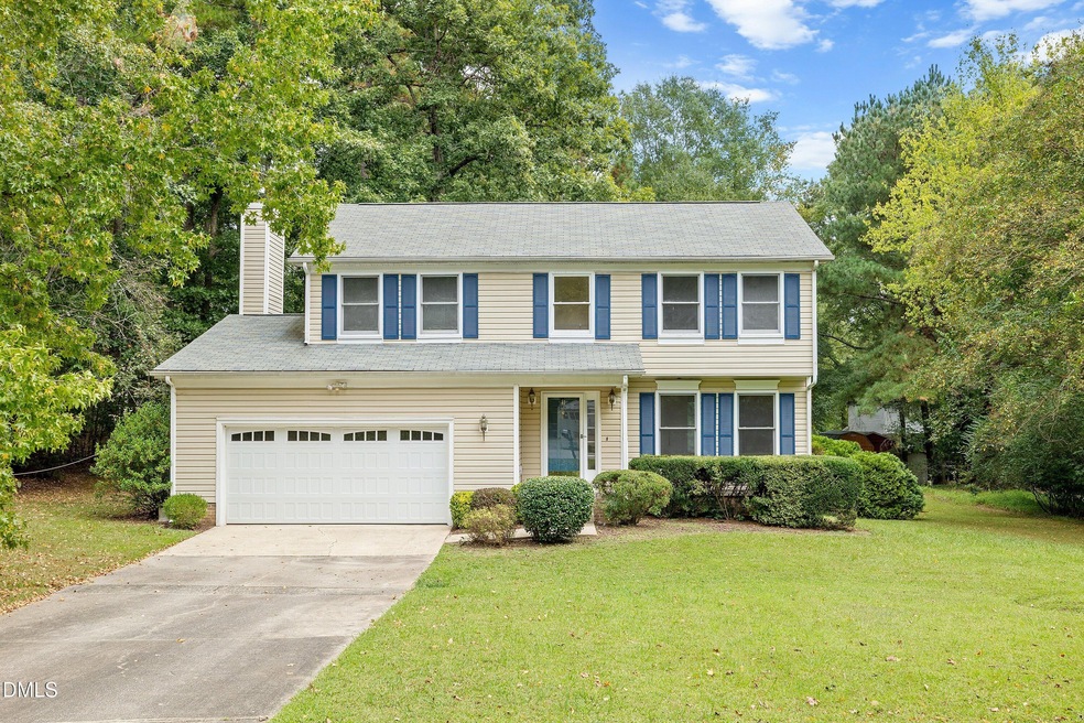
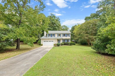
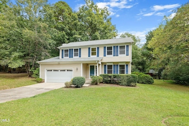
8 Nutmeg Ct Durham, NC 27713
Woodcroft NeighborhoodEstimated payment $2,491/month
Highlights
- 0.46 Acre Lot
- Colonial Architecture
- Vaulted Ceiling
- Pearsontown Elementary School Rated A
- Wooded Lot
- Wood Flooring
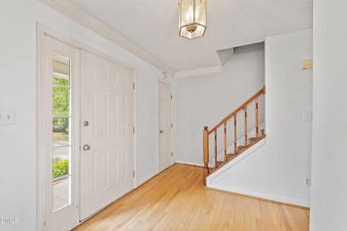
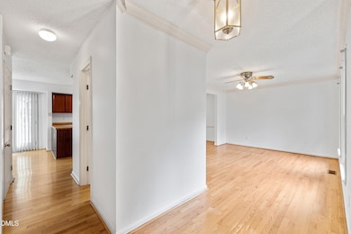
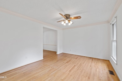
About This Home
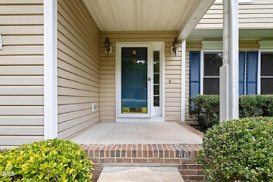
No HOA and tucked away on a cul-de-sac lot of almost half an acre, this home offers both space and privacy! Seller is offering a $10,000 decor allowance or credit—a great opportunity to personalize this home to your taste! The kitchen features a stainless-steel electric range and dishwasher, plenty of cabinet storage, a pantry & a bright breakfast area! A formal dining room with crown molding and chair rail and a formal living room with crown molding add classic touches. Hardwood floors extend through most of the main level! The family room offers a cozy wood-burning fireplace. A half bath completes the lower level. Upstairs, the primary bedroom features a vaulted ceiling, huge walk-in closet & a private bath with French doors, a garden tub & a separate tile walk-in shower! Three secondary bedrooms, one with a double closet, share a full hall bathroom. Step outside and enjoy the wooded backyard from the deck, perfect for relaxation or entertaining! Located close to The Streets at Southpoint, Brightleaf Square, and I-40 for quick access to Raleigh and RDU Airport. In addition, our preferred lender is offering up to 1% in lender credit, which can be applied toward closing costs or to help reduce the interest rate.
Home Details
Home Type
- Single Family
Est. Annual Taxes
- $4,646
Year Built
- Built in 1990
Lot Details
- 0.46 Acre Lot
- Cul-De-Sac
- Wooded Lot
Parking
- 2 Car Attached Garage
- Front Facing Garage
- Private Driveway
Home Design
- Colonial Architecture
- Transitional Architecture
- Traditional Architecture
- Shingle Roof
- Vinyl Siding
Interior Spaces
- 1,973 Sq Ft Home
- 2-Story Property
- Crown Molding
- Vaulted Ceiling
- Ceiling Fan
- French Doors
- Entrance Foyer
- Family Room with Fireplace
- Living Room
- Dining Room
- Basement
- Crawl Space
- Scuttle Attic Hole
- Laundry closet
Kitchen
- Breakfast Room
- Electric Range
- Range Hood
- Dishwasher
Flooring
- Wood
- Carpet
- Tile
Bedrooms and Bathrooms
- 4 Bedrooms
- Primary bedroom located on second floor
- Walk-In Closet
- Private Water Closet
- Separate Shower in Primary Bathroom
- Soaking Tub
- Bathtub with Shower
- Separate Shower
Outdoor Features
- Front Porch
Schools
- Pearsontown Elementary School
- Lowes Grove Middle School
- Hillside High School
Utilities
- Central Air
- Heating Available
Community Details
- No Home Owners Association
- Nottingham Forest Subdivision
Listing and Financial Details
- Assessor Parcel Number 155019
Map
Home Values in the Area
Average Home Value in this Area
Tax History
| Year | Tax Paid | Tax Assessment Tax Assessment Total Assessment is a certain percentage of the fair market value that is determined by local assessors to be the total taxable value of land and additions on the property. | Land | Improvement |
|---|---|---|---|---|
| 2025 | $4,646 | $468,712 | $109,938 | $358,774 |
| 2024 | $3,482 | $249,635 | $54,862 | $194,773 |
| 2023 | $3,270 | $249,635 | $54,862 | $194,773 |
| 2022 | $3,195 | $249,635 | $54,862 | $194,773 |
| 2021 | $3,180 | $249,635 | $54,862 | $194,773 |
| 2020 | $3,105 | $249,635 | $54,862 | $194,773 |
| 2019 | $3,105 | $249,635 | $54,862 | $194,773 |
| 2018 | $2,941 | $216,835 | $43,890 | $172,945 |
| 2017 | $2,920 | $216,835 | $43,890 | $172,945 |
| 2016 | $2,821 | $216,835 | $43,890 | $172,945 |
| 2015 | $2,689 | $194,281 | $35,546 | $158,735 |
| 2014 | $2,689 | $194,281 | $35,546 | $158,735 |
Property History
| Date | Event | Price | List to Sale | Price per Sq Ft |
|---|---|---|---|---|
| 10/08/2025 10/08/25 | Pending | -- | -- | -- |
| 09/18/2025 09/18/25 | For Sale | $399,900 | -- | $203 / Sq Ft |
Purchase History
| Date | Type | Sale Price | Title Company |
|---|---|---|---|
| Warranty Deed | $154,000 | -- |
Mortgage History
| Date | Status | Loan Amount | Loan Type |
|---|---|---|---|
| Open | $146,300 | No Value Available |
Source: Doorify MLS
MLS Number: 10122669
APN: 155019
Disclaimer: Certain information contained herein is derived from information provided by parties other than Homes.com. All information provided is deemed reliable, but is not guaranteed to be accurate and should be independently verified.
![]() Some IDX listings have been excluded from this IDX display. Brokers make an effort to deliver accurate information, but buyers should independently verify any information on which they will rely in a transaction. The listing broker shall not be responsible for any typographical errors, misinformation, or misprints, and they shall be held totally harmless from any damages arising from reliance upon this data. This data is provided exclusively for consumers’ personal, non-commercial use. Listings marked with an icon are provided courtesy of the Doorify MLS, Inc. of North Carolina, Internet Data Exchange Database. Closed (sold) listings may have been listed and/or sold by a real estate firm other than the firm(s) featured on this website. Closed data is not available until the sale of the property is recorded in the MLS. Home sale data is not an appraisal, CMA, competitive or comparative market analysis, or home valuation of any property. Copyright 2025 Doorify MLS, Inc. of North Carolina. All rights reserved.
Some IDX listings have been excluded from this IDX display. Brokers make an effort to deliver accurate information, but buyers should independently verify any information on which they will rely in a transaction. The listing broker shall not be responsible for any typographical errors, misinformation, or misprints, and they shall be held totally harmless from any damages arising from reliance upon this data. This data is provided exclusively for consumers’ personal, non-commercial use. Listings marked with an icon are provided courtesy of the Doorify MLS, Inc. of North Carolina, Internet Data Exchange Database. Closed (sold) listings may have been listed and/or sold by a real estate firm other than the firm(s) featured on this website. Closed data is not available until the sale of the property is recorded in the MLS. Home sale data is not an appraisal, CMA, competitive or comparative market analysis, or home valuation of any property. Copyright 2025 Doorify MLS, Inc. of North Carolina. All rights reserved.
- 5808 Sandstone Dr
- 5310 Reams Run Rd
- 1207 Wedgewood Ln
- 5205 Kemmont Dr
- 1303 Crimson Creek Dr
- 5708 Catskill Ct
- 1304 Copper Creek Dr
- 5816 Henner Place
- 6304 Forest Ridge Dr
- 515 Uzzle St
- 9 Drakesway Ct
- 3617 Sugar Tree Place
- 5624 Barbee Rd
- 1 Chownings St
- 19 Meadhall Ct
- 6502 Barbee Rd
- 1001 Pebble Creek Crossing Unit 12
- 311 Denton St
- 6 Lakemist Cir
- 514 Auburn Square Dr
