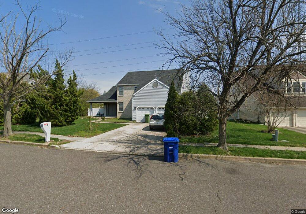
8 Owl Ct Marlton, NJ 08053
Estimated Value: $640,000 - $696,000
--
Bed
--
Bath
3,025
Sq Ft
$219/Sq Ft
Est. Value
About This Home
This home is located at 8 Owl Ct, Marlton, NJ 08053 and is currently estimated at $663,754, approximately $219 per square foot. 8 Owl Ct is a home located in Burlington County with nearby schools including Robert B. Jaggard School, Marlton Middle School, and Cherokee High School.
Ownership History
Date
Name
Owned For
Owner Type
Purchase Details
Closed on
Jun 23, 2004
Sold by
Gola Nahum and Gola Naomi
Bought by
Raval Pavitra R
Current Estimated Value
Home Financials for this Owner
Home Financials are based on the most recent Mortgage that was taken out on this home.
Original Mortgage
$236,000
Interest Rate
5.67%
Mortgage Type
Purchase Money Mortgage
Purchase Details
Closed on
Sep 26, 1997
Sold by
Nahum Gola and Gola Nahum
Bought by
Gola Nahum
Home Financials for this Owner
Home Financials are based on the most recent Mortgage that was taken out on this home.
Original Mortgage
$206,250
Interest Rate
7.48%
Purchase Details
Closed on
Dec 13, 1995
Sold by
Nahum Gola and Gola Naomi
Bought by
Nahum Gola
Create a Home Valuation Report for This Property
The Home Valuation Report is an in-depth analysis detailing your home's value as well as a comparison with similar homes in the area
Home Values in the Area
Average Home Value in this Area
Purchase History
| Date | Buyer | Sale Price | Title Company |
|---|---|---|---|
| Raval Pavitra R | $295,000 | Security First Title Partner | |
| Gola Nahum | -- | Independence Abstract & Titl | |
| Nahum Gola | -- | Sentry Land Title Agency Inc | |
| Nahum Gola | $183,000 | Sentry Land Title Agency Inc |
Source: Public Records
Mortgage History
| Date | Status | Borrower | Loan Amount |
|---|---|---|---|
| Closed | Raval Pavitra R | $236,000 | |
| Previous Owner | Gola Nahum | $206,250 |
Source: Public Records
Tax History Compared to Growth
Tax History
| Year | Tax Paid | Tax Assessment Tax Assessment Total Assessment is a certain percentage of the fair market value that is determined by local assessors to be the total taxable value of land and additions on the property. | Land | Improvement |
|---|---|---|---|---|
| 2025 | $12,140 | $355,500 | $100,000 | $255,500 |
| 2024 | $11,422 | $355,500 | $100,000 | $255,500 |
| 2023 | $11,422 | $355,500 | $100,000 | $255,500 |
| 2022 | $10,654 | $355,500 | $100,000 | $255,500 |
| 2021 | $9,933 | $355,500 | $100,000 | $255,500 |
| 2020 | $10,516 | $355,500 | $100,000 | $255,500 |
| 2019 | $10,430 | $355,500 | $100,000 | $255,500 |
| 2018 | $10,285 | $355,500 | $100,000 | $255,500 |
| 2017 | $10,164 | $355,500 | $100,000 | $255,500 |
| 2016 | $9,915 | $355,500 | $100,000 | $255,500 |
| 2015 | $9,741 | $355,500 | $100,000 | $255,500 |
| 2014 | $9,463 | $355,500 | $100,000 | $255,500 |
Source: Public Records
Map
Nearby Homes
- 38 Ashley Ct Unit 38
- 63 Banner Ct Unit 63
- 293 Ivy Ct
- 22 Hawk Ln
- 220 Deerpark Ct
- 607 Lindsey Ct
- 201 Empress Ct
- 7 Quaker St
- 800 Marlowe Rd
- 128 Cambridge Ave
- 26 Regent Rd
- 118 Cambridge Ave
- 12 Princess Ave
- 110 Conestoga Dr
- 319 Mimosa Dr
- 108 W Burgess Rd
- 100 Cambridge Ave
- 100 E Eagle Ln
- 22 E Split Rock Dr
- 1406 Jonathan Ln