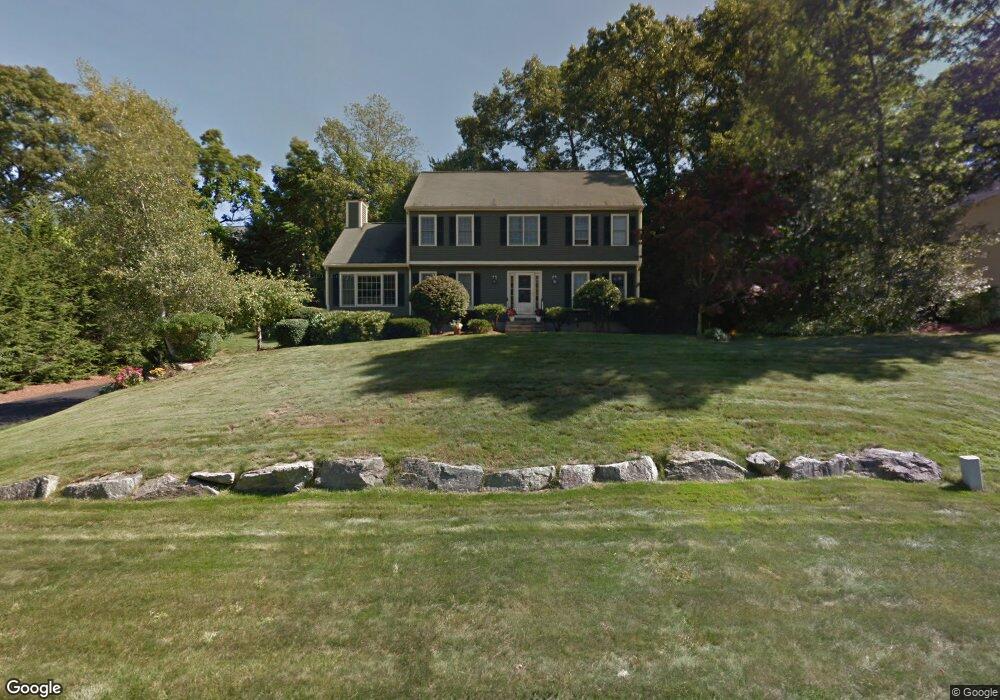
8 Pheasant Hollow Rd Natick, MA 01760
Estimated Value: $1,067,000 - $1,591,000
4
Beds
3
Baths
2,236
Sq Ft
$595/Sq Ft
Est. Value
About This Home
This home is located at 8 Pheasant Hollow Rd, Natick, MA 01760 and is currently estimated at $1,330,113, approximately $594 per square foot. 8 Pheasant Hollow Rd is a home located in Middlesex County with nearby schools including Natick High School, J F Kennedy Middle School, and Johnson Elementary School.
Ownership History
Date
Name
Owned For
Owner Type
Purchase Details
Closed on
Mar 26, 1999
Sold by
Romm Jonathan R and Romm Kirsten R
Bought by
Portnoy Stephen N and Portnoy Amy W
Current Estimated Value
Home Financials for this Owner
Home Financials are based on the most recent Mortgage that was taken out on this home.
Original Mortgage
$287,000
Interest Rate
6.78%
Mortgage Type
Purchase Money Mortgage
Create a Home Valuation Report for This Property
The Home Valuation Report is an in-depth analysis detailing your home's value as well as a comparison with similar homes in the area
Home Values in the Area
Average Home Value in this Area
Purchase History
| Date | Buyer | Sale Price | Title Company |
|---|---|---|---|
| Portnoy Stephen N | $380,000 | -- |
Source: Public Records
Mortgage History
| Date | Status | Borrower | Loan Amount |
|---|---|---|---|
| Open | Portnoy Stephen N | $319,000 | |
| Closed | Portnoy Stephen N | $287,000 | |
| Previous Owner | Portnoy Stephen N | $15,000 |
Source: Public Records
Tax History Compared to Growth
Tax History
| Year | Tax Paid | Tax Assessment Tax Assessment Total Assessment is a certain percentage of the fair market value that is determined by local assessors to be the total taxable value of land and additions on the property. | Land | Improvement |
|---|---|---|---|---|
| 2025 | $12,363 | $1,033,700 | $486,900 | $546,800 |
| 2024 | $11,999 | $978,700 | $461,300 | $517,400 |
| 2023 | $11,085 | $877,000 | $429,500 | $447,500 |
| 2022 | $10,917 | $818,400 | $387,600 | $430,800 |
| 2021 | $10,648 | $782,400 | $382,500 | $399,900 |
| 2020 | $10,440 | $767,100 | $367,200 | $399,900 |
| 2019 | $9,750 | $767,100 | $367,200 | $399,900 |
| 2018 | $10,572 | $695,900 | $354,500 | $341,400 |
| 2017 | $9,137 | $677,300 | $342,000 | $335,300 |
| 2016 | $9,146 | $674,000 | $342,000 | $332,000 |
| 2015 | $8,936 | $646,600 | $342,000 | $304,600 |
Source: Public Records
Map
Nearby Homes
- 4 Sylvia Ave
- 46 Silver Hill Ln Unit 1
- 9 Silver Hill Ln Unit 19
- 26 Walden Dr Unit 4
- 40 Silver Hill Ln Unit 4
- 12 Walden Dr Unit 19
- 32 Silver Hill Ln Unit 1
- 91 Speen St
- 57 Village Brook Ln Unit 5
- 50 Village Brook Ln Unit 4
- 51 Village Brook Ln Unit 16
- 4 Village Rock Ln Unit 9
- 6 Village Rock Ln Unit 17
- 5 Village Rock Ln Unit 24
- 1 Fern St
- 38 Ranger Rd
- 1 Glen St Unit B
- 2 Lodge Rd
- 10 Kelsey Rd
- 157 Mill St
- 2 Autumn Ln
- 6 Pheasant Hollow Rd
- 10 Pheasant Hollow Rd
- 17 Prescott Ave
- 15 Prescott Ave
- 21 Prescott Ave
- 12 Pheasant Hollow Rd L-B
- 4 Pheasant Hollow Rd
- 12 Pheasant Hollow Rd
- 15 Pheasant Hollow Rd
- 11 Prescott Ave
- 11 Pheasant Hollow Rd
- 30 Lookout Ave
- 9 Pheasant Hollow Rd
- 18 Prescott Ave
- 13 Sylvia Ave
- 25 Prescott Ave
- 1 Autumn Ln
- 28 Lookout Ave
- 9 Prescott Ave