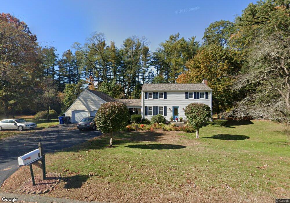
8 Pine Dr Broad Brook, CT 06016
Estimated Value: $426,000 - $567,000
3
Beds
3
Baths
2,224
Sq Ft
$220/Sq Ft
Est. Value
About This Home
This home is located at 8 Pine Dr, Broad Brook, CT 06016 and is currently estimated at $489,791, approximately $220 per square foot. 8 Pine Dr is a home located in Hartford County with nearby schools including Broad Brook Elementary School, East Windsor Middle School, and East Windsor High School.
Ownership History
Date
Name
Owned For
Owner Type
Purchase Details
Closed on
Sep 15, 2004
Sold by
Brown Thomas and Brown Debora
Bought by
Wilson Kenneth
Current Estimated Value
Home Financials for this Owner
Home Financials are based on the most recent Mortgage that was taken out on this home.
Original Mortgage
$236,000
Outstanding Balance
$118,011
Interest Rate
6.02%
Estimated Equity
$371,780
Purchase Details
Closed on
Jan 7, 1992
Sold by
Belleu James and Belleu Denise
Bought by
Brown Thomas and Brown Deborah
Home Financials for this Owner
Home Financials are based on the most recent Mortgage that was taken out on this home.
Original Mortgage
$154,350
Interest Rate
8.56%
Purchase Details
Closed on
Oct 27, 1989
Sold by
Kelly Raymond
Bought by
Bellew James
Home Financials for this Owner
Home Financials are based on the most recent Mortgage that was taken out on this home.
Original Mortgage
$164,500
Interest Rate
9.94%
Create a Home Valuation Report for This Property
The Home Valuation Report is an in-depth analysis detailing your home's value as well as a comparison with similar homes in the area
Home Values in the Area
Average Home Value in this Area
Purchase History
| Date | Buyer | Sale Price | Title Company |
|---|---|---|---|
| Wilson Kenneth | $295,000 | -- | |
| Brown Thomas | $162,500 | -- | |
| Bellew James | $229,500 | -- |
Source: Public Records
Mortgage History
| Date | Status | Borrower | Loan Amount |
|---|---|---|---|
| Open | Bellew James | $236,000 | |
| Previous Owner | Bellew James | $154,350 | |
| Previous Owner | Bellew James | $164,500 |
Source: Public Records
Tax History
| Year | Tax Paid | Tax Assessment Tax Assessment Total Assessment is a certain percentage of the fair market value that is determined by local assessors to be the total taxable value of land and additions on the property. | Land | Improvement |
|---|---|---|---|---|
| 2025 | $6,991 | $263,920 | $71,960 | $191,960 |
| 2024 | $6,482 | $263,920 | $71,960 | $191,960 |
| 2023 | $5,354 | $156,190 | $52,790 | $103,400 |
| 2022 | $5,370 | $156,190 | $52,790 | $103,400 |
| 2021 | $5,389 | $156,190 | $52,790 | $103,400 |
| 2020 | $5,423 | $156,190 | $52,790 | $103,400 |
| 2019 | $5,350 | $156,190 | $52,790 | $103,400 |
| 2018 | $5,295 | $156,190 | $52,790 | $103,400 |
| 2017 | $4,886 | $149,110 | $62,550 | $86,560 |
| 2016 | $4,612 | $149,110 | $62,550 | $86,560 |
| 2015 | $4,520 | $149,110 | $62,550 | $86,560 |
| 2014 | $4,440 | $149,110 | $62,550 | $86,560 |
Source: Public Records
Map
Nearby Homes
- 0 Ellsworth Rd
- 0 Chamberlain Rd Unit 24154561
- 20 Apothecaries Hall Rd
- 133 Phelps Rd
- 27 Folkstone Rd Unit C
- 10 Thistle Way Unit D
- 111 Old Ellington Rd
- 26 Julia Ct Unit 26
- 0 Thrall Rd Unit 24150600
- 4 Rye St
- 13 Reservoir Ave
- 8 Old Barn Rd
- 72 Rockville Rd
- 814 Graham Rd
- 76 Griffin Rd
- 19 Steeple Chase Rd Unit 19
- 0 Wells Rd
- 56 Highland Ave
- 77 Thrall Rd
- 0 Abbe Rd
Your Personal Tour Guide
Ask me questions while you tour the home.