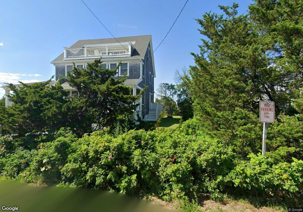
8 Pine Point Rd Duxbury, MA 02332
Green Harbor-Cedar Crest NeighborhoodEstimated Value: $1,387,000 - $1,601,000
3
Beds
3
Baths
2,190
Sq Ft
$698/Sq Ft
Est. Value
About This Home
This home is located at 8 Pine Point Rd, Duxbury, MA 02332 and is currently estimated at $1,528,276, approximately $697 per square foot. 8 Pine Point Rd is a home located in Plymouth County with nearby schools including Chandler Elementary School, Alden School, and Duxbury Middle School.
Ownership History
Date
Name
Owned For
Owner Type
Purchase Details
Closed on
Apr 7, 2022
Sold by
Carlin Ft and Carlin
Bought by
Carlin Robin A and Carlin Steven
Current Estimated Value
Home Financials for this Owner
Home Financials are based on the most recent Mortgage that was taken out on this home.
Original Mortgage
$500,000
Outstanding Balance
$453,109
Interest Rate
2.38%
Mortgage Type
Adjustable Rate Mortgage/ARM
Estimated Equity
$1,075,167
Purchase Details
Closed on
Apr 17, 2009
Sold by
Santoro Robert J and Santoro Anna M
Bought by
Carlin Ft and Carlin
Create a Home Valuation Report for This Property
The Home Valuation Report is an in-depth analysis detailing your home's value as well as a comparison with similar homes in the area
Home Values in the Area
Average Home Value in this Area
Purchase History
| Date | Buyer | Sale Price | Title Company |
|---|---|---|---|
| Carlin Robin A | -- | None Available | |
| Carlin Robin A | -- | None Available | |
| Carlin Ft | $300,000 | -- | |
| Carlin Ft | $300,000 | -- |
Source: Public Records
Mortgage History
| Date | Status | Borrower | Loan Amount |
|---|---|---|---|
| Open | Carlin Robin A | $500,000 | |
| Closed | Carlin Robin A | $500,000 |
Source: Public Records
Tax History
| Year | Tax Paid | Tax Assessment Tax Assessment Total Assessment is a certain percentage of the fair market value that is determined by local assessors to be the total taxable value of land and additions on the property. | Land | Improvement |
|---|---|---|---|---|
| 2025 | $13,385 | $1,320,000 | $593,700 | $726,300 |
| 2024 | $13,249 | $1,317,000 | $626,300 | $690,700 |
| 2023 | $11,076 | $1,036,100 | $507,100 | $529,000 |
| 2022 | $7,346 | $572,100 | $433,000 | $139,100 |
| 2021 | $5,721 | $395,100 | $314,800 | $80,300 |
| 2020 | $4,696 | $320,300 | $245,000 | $75,300 |
| 2019 | $5,009 | $341,200 | $255,400 | $85,800 |
| 2018 | $5,306 | $350,000 | $252,800 | $97,200 |
| 2017 | $4,214 | $271,700 | $226,900 | $44,800 |
| 2016 | $4,225 | $271,700 | $226,900 | $44,800 |
| 2015 | $4,239 | $271,700 | $226,900 | $44,800 |
Source: Public Records
Map
Nearby Homes
- 71 Gurnet Rd
- 236 Powder Point Ave
- 39 Bay Pond Rd
- 387 Lot 2A Old Cove Rd
- 387 Lot 3A Old Cove Rd
- 387 Lot 4A Old Cove Rd
- 106 Careswell St
- 98 Cherry St
- 116 Island St
- 54 Chapel St
- 116 Outlook Rd
- 256 Ocean St
- 17 Dyke Rd
- 122 June St
- Two Railroad Ave Unit 9
- Two Railroad Ave Unit 10
- Two Railroad Ave Unit 1
- Two Railroad Ave Unit 8
- Two Railroad Ave Unit 2
- 78 Tower Ave
- 11 Marginal Rd
- 9 Marginal Rd
- 246 Gurnet Rd
- 16 Pine Point Rd
- 244 Gurnet Rd
- 244 Gurnet Rd
- 250 Gurnet Rd (Winter Rental) Unit 250
- 250 Gurnet Rd
- 7 Pine Point Rd
- 15 Marginal Rd
- 18 Pine Point Rd
- 240 Gurnet Rd
- 254 Gurnet Rd
- 254 Gurnet Rd Unit 254
- 254 Gurnet Rd
- 258 Gurnet Rd
- 11 Pine Point Rd
- 15 Pine Point Rd
- 0 Gurnet Point
- 0 Gurnet Point Unit 21202590
Your Personal Tour Guide
Ask me questions while you tour the home.