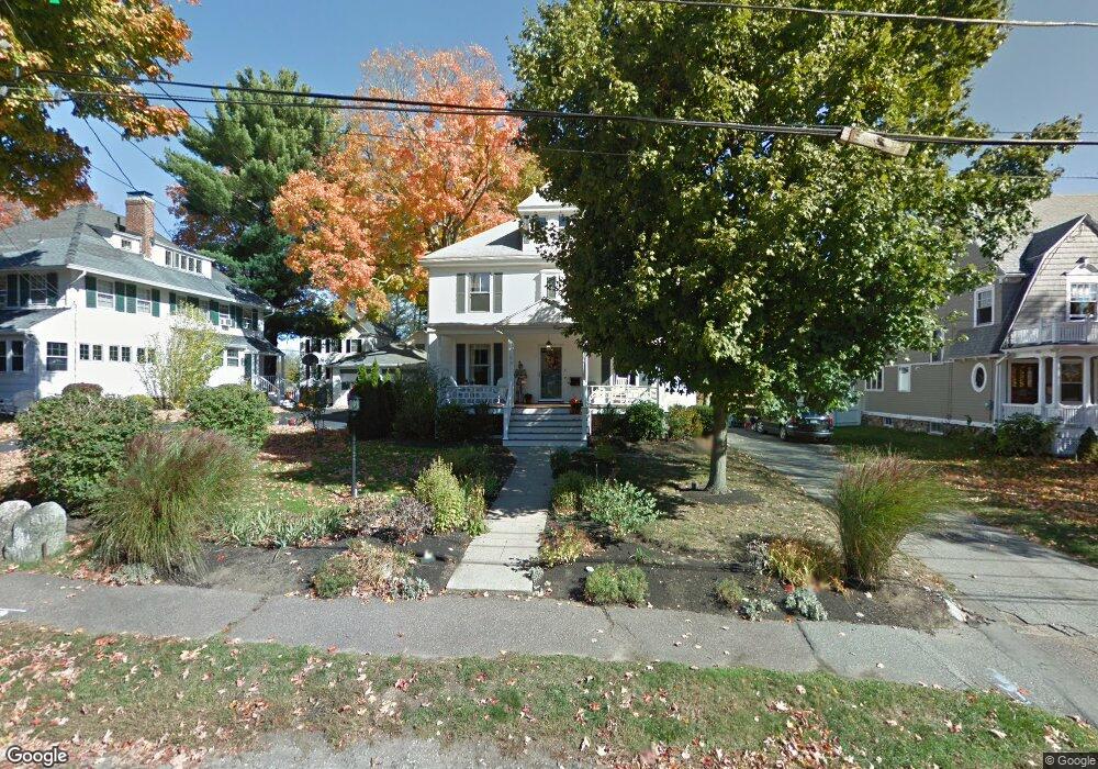
8 Pratt St Reading, MA 01867
Estimated Value: $1,176,000 - $1,354,000
5
Beds
2
Baths
2,645
Sq Ft
$468/Sq Ft
Est. Value
About This Home
This home is located at 8 Pratt St, Reading, MA 01867 and is currently estimated at $1,237,533, approximately $467 per square foot. 8 Pratt St is a home located in Middlesex County with nearby schools including Alice M. Barrows Elementary School, Walter S. Parker Middle School, and Reading Memorial High School.
Ownership History
Date
Name
Owned For
Owner Type
Purchase Details
Closed on
Aug 23, 2007
Sold by
Connolly Andrew P and Connolly Pamela R
Bought by
Lydon Daniel J and Lydon Jacqueline Ann
Current Estimated Value
Purchase Details
Closed on
May 31, 1991
Sold by
Rose Anthony and Rose Beatrice
Bought by
Connolly Andrew P and Connolly Pamela R
Create a Home Valuation Report for This Property
The Home Valuation Report is an in-depth analysis detailing your home's value as well as a comparison with similar homes in the area
Home Values in the Area
Average Home Value in this Area
Purchase History
| Date | Buyer | Sale Price | Title Company |
|---|---|---|---|
| Lydon Daniel J | $574,000 | -- | |
| Connolly Andrew P | $235,000 | -- |
Source: Public Records
Mortgage History
| Date | Status | Borrower | Loan Amount |
|---|---|---|---|
| Open | Connolly Andrew P | $270,000 | |
| Closed | Connolly Andrew P | $275,000 |
Source: Public Records
Tax History
| Year | Tax Paid | Tax Assessment Tax Assessment Total Assessment is a certain percentage of the fair market value that is determined by local assessors to be the total taxable value of land and additions on the property. | Land | Improvement |
|---|---|---|---|---|
| 2025 | $12,399 | $1,088,600 | $591,200 | $497,400 |
| 2024 | $12,039 | $1,027,200 | $557,400 | $469,800 |
| 2023 | $11,988 | $952,200 | $516,100 | $436,100 |
| 2022 | $11,558 | $867,100 | $469,200 | $397,900 |
| 2021 | $4,842 | $767,700 | $430,600 | $337,100 |
| 2020 | $4,388 | $753,100 | $422,300 | $330,800 |
| 2019 | $10,203 | $717,000 | $401,700 | $315,300 |
| 2018 | $9,391 | $677,100 | $379,000 | $298,100 |
| 2017 | $8,769 | $625,000 | $360,900 | $264,100 |
| 2016 | $8,152 | $562,200 | $307,200 | $255,000 |
| 2015 | $7,638 | $519,600 | $283,900 | $235,700 |
| 2014 | $7,401 | $502,100 | $274,300 | $227,800 |
Source: Public Records
Map
Nearby Homes
- 100 Prescott St
- 5 Washington St Unit D4
- 37 Fremont St
- 101 King St Unit 101
- 103 Oak St
- 69 Ash St
- 319 West St
- 45 Longview Rd
- 20 Pinevale Ave
- 52 Sanborn St Unit 7
- 51 Winslow Rd
- 89 Grand St
- 241 Main St Unit C3
- 16 Munroe Ave
- 48 Village St Unit 1001
- 29 Louanis Dr
- 26 Lothrop Rd
- 430 West St
- 75 Whitehall Ln
- 35 Longfellow Rd
Your Personal Tour Guide
Ask me questions while you tour the home.