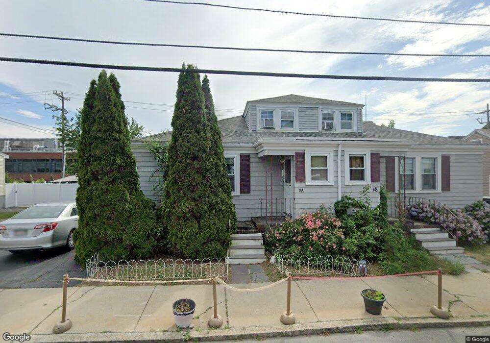
8 Raymond Rd Unit 1 Salem, MA 01970
South Salem NeighborhoodEstimated Value: $442,000 - $563,000
3
Beds
1
Bath
1,332
Sq Ft
$385/Sq Ft
Est. Value
About This Home
This home is located at 8 Raymond Rd Unit 1, Salem, MA 01970 and is currently estimated at $513,425, approximately $385 per square foot. 8 Raymond Rd Unit 1 is a home located in Essex County with nearby schools including Saltonstall School, Horace Mann Laboratory, and Carlton Elementary School.
Ownership History
Date
Name
Owned For
Owner Type
Purchase Details
Closed on
Oct 15, 2010
Sold by
Bank Of New York Mello
Bought by
Ogden Harry E
Current Estimated Value
Purchase Details
Closed on
Apr 12, 2010
Sold by
Lausier Susan
Bought by
Bank New York Mellon
Purchase Details
Closed on
Jun 4, 2004
Sold by
Caron Christine J and Caron John A
Bought by
Lausier Susan and Lausier Paul
Home Financials for this Owner
Home Financials are based on the most recent Mortgage that was taken out on this home.
Original Mortgage
$332,500
Interest Rate
5.94%
Mortgage Type
Purchase Money Mortgage
Create a Home Valuation Report for This Property
The Home Valuation Report is an in-depth analysis detailing your home's value as well as a comparison with similar homes in the area
Home Values in the Area
Average Home Value in this Area
Purchase History
| Date | Buyer | Sale Price | Title Company |
|---|---|---|---|
| Ogden Harry E | $113,000 | -- | |
| Bank New York Mellon | $200,700 | -- | |
| Lausier Susan | $350,000 | -- |
Source: Public Records
Mortgage History
| Date | Status | Borrower | Loan Amount |
|---|---|---|---|
| Open | Lausier Susan | $260,000 | |
| Previous Owner | Lausier Susan | $332,500 |
Source: Public Records
Tax History Compared to Growth
Tax History
| Year | Tax Paid | Tax Assessment Tax Assessment Total Assessment is a certain percentage of the fair market value that is determined by local assessors to be the total taxable value of land and additions on the property. | Land | Improvement |
|---|---|---|---|---|
| 2025 | $5,275 | $465,200 | $0 | $465,200 |
| 2024 | $5,191 | $446,700 | $0 | $446,700 |
| 2023 | $5,189 | $414,800 | $0 | $414,800 |
| 2022 | $5,028 | $379,500 | $0 | $379,500 |
| 2021 | $4,949 | $358,600 | $0 | $358,600 |
| 2020 | $4,838 | $334,800 | $0 | $334,800 |
| 2019 | $4,586 | $303,700 | $0 | $303,700 |
| 2018 | $4,249 | $276,300 | $0 | $276,300 |
| 2017 | $4,163 | $262,500 | $0 | $262,500 |
| 2016 | $3,938 | $251,300 | $0 | $251,300 |
| 2015 | $3,942 | $240,200 | $0 | $240,200 |
Source: Public Records
Map
Nearby Homes
- 11 Sumner Rd
- 436 Lafayette St
- 24 Wisteria St Unit 2
- 10 Quadrant Rd
- 327 Lafayette St Unit 2
- 23 Marion Rd Unit B
- 263 Jefferson Ave
- 5 Riverbank Rd
- 2 Fletcher Way Unit 34D
- 17 Cliff St
- 14 Meadow St
- 29 Willson St
- 10 Horton St
- 4 Willow Ave Unit 2
- 10 Hazel St Unit 2
- 2A Hazel St Unit 3
- 9 Glover St Unit 1
- 9 Lyme St
- 7 Fairfield St
- 83 Lafayette St
- 8 Raymond Rd Unit U-2
- 8 Raymond Rd Unit 2
- 6 1/2 Raymond Rd
- 10 Raymond Rd
- 5 Raymond Rd
- 6 Raymond Rd
- 3 Raymond Rd Unit 2
- 3 Raymond Rd Unit 1
- 3 Raymond Rd
- 3 Raymond Rd Unit 3
- 7 Raymond Rd
- 7 Raymond Rd Unit 1B
- 7 Raymond Rd Unit 1C
- 7 Raymond Rd Unit 1A
- 12 Raymond Rd
- 2 Raymond Rd
- 1 Raymond Rd
- 9 Raymond Rd
- 11 Raymond Rd Unit 1
- 69 Loring Ave