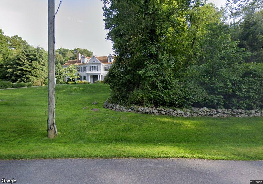
8 River Wind Rd New Canaan, CT 06840
Estimated Value: $3,843,961 - $4,507,000
5
Beds
6
Baths
6,716
Sq Ft
$633/Sq Ft
Est. Value
About This Home
This home is located at 8 River Wind Rd, New Canaan, CT 06840 and is currently estimated at $4,249,320, approximately $632 per square foot. 8 River Wind Rd is a home located in Fairfield County with nearby schools including West Elementary School, Saxe Middle School, and New Canaan High School.
Ownership History
Date
Name
Owned For
Owner Type
Purchase Details
Closed on
Apr 23, 2025
Sold by
Lapolice Lisa
Bought by
Lisa L Lapolice Ret and Lapolice
Current Estimated Value
Purchase Details
Closed on
Mar 4, 2003
Sold by
Robert Monda Custom H
Bought by
Lapolice Denis La and Lapolice Lisa La
Purchase Details
Closed on
Apr 18, 2000
Sold by
Eklund Coy G
Bought by
Robert Monda Cust Home
Create a Home Valuation Report for This Property
The Home Valuation Report is an in-depth analysis detailing your home's value as well as a comparison with similar homes in the area
Home Values in the Area
Average Home Value in this Area
Purchase History
| Date | Buyer | Sale Price | Title Company |
|---|---|---|---|
| Lisa L Lapolice Ret | -- | None Available | |
| Lapolice Denis La | $2,750,000 | -- | |
| Police Denis La | $2,750,000 | -- | |
| Robert Monda Cust Home | $775,000 | -- | |
| Robert Monda Cust Home | $775,000 | -- |
Source: Public Records
Mortgage History
| Date | Status | Borrower | Loan Amount |
|---|---|---|---|
| Previous Owner | Robert Monda Cust Home | $670,000 | |
| Previous Owner | Robert Monda Cust Home | $500,000 | |
| Previous Owner | Robert Monda Cust Home | $687,000 |
Source: Public Records
Tax History Compared to Growth
Tax History
| Year | Tax Paid | Tax Assessment Tax Assessment Total Assessment is a certain percentage of the fair market value that is determined by local assessors to be the total taxable value of land and additions on the property. | Land | Improvement |
|---|---|---|---|---|
| 2025 | $37,768 | $2,262,890 | $738,150 | $1,524,740 |
| 2024 | $36,523 | $2,262,890 | $738,150 | $1,524,740 |
| 2023 | $32,776 | $1,730,540 | $674,800 | $1,055,740 |
| 2022 | $31,790 | $1,730,540 | $674,800 | $1,055,740 |
| 2021 | $31,427 | $1,730,540 | $674,800 | $1,055,740 |
| 2020 | $31,427 | $1,730,540 | $674,800 | $1,055,740 |
| 2019 | $31,565 | $1,730,540 | $674,800 | $1,055,740 |
| 2018 | $34,158 | $2,014,040 | $728,980 | $1,285,060 |
| 2017 | $33,574 | $2,014,040 | $728,980 | $1,285,060 |
| 2016 | $32,849 | $2,014,040 | $728,980 | $1,285,060 |
| 2015 | $33,353 | $2,014,040 | $728,980 | $1,285,060 |
| 2014 | $31,298 | $2,014,040 | $728,980 | $1,285,060 |
Source: Public Records
Map
Nearby Homes
- 331 Dans Hwy
- 104 Dans Hwy
- 104 Ramhorne Rd
- 1580 Ponus Ridge
- 928 West Rd
- 148 W Hills Rd
- 230 & 244 West Rd
- 119 Proprietors Crossing
- 26 Pequot Ln
- 501 Woodbine Rd
- 518 Woodbine Rd
- 171 Proprietors Crossing
- 51 Reeder Ln
- 226 Ingleside Dr
- 0 Rolling Meadow Ln Unit ONEH6302491
- 176 Logan Rd
- 30 Thornwood Rd
- 78 Trinity Pass
- 2993 High Ridge Rd
- 298 Greenley Rd
- 30 River Wind Rd
- 322 Dans Hwy
- 79 Lake Wind Rd
- 111 Lake Wind Rd
- 82 Lake Wind Rd
- 346 Dans Hwy
- 290 Dans Hwy
- 40 River Wind Rd
- 282 Dans Hwy
- 64 Lakewind Rd
- 64 Lake Wind Rd
- 65 Lake Wind Rd
- 1801 Ponus Ridge
- 1801 Ponus Ridge Rd
- 73 Lake Wind Rd
- 1757 Ponus Ridge
- 258 Dans Hwy
- 250 Dans Hwy
- 329 Dans Hwy
- 39 River Wind Rd