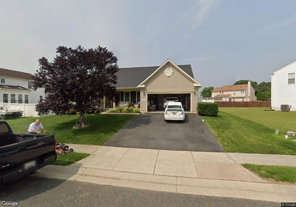
8 Robins Ct Ridgely, MD 21660
Estimated Value: $331,541 - $462,000
Studio
3
Baths
2,148
Sq Ft
$183/Sq Ft
Est. Value
About This Home
This home is located at 8 Robins Ct, Ridgely, MD 21660 and is currently estimated at $394,135, approximately $183 per square foot. 8 Robins Ct is a home located in Caroline County with nearby schools including Ridgely Elementary School, Lockerman Middle School, and North Caroline High School.
Ownership History
Date
Name
Owned For
Owner Type
Purchase Details
Closed on
Mar 18, 2022
Sold by
Shandrowski Joseph R and Shandrowski Janet C
Bought by
Joseph R Shandrowski And Janet C Shandrowski
Current Estimated Value
Purchase Details
Closed on
May 19, 2006
Sold by
Nvr Inc
Bought by
Shandrowski Joseph R And and Shandrowski Janet C
Home Financials for this Owner
Home Financials are based on the most recent Mortgage that was taken out on this home.
Original Mortgage
$290,790
Interest Rate
6.4%
Mortgage Type
Purchase Money Mortgage
Purchase Details
Closed on
Apr 28, 2006
Sold by
Nvr Inc
Bought by
Shandrowski Joseph R And and Shandrowski Janet C
Home Financials for this Owner
Home Financials are based on the most recent Mortgage that was taken out on this home.
Original Mortgage
$290,790
Interest Rate
6.4%
Mortgage Type
Purchase Money Mortgage
Purchase Details
Closed on
Jan 19, 2006
Sold by
Dng L L C
Bought by
Nvr Inc
Create a Home Valuation Report for This Property
The Home Valuation Report is an in-depth analysis detailing your home's value as well as a comparison with similar homes in the area
Purchase History
| Date | Buyer | Sale Price | Title Company |
|---|---|---|---|
| Joseph R Shandrowski And Janet C Shandrowski | -- | None Listed On Document | |
| Shandrowski Joseph R And | $363,490 | -- | |
| Shandrowski Joseph R And | $363,490 | -- | |
| Nvr Inc | $78,000 | -- |
Source: Public Records
Mortgage History
| Date | Status | Borrower | Loan Amount |
|---|---|---|---|
| Previous Owner | Shandrowski Joseph R And | $290,790 | |
| Previous Owner | Shandrowski Joseph R And | $290,790 |
Source: Public Records
Tax History
| Year | Tax Paid | Tax Assessment Tax Assessment Total Assessment is a certain percentage of the fair market value that is determined by local assessors to be the total taxable value of land and additions on the property. | Land | Improvement |
|---|---|---|---|---|
| 2025 | $4,236 | $281,000 | $0 | $0 |
| 2024 | $4,055 | $269,000 | $50,000 | $219,000 |
| 2023 | $3,983 | $260,267 | $0 | $0 |
| 2022 | $3,909 | $251,533 | $0 | $0 |
| 2021 | $3,628 | $242,800 | $35,000 | $207,800 |
| 2020 | $3,628 | $227,967 | $0 | $0 |
| 2019 | $3,433 | $213,133 | $0 | $0 |
| 2018 | $3,162 | $198,300 | $35,000 | $163,300 |
| 2017 | $3,121 | $194,933 | $0 | $0 |
| 2016 | -- | $191,567 | $0 | $0 |
| 2015 | $3,474 | $188,200 | $0 | $0 |
| 2014 | $3,474 | $188,200 | $0 | $0 |
Source: Public Records
Map
Nearby Homes
- 12 N Maple Ave
- 1 Sunrise Ave
- 6 N Central Ave
- 3 Sunrise Ave
- 12658 Oakland Rd
- 504 Central Ave
- 11920 Central Ave
- 8 W Liberty St
- 7 W Belle St
- 305 Maple Ave
- 302 W Railroad St
- 208 W 2nd St
- 210 W 2nd St
- 506 Park Ave
- 12115 Lincoln St
- 1 Oakview Ct
- 0 Douglas & Lincoln St Unit MDCM2006716
- 24029 Meadows Dr
- 22691 Sawmill Rd
- 11473 Holly Rd
Your Personal Tour Guide
Ask me questions while you tour the home.