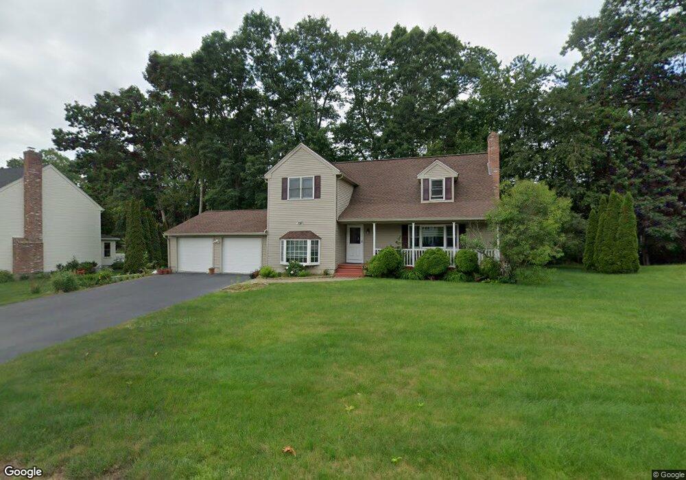
8 Rollie Shepard Dr Millbury, MA 01527
Estimated Value: $611,697 - $687,000
3
Beds
3
Baths
2,099
Sq Ft
$312/Sq Ft
Est. Value
About This Home
This home is located at 8 Rollie Shepard Dr, Millbury, MA 01527 and is currently estimated at $654,924, approximately $312 per square foot. 8 Rollie Shepard Dr is a home located in Worcester County with nearby schools including Elmwood Street Elementary School, Raymond E. Shaw Elementary School, and Millbury Junior/Senior High School.
Ownership History
Date
Name
Owned For
Owner Type
Purchase Details
Closed on
Dec 17, 1999
Sold by
Zanadu Inc
Bought by
Bhattacharya Asish K and Bhattacharya Arpita
Current Estimated Value
Home Financials for this Owner
Home Financials are based on the most recent Mortgage that was taken out on this home.
Original Mortgage
$172,900
Interest Rate
7.81%
Mortgage Type
Purchase Money Mortgage
Create a Home Valuation Report for This Property
The Home Valuation Report is an in-depth analysis detailing your home's value as well as a comparison with similar homes in the area
Home Values in the Area
Average Home Value in this Area
Purchase History
| Date | Buyer | Sale Price | Title Company |
|---|---|---|---|
| Bhattacharya Asish K | $182,000 | -- | |
| Bhattacharya Asish K | $182,000 | -- |
Source: Public Records
Mortgage History
| Date | Status | Borrower | Loan Amount |
|---|---|---|---|
| Open | Bhattacharya Asish K | $170,000 | |
| Closed | Bhattacharya Asish K | $30,000 | |
| Closed | Bhattacharya Asish K | $172,900 |
Source: Public Records
Tax History Compared to Growth
Tax History
| Year | Tax Paid | Tax Assessment Tax Assessment Total Assessment is a certain percentage of the fair market value that is determined by local assessors to be the total taxable value of land and additions on the property. | Land | Improvement |
|---|---|---|---|---|
| 2025 | $7,118 | $531,600 | $115,700 | $415,900 |
| 2024 | $6,537 | $494,100 | $107,200 | $386,900 |
| 2023 | $5,796 | $401,100 | $75,200 | $325,900 |
| 2022 | $5,649 | $376,600 | $75,200 | $301,400 |
| 2021 | $3,476 | $357,000 | $75,200 | $281,800 |
| 2020 | $2,698 | $347,200 | $75,200 | $272,000 |
| 2019 | $5,353 | $337,700 | $74,800 | $262,900 |
| 2018 | $1,123 | $320,200 | $74,800 | $245,400 |
| 2017 | $2,711 | $282,300 | $74,800 | $207,500 |
| 2016 | $4,620 | $280,700 | $74,800 | $205,900 |
| 2015 | $4,554 | $276,700 | $76,100 | $200,600 |
| 2014 | $4,338 | $253,700 | $79,500 | $174,200 |
Source: Public Records
Map
Nearby Homes
- 3 May St
- 86 Wheelock Ave
- 2 Diane St
- 90 Macarthur Dr
- 12 Irene Ct
- 11 Westview Ave
- 1 Pineland Ave
- 1 Broadmeadow Ave
- 12 Alstead Path
- 46 John Dr Unit 46
- 5 Edward Dr
- 11 Maplewood Rd
- 330 Millbury Ave
- 21 Lordvale Blvd Unit 406
- 27 A-B Grafton St
- 28 Lincoln Ln
- 5 Lincoln Ln Unit 5
- 76 Samuel Dr
- 3 Stidsen Way
- 497 Massasoit Rd
- 10 Rollie Shepard Dr
- 35 Macarthur Dr
- 31 Macarthur Dr
- 6 Rollie Shepard Dr
- 9 Rollie Shepard Dr
- 41 Macarthur Dr
- 11 Rollie Shepard Dr
- 12 Rollie Shepard Dr
- 27 Macarthur Dr
- 43 Macarthur Dr
- 7 Rollie Shepard Dr
- 34 Macarthur Dr
- 1 Bill Graham Ln
- 25 Macarthur Dr
- 14 Rollie Shepard Dr
- 1 Montgomery Dr
- 2 Bill Graham Ln
- 13 Rollie Shepard Dr
- 38 Macarthur Dr
- 28 Macarthur Dr