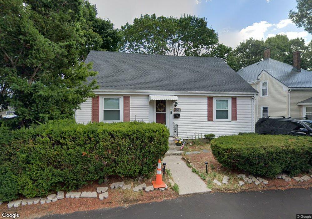
8 Spruce St Quincy, MA 02171
Montclair NeighborhoodEstimated Value: $648,000 - $741,917
3
Beds
1
Bath
1,404
Sq Ft
$480/Sq Ft
Est. Value
About This Home
This home is located at 8 Spruce St, Quincy, MA 02171 and is currently estimated at $674,229, approximately $480 per square foot. 8 Spruce St is a home located in Norfolk County with nearby schools including Squantum Elementary School, Atlantic Middle School, and North Quincy High School.
Ownership History
Date
Name
Owned For
Owner Type
Purchase Details
Closed on
Jul 14, 2025
Sold by
Moy Gary G W Est and Moy
Bought by
Lindsay Robert
Current Estimated Value
Home Financials for this Owner
Home Financials are based on the most recent Mortgage that was taken out on this home.
Original Mortgage
$544,000
Outstanding Balance
$542,162
Interest Rate
6.89%
Mortgage Type
New Conventional
Estimated Equity
$132,067
Purchase Details
Closed on
Nov 27, 1991
Sold by
Cavanagh Ann M
Bought by
Moy Gary G
Home Financials for this Owner
Home Financials are based on the most recent Mortgage that was taken out on this home.
Original Mortgage
$94,400
Interest Rate
8.72%
Mortgage Type
Purchase Money Mortgage
Create a Home Valuation Report for This Property
The Home Valuation Report is an in-depth analysis detailing your home's value as well as a comparison with similar homes in the area
Home Values in the Area
Average Home Value in this Area
Purchase History
| Date | Buyer | Sale Price | Title Company |
|---|---|---|---|
| Lindsay Robert | $640,000 | -- | |
| Lindsay Robert | $640,000 | -- | |
| Moy Gary G | $118,000 | -- | |
| Moy Gary G | $118,000 | -- |
Source: Public Records
Mortgage History
| Date | Status | Borrower | Loan Amount |
|---|---|---|---|
| Open | Lindsay Robert | $544,000 | |
| Closed | Lindsay Robert | $544,000 | |
| Previous Owner | Moy Gary G | $25,000 | |
| Previous Owner | Moy Gary G | $94,400 |
Source: Public Records
Tax History Compared to Growth
Tax History
| Year | Tax Paid | Tax Assessment Tax Assessment Total Assessment is a certain percentage of the fair market value that is determined by local assessors to be the total taxable value of land and additions on the property. | Land | Improvement |
|---|---|---|---|---|
| 2025 | $7,598 | $659,000 | $393,400 | $265,600 |
| 2024 | $7,395 | $656,200 | $393,400 | $262,800 |
| 2023 | $6,905 | $620,400 | $374,700 | $245,700 |
| 2022 | $6,740 | $562,600 | $325,800 | $236,800 |
| 2021 | $6,535 | $538,300 | $310,300 | $228,000 |
| 2020 | $6,561 | $527,800 | $310,300 | $217,500 |
| 2019 | $6,049 | $482,000 | $290,000 | $192,000 |
| 2018 | $6,043 | $453,000 | $268,500 | $184,500 |
| 2017 | $5,845 | $412,500 | $255,700 | $156,800 |
| 2016 | $5,295 | $368,700 | $222,400 | $146,300 |
| 2015 | $5,005 | $342,800 | $202,200 | $140,600 |
| 2014 | $4,630 | $311,600 | $192,600 | $119,000 |
Source: Public Records
Map
Nearby Homes
- 68 Atlantic St
- 91 Atlantic St
- 133 Commander Shea Blvd Unit 315
- 133 Commander Shea Blvd Unit 609
- 133 Commander Shea Blvd Unit 620
- 133 Commander Shea Blvd Unit 204
- 60 Newbury St Unit 10
- 45 Hancock St Unit 203
- 90 Quincy Shore Dr Unit 701
- 90 Quincy Shore Dr Unit 501
- 90 Shore Ave
- 85 E Squantum St Unit 10
- 38 Walker St
- 17 Holmes St Unit 2
- 17 Holmes St Unit 4
- 115 W Squantum St Unit 907
- 115 W Squantum St Unit 810
- 138 Quincy Shore Dr Unit 170
- 148 Quincy Shore Dr Unit 43
- 175 Quincy Shore Dr Unit B24
- 12 Spruce St
- 165 Hancock St
- 14 Spruce St
- 11 Spruce St
- 15 Spruce St
- 157 Hancock St Unit 4
- 157 Hancock St Unit 11
- 157 Hancock St Unit 1
- 157 Hancock St Unit 3
- 157 Hancock St Unit 5
- 157 Hancock St Unit 12
- 157 Hancock St Unit 9
- 157 Hancock St Unit 13
- 157 Hancock St Unit 14
- 157 Hancock St Unit 10
- 157 Hancock St Unit 6
- 157 Hancock St Unit 7
- 157 Hancock St Unit 8
- 157 Hancock St
- 17 Spruce St