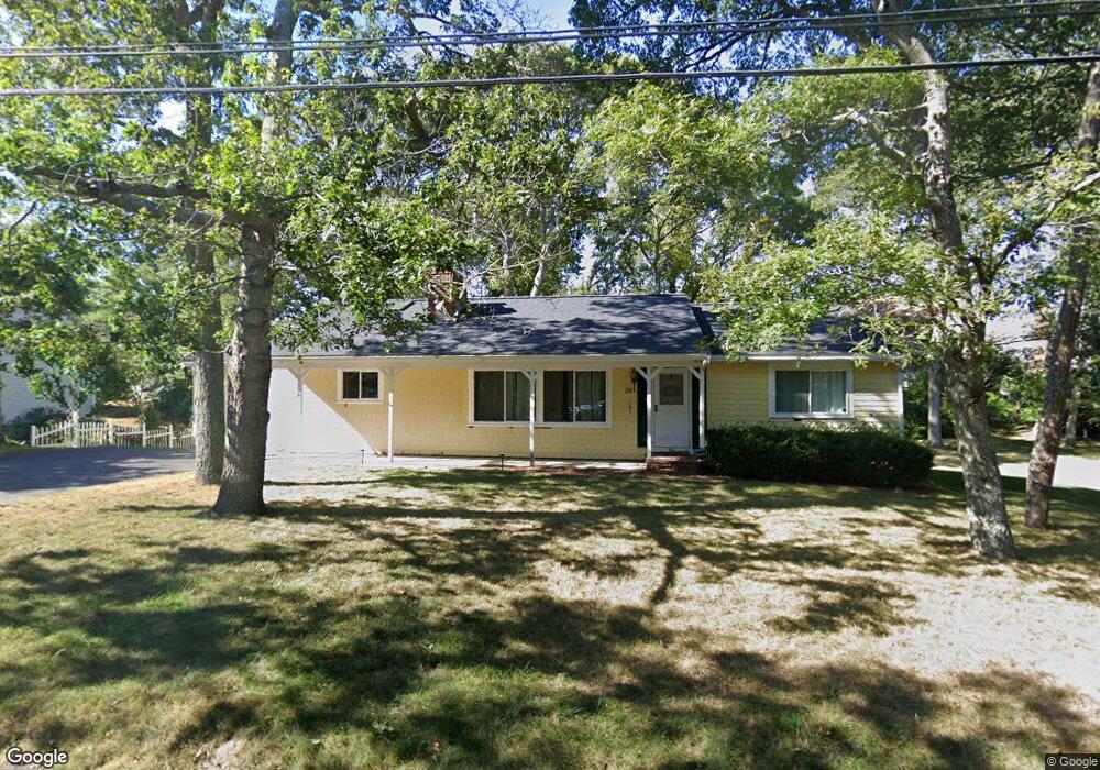
8 Sterling Rd Hyannis, MA 02601
Estimated Value: $579,000 - $686,000
3
Beds
2
Baths
1,484
Sq Ft
$420/Sq Ft
Est. Value
About This Home
This home is located at 8 Sterling Rd, Hyannis, MA 02601 and is currently estimated at $622,665, approximately $419 per square foot. 8 Sterling Rd is a home located in Barnstable County with nearby schools including Hyannis West Elementary School, Barnstable United Elementary School, and Barnstable Intermediate School.
Ownership History
Date
Name
Owned For
Owner Type
Purchase Details
Closed on
Jun 24, 2021
Sold by
Bosworth W Chandler
Bought by
Nieves Hector and Nieves Jessica
Current Estimated Value
Home Financials for this Owner
Home Financials are based on the most recent Mortgage that was taken out on this home.
Original Mortgage
$403,750
Outstanding Balance
$365,545
Interest Rate
2.9%
Mortgage Type
Purchase Money Mortgage
Estimated Equity
$257,120
Purchase Details
Closed on
Feb 3, 2021
Sold by
Healy Lawrence J
Bought by
Bosworth W Chandler
Create a Home Valuation Report for This Property
The Home Valuation Report is an in-depth analysis detailing your home's value as well as a comparison with similar homes in the area
Home Values in the Area
Average Home Value in this Area
Purchase History
| Date | Buyer | Sale Price | Title Company |
|---|---|---|---|
| Nieves Hector | $425,000 | None Available | |
| Bosworth W Chandler | $278,000 | None Available |
Source: Public Records
Mortgage History
| Date | Status | Borrower | Loan Amount |
|---|---|---|---|
| Open | Nieves Hector | $403,750 |
Source: Public Records
Tax History
| Year | Tax Paid | Tax Assessment Tax Assessment Total Assessment is a certain percentage of the fair market value that is determined by local assessors to be the total taxable value of land and additions on the property. | Land | Improvement |
|---|---|---|---|---|
| 2025 | $4,925 | $531,300 | $150,000 | $381,300 |
| 2024 | $4,777 | $527,800 | $150,000 | $377,800 |
| 2023 | $4,425 | $462,400 | $136,300 | $326,100 |
| 2022 | $4,480 | $387,200 | $101,000 | $286,200 |
| 2021 | $3,987 | $334,800 | $101,000 | $233,800 |
| 2020 | $4,047 | $328,200 | $101,000 | $227,200 |
| 2019 | $3,788 | $301,100 | $101,000 | $200,100 |
| 2018 | $3,486 | $283,400 | $106,300 | $177,100 |
| 2017 | $3,300 | $275,200 | $106,300 | $168,900 |
| 2016 | $3,236 | $275,900 | $107,000 | $168,900 |
| 2015 | $3,022 | $261,200 | $103,100 | $158,100 |
Source: Public Records
Map
Nearby Homes
- 135 W Main St Unit 41
- 135 W Main St Unit 26
- 135 W Main St Unit 7
- 36 Grouse Ln
- 24 Bettys Pond Rd Unit K
- 24 Betty's Pond Rd Unit 1K
- 20 Sunset Terrace
- 83 Peacock Dr
- 292 Megan Rd
- 281 Megan Rd
- 15 Glen Rd
- 14 Marston Ave
- 417 Scudder Ave
- 260 Tobey Way
- 125 Sea St
- 93 Sea St
- 75 Olander Dr
- 75 Olander Dr
- 78 Bristol Ave
- 267 Lincoln Rd
- 28 Sterling Rd
- 28 Sterling Rd
- 38 Sterling Rd
- 18 Sterling Rd
- 90 Whip o Will Dr
- 28 Town House Ct
- 26 Town House Ct
- 24 Town House Ct
- 22 Town House Ct
- 20 Town House Ct
- 18 Town House Ct
- 20 Townhouse Ct Unit U-20
- 26 Townhouse Ct Unit 26
- 22 Townhouse Ct Unit 22
- 18 Town House Ct Unit 18
- 22 Town House Ct Unit 22
- 86 Town House Terrace
- 88 Town House Terrace
- 90 Town House Terrace
- 92 Town House Terrace