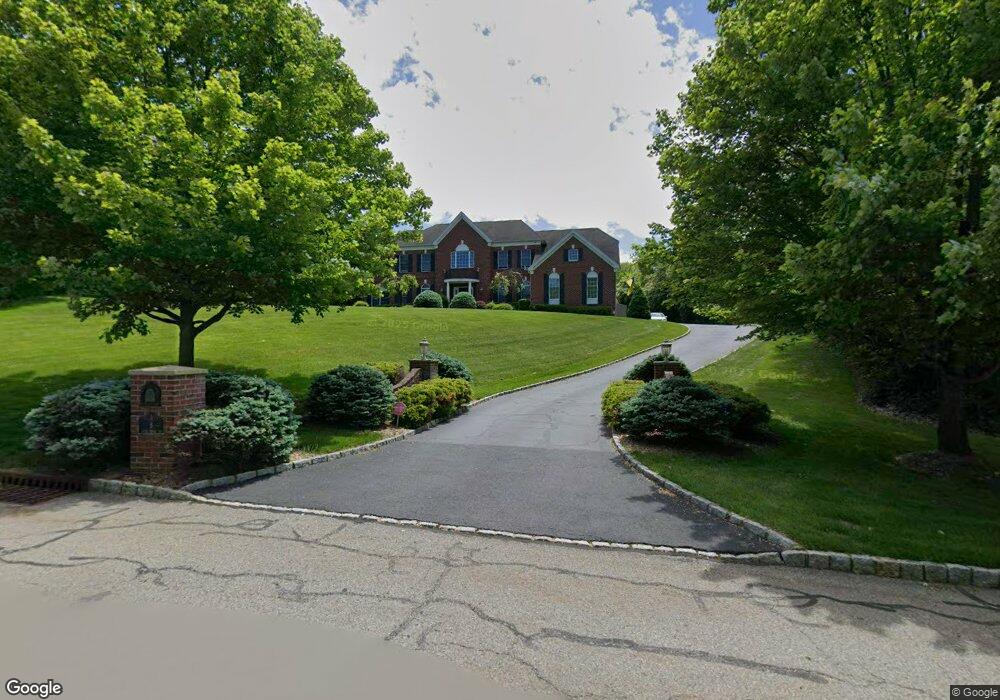
8 Stone Forge Rd Andover, NJ 07821
Estimated Value: $845,000 - $912,000
Studio
--
Bath
3,980
Sq Ft
$223/Sq Ft
Est. Value
About This Home
This home is located at 8 Stone Forge Rd, Andover, NJ 07821 and is currently estimated at $888,103, approximately $223 per square foot. 8 Stone Forge Rd is a home located in Sussex County with nearby schools including Green Hills School and Tranquility Adventist School.
Ownership History
Date
Name
Owned For
Owner Type
Purchase Details
Closed on
Jun 23, 2015
Sold by
Nrz Reo Iv Corp
Bought by
Pretium Mortgage Acquistion Trust and Christiana Trust
Current Estimated Value
Purchase Details
Closed on
Jun 27, 2006
Sold by
Toll Land Xxv Lp
Bought by
Dobroskok Peter P and Dobroskok Rosemarie
Home Financials for this Owner
Home Financials are based on the most recent Mortgage that was taken out on this home.
Original Mortgage
$200,000
Interest Rate
6.67%
Mortgage Type
Balloon
Purchase Details
Closed on
Jan 16, 2004
Sold by
Federal Financial Co
Bought by
Toll Land Xxv Lp
Create a Home Valuation Report for This Property
The Home Valuation Report is an in-depth analysis detailing your home's value as well as a comparison with similar homes in the area
Home Values in the Area
Average Home Value in this Area
Purchase History
| Date | Buyer | Sale Price | Title Company |
|---|---|---|---|
| Pretium Mortgage Acquistion Trust | -- | Title365 | |
| Dobroskok Peter P | $769,259 | None Available | |
| Toll Land Xxv Lp | $2,240,000 | Westminster Title Agency |
Source: Public Records
Mortgage History
| Date | Status | Borrower | Loan Amount |
|---|---|---|---|
| Previous Owner | Dobroskok Peter P | $200,000 |
Source: Public Records
Tax History
| Year | Tax Paid | Tax Assessment Tax Assessment Total Assessment is a certain percentage of the fair market value that is determined by local assessors to be the total taxable value of land and additions on the property. | Land | Improvement |
|---|---|---|---|---|
| 2025 | $20,472 | $881,300 | $184,100 | $697,200 |
| 2024 | $20,325 | $526,000 | $148,400 | $377,600 |
Source: Public Records
Map
Nearby Homes
- 88 Kennedy Rd
- 112 Kennedy Rd
- 4 Spruce Dr
- 37 Pequest Rd
- 30 Scenic Dr
- 95 Forest Rd
- 0 Decker Pond Airport Rd Unit 3945534
- 10 Sunny Ln
- 30 MacKerley Rd
- 203 Johnsonburg Rd
- 52 Whitehall Rd
- 33 Hibler Rd
- 96 Brighton Rd
- 70 S Shore Rd
- 43 Rushmore Ln
- 6 Jans Way
- 10 Rushmore Ln
- 17 Rushmore Ln
- 5 Rushmore Ln
- 17 High St
- 6 Stone Forge Rd
- 9 Green Tree Dr
- 7 Stone Forge Rd
- 5 Stone Forge Rd
- 4 Stone Forge Rd
- 3 Stone Forge Rd
- 7 Green Tree Dr
- 4 Carriage Dr
- 20 Green Tree Dr
- 2 Stone Forge Rd
- 1 Stone Forge Rd
- 14 Green Tree Dr
- 54 Creek Rd
- 22 Green Tree Dr
- 15 Green Tree Dr
- 30 Creek Rd
- 2 Carriage Dr
- 6 Carriage Dr
- 12 Green Tree Dr
- 18 Green Tree Dr
Your Personal Tour Guide
Ask me questions while you tour the home.