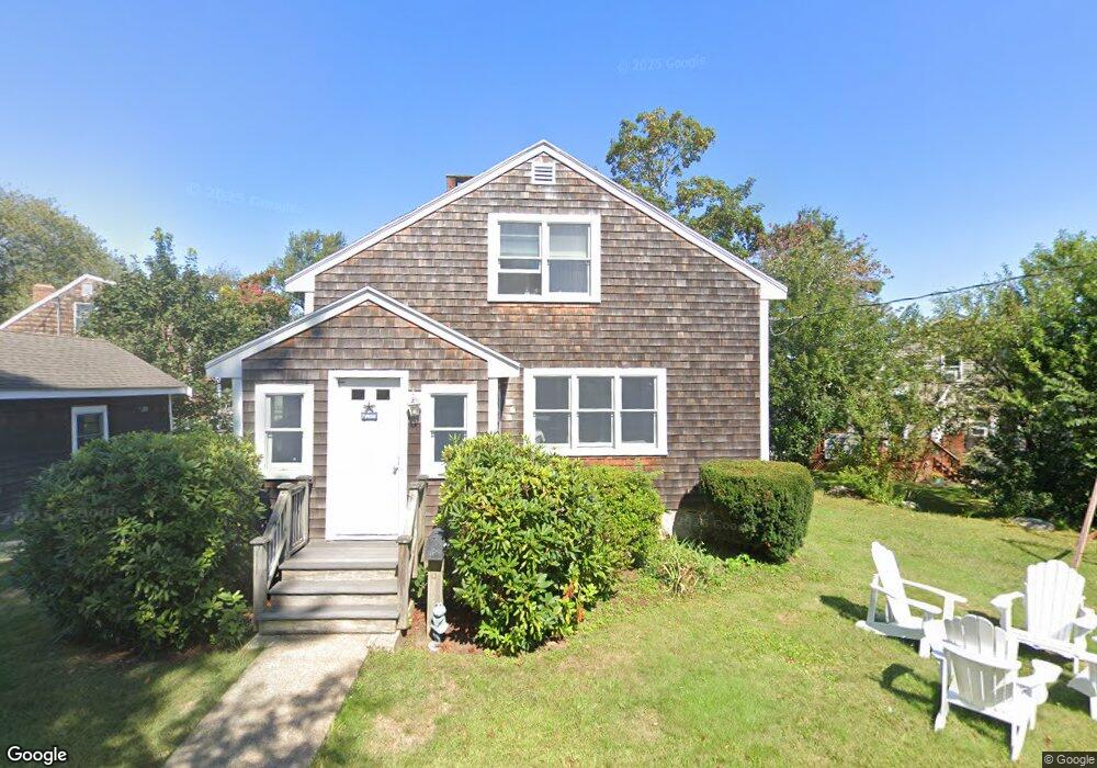
8 Stone Rd Scituate, MA 02066
Estimated Value: $737,000 - $944,000
3
Beds
2
Baths
1,437
Sq Ft
$562/Sq Ft
Est. Value
About This Home
This home is located at 8 Stone Rd, Scituate, MA 02066 and is currently estimated at $807,083, approximately $561 per square foot. 8 Stone Rd is a home located in Plymouth County with nearby schools including Jenkins Elementary School, Lester J. Gates Middle School, and Scituate High School.
Ownership History
Date
Name
Owned For
Owner Type
Purchase Details
Closed on
May 28, 2020
Sold by
Robert M Shea Ret
Bought by
Hennessey Roberta G
Current Estimated Value
Home Financials for this Owner
Home Financials are based on the most recent Mortgage that was taken out on this home.
Original Mortgage
$475,000
Outstanding Balance
$421,836
Interest Rate
3.3%
Mortgage Type
New Conventional
Estimated Equity
$385,247
Purchase Details
Closed on
Jul 3, 2013
Sold by
Shea Robert M
Bought by
Robert M Shea Ret
Create a Home Valuation Report for This Property
The Home Valuation Report is an in-depth analysis detailing your home's value as well as a comparison with similar homes in the area
Home Values in the Area
Average Home Value in this Area
Purchase History
| Date | Buyer | Sale Price | Title Company |
|---|---|---|---|
| Hennessey Roberta G | $500,000 | None Available | |
| Robert M Shea Ret | -- | -- | |
| Shea Robert M | -- | -- |
Source: Public Records
Mortgage History
| Date | Status | Borrower | Loan Amount |
|---|---|---|---|
| Open | Hennessey Roberta G | $475,000 |
Source: Public Records
Tax History
| Year | Tax Paid | Tax Assessment Tax Assessment Total Assessment is a certain percentage of the fair market value that is determined by local assessors to be the total taxable value of land and additions on the property. | Land | Improvement |
|---|---|---|---|---|
| 2025 | $6,534 | $654,100 | $346,900 | $307,200 |
| 2024 | $6,389 | $616,700 | $315,400 | $301,300 |
| 2023 | $6,143 | $571,400 | $302,600 | $268,800 |
| 2022 | $6,143 | $486,800 | $260,700 | $226,100 |
| 2021 | $5,833 | $437,600 | $248,300 | $189,300 |
| 2020 | $5,661 | $419,300 | $238,700 | $180,600 |
| 2019 | $5,561 | $404,700 | $234,000 | $170,700 |
| 2018 | $5,464 | $391,700 | $239,900 | $151,800 |
| 2017 | $5,047 | $358,200 | $229,900 | $128,300 |
| 2016 | $4,719 | $333,700 | $209,900 | $123,800 |
| 2015 | $4,240 | $323,700 | $199,900 | $123,800 |
Source: Public Records
Map
Nearby Homes
- 46 Tilden Rd
- 50 First Parish Rd
- 24 Ridge Hill Rd
- 15 Bearce Ln
- 91 Front St Unit 106
- 59 Greenfield Ln
- 25 Morton Place
- 38 Lauren Ln
- 1 Washington Ln
- 111 Elm St
- 115 Elm St
- 21 Jenkins Place
- 20 Lee Ave
- 20 Grace Way Unit 20
- 6 Grace Way Unit 6
- 27 Grace Way
- 14 Old Country Way Unit C
- 14 Old Country Way Unit B
- 49 Jackson Rd
- 34 Cudworth Rd
- 2 Chester St
- 65 Common St
- 67 Common St
- 9 Stone Rd
- 3 Stone Rd
- 5 Roslin Rd
- 119 First Parish Rd
- 15 Stone Rd
- 121 First Parish Rd
- 3 Chester St
- 111 First Parish Rd
- 111 First Parish Rd
- 4 Roslin Rd
- 6 Roslin Rd
- 55 Common St
- 67 Station St
- 125 First Parish Rd
- 123 First Parish Rd
- 125 First Parish Rd Unit 1
- 55 Station St
Your Personal Tour Guide
Ask me questions while you tour the home.