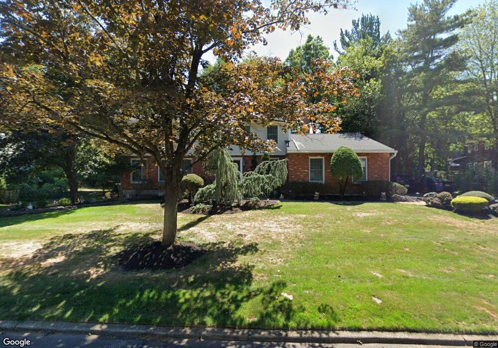
8 Sundbury Dr New City, NY 10956
Estimated Value: $863,312 - $1,007,000
--
Bed
1
Bath
2,767
Sq Ft
$336/Sq Ft
Est. Value
About This Home
This home is located at 8 Sundbury Dr, New City, NY 10956 and is currently estimated at $929,578, approximately $335 per square foot. 8 Sundbury Dr is a home located in Rockland County with nearby schools including Little Tor Elementary School, Felix Festa Middle School, and Clarkstown North Senior High School.
Ownership History
Date
Name
Owned For
Owner Type
Purchase Details
Closed on
Aug 30, 2000
Sold by
Lenchner Harvey
Bought by
Desarlo Patrick and Desarlo Noreen
Current Estimated Value
Home Financials for this Owner
Home Financials are based on the most recent Mortgage that was taken out on this home.
Original Mortgage
$295,000
Outstanding Balance
$106,755
Interest Rate
8%
Estimated Equity
$822,823
Purchase Details
Closed on
Oct 18, 1999
Sold by
Lenchner Harvey
Bought by
Lenchner Harvey
Create a Home Valuation Report for This Property
The Home Valuation Report is an in-depth analysis detailing your home's value as well as a comparison with similar homes in the area
Home Values in the Area
Average Home Value in this Area
Purchase History
| Date | Buyer | Sale Price | Title Company |
|---|---|---|---|
| Desarlo Patrick | $447,000 | Lawyers Title Insurance Corp | |
| Lenchner Harvey | -- | -- |
Source: Public Records
Mortgage History
| Date | Status | Borrower | Loan Amount |
|---|---|---|---|
| Open | Desarlo Patrick | $295,000 |
Source: Public Records
Tax History Compared to Growth
Tax History
| Year | Tax Paid | Tax Assessment Tax Assessment Total Assessment is a certain percentage of the fair market value that is determined by local assessors to be the total taxable value of land and additions on the property. | Land | Improvement |
|---|---|---|---|---|
| 2024 | $22,485 | $189,300 | $32,500 | $156,800 |
| 2023 | $22,485 | $189,300 | $32,500 | $156,800 |
| 2022 | $17,715 | $189,300 | $32,500 | $156,800 |
| 2021 | $17,715 | $189,300 | $32,500 | $156,800 |
| 2020 | $17,518 | $189,300 | $32,500 | $156,800 |
| 2019 | $16,765 | $189,300 | $32,500 | $156,800 |
| 2018 | $16,765 | $189,300 | $32,500 | $156,800 |
| 2017 | $16,358 | $189,300 | $32,500 | $156,800 |
| 2016 | $16,244 | $189,300 | $32,500 | $156,800 |
| 2015 | -- | $189,300 | $32,500 | $156,800 |
| 2014 | -- | $189,300 | $32,500 | $156,800 |
Source: Public Records
Map
Nearby Homes
- 8 Liberty Cir
- 40 Ruth Dr
- 8 Ungava Dr
- 11 Ungava Dr
- 5 Rookery Cir
- 44 Yale Dr
- 31 Concord Dr
- 28 The Promenade
- 4 Susan Dr
- 31 Brookline Way
- 13 (formerly 19A) Deerfield Dr
- 12 Heritage Dr Unit C
- 10 Heritage Dr Unit B
- 31 Lowell Dr
- 37 Heritage Dr Unit B
- 31 Verdin Dr
- 30 James St
- 40 Heritage Dr
- 11 Old Phillips Hill Rd
- 43 Cranford Dr