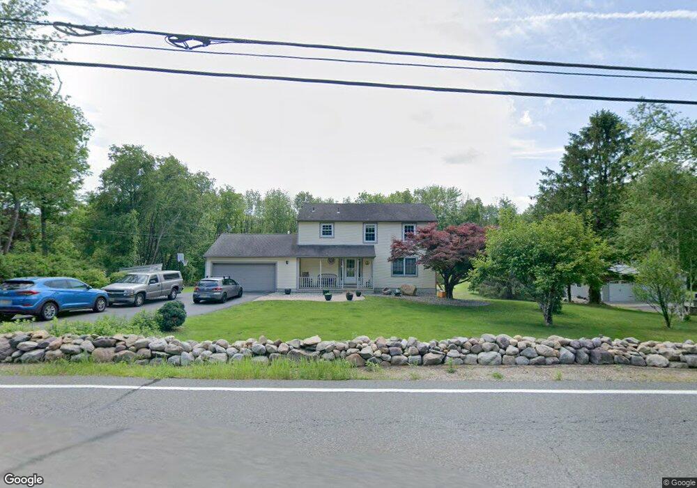
8 W Owassa Turnpike Newton, NJ 07860
Estimated Value: $452,141 - $570,000
--
Bed
--
Bath
1,752
Sq Ft
$300/Sq Ft
Est. Value
About This Home
This home is located at 8 W Owassa Turnpike, Newton, NJ 07860 and is currently estimated at $525,285, approximately $299 per square foot. 8 W Owassa Turnpike is a home located in Sussex County with nearby schools including Frankford Township School and High Point Regional High School.
Ownership History
Date
Name
Owned For
Owner Type
Purchase Details
Closed on
Jul 31, 2019
Sold by
Groat Donald L De and Groat Dawn T De
Bought by
Schnabel Angela J and Schnabel Kenneth W
Current Estimated Value
Home Financials for this Owner
Home Financials are based on the most recent Mortgage that was taken out on this home.
Original Mortgage
$244,000
Outstanding Balance
$212,769
Interest Rate
3.7%
Mortgage Type
New Conventional
Estimated Equity
$312,516
Purchase Details
Closed on
Dec 17, 1993
Sold by
Morville George W
Bought by
Degrocet Dawn T and Degroet Donald L
Home Financials for this Owner
Home Financials are based on the most recent Mortgage that was taken out on this home.
Original Mortgage
$140,000
Interest Rate
7.03%
Create a Home Valuation Report for This Property
The Home Valuation Report is an in-depth analysis detailing your home's value as well as a comparison with similar homes in the area
Home Values in the Area
Average Home Value in this Area
Purchase History
| Date | Buyer | Sale Price | Title Company |
|---|---|---|---|
| Schnabel Angela J | $305,000 | Simplicity Title Llc | |
| Degrocet Dawn T | $155,000 | -- |
Source: Public Records
Mortgage History
| Date | Status | Borrower | Loan Amount |
|---|---|---|---|
| Open | Schnabel Angela J | $244,000 | |
| Previous Owner | Degrocet Dawn T | $140,000 |
Source: Public Records
Tax History Compared to Growth
Tax History
| Year | Tax Paid | Tax Assessment Tax Assessment Total Assessment is a certain percentage of the fair market value that is determined by local assessors to be the total taxable value of land and additions on the property. | Land | Improvement |
|---|---|---|---|---|
| 2025 | $7,260 | $244,100 | $81,600 | $162,500 |
| 2024 | $7,042 | $244,100 | $81,600 | $162,500 |
| 2023 | $7,042 | $244,100 | $81,600 | $162,500 |
| 2022 | $6,871 | $244,100 | $81,600 | $162,500 |
| 2021 | $6,664 | $244,100 | $81,600 | $162,500 |
| 2020 | $6,474 | $244,100 | $81,600 | $162,500 |
| 2019 | $6,290 | $244,100 | $81,600 | $162,500 |
| 2018 | $6,232 | $244,100 | $81,600 | $162,500 |
| 2017 | $6,210 | $244,100 | $81,600 | $162,500 |
| 2016 | $6,288 | $244,100 | $81,600 | $162,500 |
| 2015 | $6,256 | $244,100 | $81,600 | $162,500 |
| 2014 | $6,400 | $244,100 | $81,600 | $162,500 |
Source: Public Records
Map
Nearby Homes
- 17 17 West Owassa Tnpk
- 121 W Shore Dr
- 68 W Shore Dr
- 000 Pepperidge Dr
- 17 Eastbrook Ln
- 903 Aspen Ct
- 10 Glenbrook Dr
- 921 Tulip Trail
- 31 Kent Rd
- 90 Kemah Mecca Lake Rd
- 40 Martin Ln
- 936 Hampton Rd
- 908 Willow Dr
- 196 W Owassa Turnpike
- 1 South Trail
- 26 Mill Ln
- 57 E Shore Trail
- 95 Woods Rd
- 8 Possaghi Rd
- 25 E Shore Lake Owassa Rd
- 6 W Owassa Turnpike
- 10 W Owassa Turnpike
- 4 W Owassa Turnpike
- 11 W Owassa Turnpike
- 12 W Owassa Turnpike
- 5 W Owassa Turnpike
- 16 W Owassa Turnpike
- 17 W Owassa Turnpike
- 38 Mountain Rd
- 0 W Owassa Turnpike
- 32 Mountain Rd
- 21 W Owassa Turnpike
- 25 W Owassa Turnpike
- 28 Mountain Rd
- 27 W Owassa Turnpike
- 26 W Owassa Turnpike
- 28 W Owassa Turnpike
- 24 Mountain Rd
- 31 W Owassa Turnpike
- 4 Love Rd