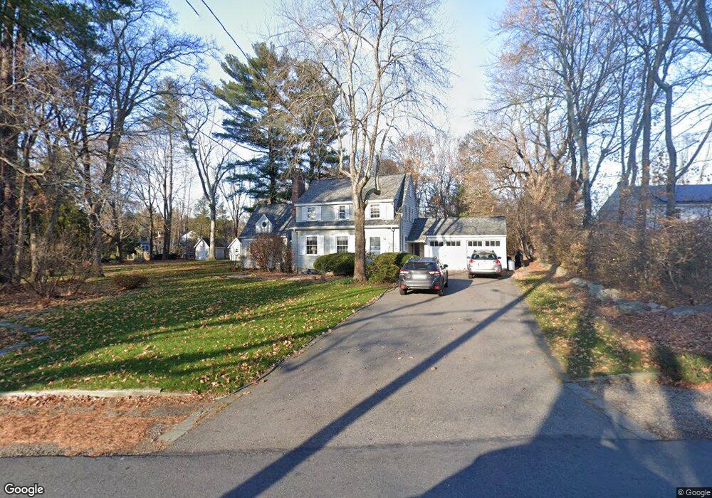
8 Waltham Rd Wayland, MA 01778
Estimated Value: $1,046,000 - $1,115,000
3
Beds
2
Baths
1,894
Sq Ft
$570/Sq Ft
Est. Value
About This Home
This home is located at 8 Waltham Rd, Wayland, MA 01778 and is currently estimated at $1,078,903, approximately $569 per square foot. 8 Waltham Rd is a home located in Middlesex County with nearby schools including Wayland High School and Corwin-Russell School at Broccoli Hall.
Ownership History
Date
Name
Owned For
Owner Type
Purchase Details
Closed on
Feb 27, 2020
Sold by
Crowell S Fiske S and Crowell Andrea S
Bought by
Sumner Fiske Crowell Jr T and Sumner Crowell
Current Estimated Value
Purchase Details
Closed on
Dec 31, 1984
Bought by
Crowell Fiske and Crowell Andrea S
Create a Home Valuation Report for This Property
The Home Valuation Report is an in-depth analysis detailing your home's value as well as a comparison with similar homes in the area
Home Values in the Area
Average Home Value in this Area
Purchase History
| Date | Buyer | Sale Price | Title Company |
|---|---|---|---|
| Sumner Fiske Crowell Jr T | -- | None Available | |
| Sumner Fiske Crowell Jr T | -- | None Available | |
| Crowell Fiske | -- | -- |
Source: Public Records
Mortgage History
| Date | Status | Borrower | Loan Amount |
|---|---|---|---|
| Previous Owner | Crowell Fiske | $175,000 | |
| Previous Owner | Crowell Fiske | $130,000 |
Source: Public Records
Tax History Compared to Growth
Tax History
| Year | Tax Paid | Tax Assessment Tax Assessment Total Assessment is a certain percentage of the fair market value that is determined by local assessors to be the total taxable value of land and additions on the property. | Land | Improvement |
|---|---|---|---|---|
| 2025 | $14,642 | $936,800 | $559,000 | $377,800 |
| 2024 | $13,867 | $893,500 | $532,600 | $360,900 |
| 2023 | $13,258 | $796,300 | $484,100 | $312,200 |
| 2022 | $12,944 | $705,400 | $400,700 | $304,700 |
| 2021 | $12,355 | $667,100 | $364,300 | $302,800 |
| 2020 | $11,681 | $657,700 | $364,300 | $293,400 |
| 2019 | $11,785 | $644,700 | $347,100 | $297,600 |
| 2018 | $10,789 | $598,400 | $347,100 | $251,300 |
| 2017 | $10,356 | $570,900 | $330,600 | $240,300 |
| 2016 | $10,007 | $577,100 | $324,200 | $252,900 |
| 2015 | $10,322 | $561,300 | $324,200 | $237,100 |
Source: Public Records
Map
Nearby Homes
- 12 Pine Ridge Rd
- 93 Old Sudbury Rd
- 244 Lincoln Rd
- 236 Lincoln Rd
- 224 Aspen Cir
- 134 Chestnut Cir
- 15 Lewis Path
- 11 Grove St
- 25 Birchwood Ln
- 49 Birchwood Ln Unit 49
- 52 Greenridge Ln
- 448 & 454 Concord Rd
- 50 3 Ponds Rd
- 33 Old Concord Rd
- 130 Tower Rd
- 156 Cherry Brook Rd
- 3 Clifford Ln
- 99 Tower Rd
- 44 Baker Bridge Rd
- 6 Clifford Ln