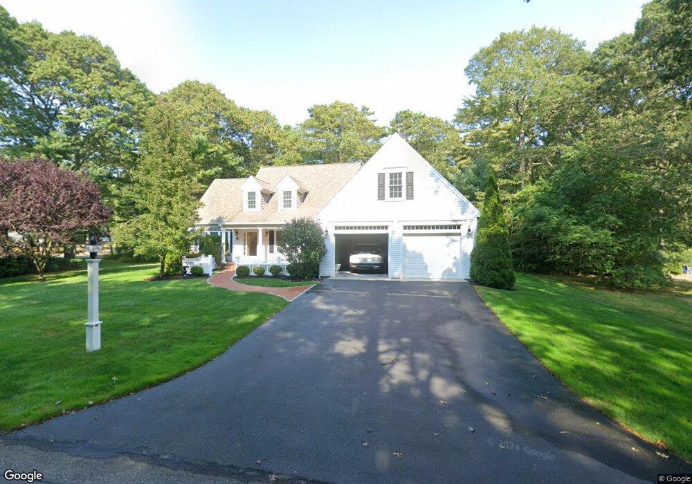
8 White Pine Ln Centerville, MA 2632
Centerville NeighborhoodEstimated Value: $980,000 - $1,256,961
About This Home
This home is located at 8 White Pine Ln, Centerville, MA 2632 and is currently estimated at $1,126,490, approximately $449 per square foot. 8 White Pine Ln is a home located in Barnstable County with nearby schools including Centerville Elementary School, Barnstable United Elementary School, and Barnstable Intermediate School.
Ownership History
We collect this data history from publicly available records. To have your information removed, we recommend requesting removal directly through your county’s website.
Purchase Details
Purchase Details
Home Values in the Area
Average Home Value in this Area
Purchase History
We collect this data history from publicly available records. To have your information removed, we recommend requesting removal directly through your county’s website.
| Date | Buyer | Sale Price | Title Company |
|---|---|---|---|
| -- | -- | ||
| $175,000 | -- |
Tax History
We collect this data history from publicly available records. To have your information removed, we recommend requesting removal directly through your county’s website.
| Year | Tax Paid | Tax Assessment Tax Assessment Total Assessment is a certain percentage of the fair market value that is determined by local assessors to be the total taxable value of land and additions on the property. | Land | Improvement |
|---|---|---|---|---|
| 2025 | $8,711 | $1,076,700 | $263,300 | $813,400 |
| 2024 | $8,051 | $1,030,800 | $263,300 | $767,500 |
| 2023 | $7,905 | $947,900 | $260,500 | $687,400 |
| 2022 | $7,165 | $743,300 | $166,900 | $576,400 |
| 2021 | $1,570 | $668,000 | $177,300 | $490,700 |
| 2020 | $1,458 | $685,000 | $187,700 | $497,300 |
| 2019 | $7,261 | $643,700 | $198,100 | $445,600 |
| 2018 | $1,241 | $584,700 | $197,600 | $387,100 |
| 2017 | $6,148 | $571,400 | $203,100 | $368,300 |
| 2016 | $6,248 | $573,200 | $204,900 | $368,300 |
| 2015 | $5,335 | $491,700 | $167,400 | $324,300 |
Map
- 442 Bay Ln
- 14 Valley Brook Rd
- 139 Fuller Rd
- 420 Starboard Ln
- 562 Skunknet Rd
- 16 Maple Rd
- 48 Starboard Ln
- 35 Stoney Cliff Rd
- 20 Deerfield Rd
- 49 Powderhorn Way
- 1309 Shootflying Hill Rd
- 1309 Shootflying Hill Rd
- 37 Old Salem Way
- 105 Taramac Rd
- 25 Joyce Anne Rd
- 170 Sturbridge Dr
- 441 Old Mill Rd
- 168 Highland Dr
- 63 Main St
- 48 Bridgets Path
- 106 Scudder Bay Cir
- 116 Scudder Bay Cir
- 35 Holly Hill Rd
- 72 Scudder Bay Cir
- 132 Scudder Bay Cir
- 27 Holly Hill Rd
- 46 Scudder Bay Cir
- 0 Holly Hill Rd
- 0 Holly Hill Rd
- 87 Scudder Bay Cir
- 10 Bay View Terrace
- 158 Scudder Bay Cir
- 18 White Pine Ln
- 73 Scudder Bay Cir
- 4 Hill Creek Rd
- 40 Holly Hill Rd
- 50 Holly Hill Rd
- 172 Scudder Bay Cir
- 28 Holly Hill Rd
- 65 Scudder Bay Cir
Ask me questions while you tour the home.