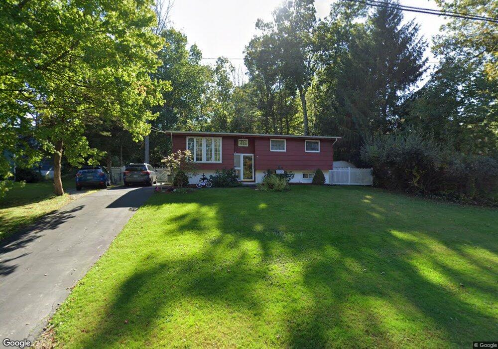
8 Whitewood Ln Ledyard, CT 06339
Estimated Value: $354,000 - $381,000
3
Beds
2
Baths
1,028
Sq Ft
$353/Sq Ft
Est. Value
About This Home
This home is located at 8 Whitewood Ln, Ledyard, CT 06339 and is currently estimated at $362,754, approximately $352 per square foot. 8 Whitewood Ln is a home located in New London County with nearby schools including Ledyard Middle School and Ledyard High School.
Ownership History
Date
Name
Owned For
Owner Type
Purchase Details
Closed on
Aug 31, 2009
Sold by
Quinn Suzanne
Bought by
Depasquale Michael J and Moniz Gloria J
Current Estimated Value
Home Financials for this Owner
Home Financials are based on the most recent Mortgage that was taken out on this home.
Original Mortgage
$181,623
Outstanding Balance
$118,660
Interest Rate
5.17%
Estimated Equity
$244,094
Purchase Details
Closed on
Jun 20, 2001
Sold by
Herr Lisa
Bought by
Quinn James T
Home Financials for this Owner
Home Financials are based on the most recent Mortgage that was taken out on this home.
Original Mortgage
$127,000
Interest Rate
7.09%
Purchase Details
Closed on
Oct 30, 1997
Sold by
Pias Marion Scott
Bought by
Shahenn Lisa M
Create a Home Valuation Report for This Property
The Home Valuation Report is an in-depth analysis detailing your home's value as well as a comparison with similar homes in the area
Home Values in the Area
Average Home Value in this Area
Purchase History
| Date | Buyer | Sale Price | Title Company |
|---|---|---|---|
| Depasquale Michael J | $185,000 | -- | |
| Quinn James T | $127,000 | -- | |
| Shahenn Lisa M | $96,000 | -- |
Source: Public Records
Mortgage History
| Date | Status | Borrower | Loan Amount |
|---|---|---|---|
| Open | Shahenn Lisa M | $181,623 | |
| Closed | Shahenn Lisa M | $6,500 | |
| Previous Owner | Shahenn Lisa M | $126,000 | |
| Previous Owner | Shahenn Lisa M | $127,000 |
Source: Public Records
Tax History Compared to Growth
Tax History
| Year | Tax Paid | Tax Assessment Tax Assessment Total Assessment is a certain percentage of the fair market value that is determined by local assessors to be the total taxable value of land and additions on the property. | Land | Improvement |
|---|---|---|---|---|
| 2025 | $4,570 | $123,060 | $40,460 | $82,600 |
| 2024 | $4,318 | $122,640 | $40,460 | $82,180 |
| 2023 | $4,238 | $122,640 | $40,460 | $82,180 |
| 2022 | $4,148 | $122,640 | $40,460 | $82,180 |
| 2021 | $4,121 | $122,640 | $40,460 | $82,180 |
| 2020 | $3,740 | $106,960 | $32,340 | $74,620 |
| 2019 | $3,750 | $106,960 | $32,340 | $74,620 |
| 2018 | $3,668 | $106,960 | $32,340 | $74,620 |
| 2017 | $3,480 | $106,960 | $32,340 | $74,620 |
| 2016 | $3,412 | $106,960 | $32,340 | $74,620 |
| 2015 | $3,252 | $106,960 | $32,340 | $74,620 |
| 2014 | $3,257 | $108,920 | $32,340 | $76,580 |
Source: Public Records
Map
Nearby Homes
- 7 Captain Amos Stanton Dr
- 8 Powder Horn Ln
- 113 Meeting House Ln
- 146 Gallup Hill Rd
- 148 Gallup Hill Rd
- 14 Lakeside Dr Unit K
- 2 Autumn Way
- 180 Gallup Hill Rd
- 153 Meeting House Ln
- 7 Chidley Way
- 675 Colonel Ledyard Hwy
- 678 Colonel Ledyard Hwy
- 71 Iron St
- 6 Wolf Ridge Gap
- 173 Lambtown Rd
- 45R Long Pond Rd S
- 105 Spicer Hill Rd
- 11 Sable Dr
- 75 Homestead Rd
- 38 Fairway Dr Unit 1