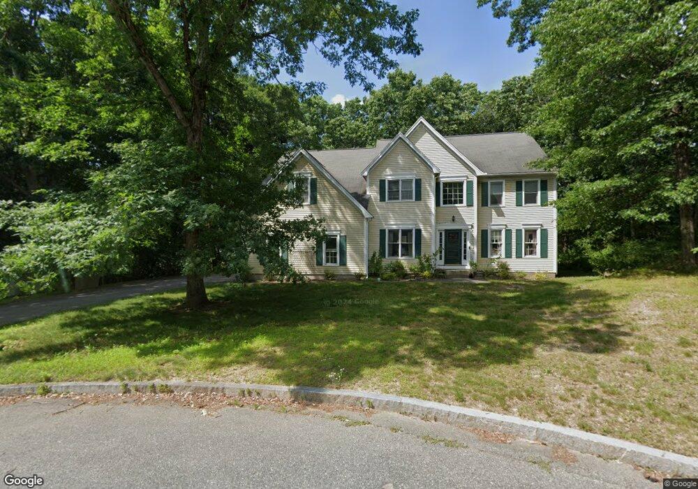
8 Whitney Cir Natick, MA 01760
Estimated Value: $1,363,000 - $1,474,714
4
Beds
3
Baths
3,252
Sq Ft
$441/Sq Ft
Est. Value
About This Home
This home is located at 8 Whitney Cir, Natick, MA 01760 and is currently estimated at $1,433,929, approximately $440 per square foot. 8 Whitney Cir is a home located in Middlesex County with nearby schools including Natick High School, Bennett-Hemenway (Ben-Hem) Elementary School, and Wilson Middle School.
Ownership History
Date
Name
Owned For
Owner Type
Purchase Details
Closed on
Dec 2, 1996
Sold by
Tysan Land Corp
Bought by
Dillaway Gregg R and Dillaway Sarah N
Current Estimated Value
Home Financials for this Owner
Home Financials are based on the most recent Mortgage that was taken out on this home.
Original Mortgage
$250,000
Outstanding Balance
$25,688
Interest Rate
7.82%
Mortgage Type
Purchase Money Mortgage
Estimated Equity
$1,408,241
Purchase Details
Closed on
Jun 3, 1996
Sold by
Tysan Dev Corp
Bought by
Rubin Lee C and Jarrett Collins D
Home Financials for this Owner
Home Financials are based on the most recent Mortgage that was taken out on this home.
Original Mortgage
$295,200
Interest Rate
7.91%
Mortgage Type
Purchase Money Mortgage
Create a Home Valuation Report for This Property
The Home Valuation Report is an in-depth analysis detailing your home's value as well as a comparison with similar homes in the area
Home Values in the Area
Average Home Value in this Area
Purchase History
| Date | Buyer | Sale Price | Title Company |
|---|---|---|---|
| Dillaway Gregg R | $419,900 | -- | |
| Rubin Lee C | $369,000 | -- |
Source: Public Records
Mortgage History
| Date | Status | Borrower | Loan Amount |
|---|---|---|---|
| Open | Rubin Lee C | $250,000 | |
| Previous Owner | Rubin Lee C | $295,200 |
Source: Public Records
Tax History
| Year | Tax Paid | Tax Assessment Tax Assessment Total Assessment is a certain percentage of the fair market value that is determined by local assessors to be the total taxable value of land and additions on the property. | Land | Improvement |
|---|---|---|---|---|
| 2025 | $14,537 | $1,215,500 | $449,200 | $766,300 |
| 2024 | $14,017 | $1,143,300 | $422,700 | $720,600 |
| 2023 | $13,114 | $1,037,500 | $404,600 | $632,900 |
| 2022 | $12,952 | $970,900 | $365,900 | $605,000 |
| 2021 | $12,344 | $907,000 | $345,000 | $562,000 |
| 2020 | $12,131 | $891,300 | $329,300 | $562,000 |
| 2019 | $11,328 | $891,300 | $329,300 | $562,000 |
| 2018 | $11,381 | $872,100 | $313,600 | $558,500 |
| 2017 | $11,067 | $820,400 | $272,000 | $548,400 |
| 2016 | $10,776 | $794,100 | $251,000 | $543,100 |
| 2015 | $10,271 | $743,200 | $251,000 | $492,200 |
Source: Public Records
Map
Nearby Homes
Your Personal Tour Guide
Ask me questions while you tour the home.